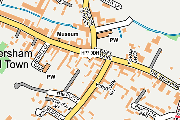
HP7 0DH is located in the Penn Wood and Old Amersham electoral ward, within the unitary authority of Buckinghamshire and the English Parliamentary constituency of Chesham and Amersham. The Sub Integrated Care Board (ICB) Location is NHS Buckinghamshire, Oxfordshire and Berkshire West ICB - 14Y and the police force is Thames Valley. This postcode has been in use since January 1980.


GetTheData
Source: OS OpenMap – Local (Ordnance Survey)
Source: OS VectorMap District (Ordnance Survey)
Licence: Open Government Licence (requires attribution)
| Easting | 495759 |
| Northing | 197293 |
| Latitude | 51.666265 |
| Longitude | -0.616805 |
GetTheData
Source: Open Postcode Geo
Licence: Open Government Licence
| Country | England |
| Postcode District | HP7 |
➜ See where HP7 is on a map ➜ Where is Amersham? | |
GetTheData
Source: Land Registry Price Paid Data
Licence: Open Government Licence
Elevation or altitude of HP7 0DH as distance above sea level:
| Metres | Feet | |
|---|---|---|
| Elevation | 100m | 328ft |
Elevation is measured from the approximate centre of the postcode, to the nearest point on an OS contour line from OS Terrain 50, which has contour spacing of ten vertical metres.
➜ How high above sea level am I? Find the elevation of your current position using your device's GPS.
GetTheData
Source: Open Postcode Elevation
Licence: Open Government Licence
| Ward | Penn Wood And Old Amersham |
| Constituency | Chesham And Amersham |
GetTheData
Source: ONS Postcode Database
Licence: Open Government Licence
| Whielden Street | Old Amersham | 64m |
| Whielden Street | Old Amersham | 76m |
| Broadway | Old Amersham | 273m |
| Broadway | Old Amersham | 289m |
| Gore Hill | Old Amersham | 330m |
| Amersham Underground Station | Amersham | 1,077m |
| Amersham Station | 1.1km |
| Chalfont & Latimer Station | 3.9km |
GetTheData
Source: NaPTAN
Licence: Open Government Licence
GetTheData
Source: ONS Postcode Database
Licence: Open Government Licence


➜ Get more ratings from the Food Standards Agency
GetTheData
Source: Food Standards Agency
Licence: FSA terms & conditions
| Last Collection | |||
|---|---|---|---|
| Location | Mon-Fri | Sat | Distance |
| High Street P.o. | 17:30 | 12:00 | 44m |
| High Street | 17:30 | 12:00 | 130m |
| Hospital | 17:15 | 12:00 | 359m |
GetTheData
Source: Dracos
Licence: Creative Commons Attribution-ShareAlike
The below table lists the International Territorial Level (ITL) codes (formerly Nomenclature of Territorial Units for Statistics (NUTS) codes) and Local Administrative Units (LAU) codes for HP7 0DH:
| ITL 1 Code | Name |
|---|---|
| TLJ | South East (England) |
| ITL 2 Code | Name |
| TLJ1 | Berkshire, Buckinghamshire and Oxfordshire |
| ITL 3 Code | Name |
| TLJ13 | Buckinghamshire |
| LAU 1 Code | Name |
| E06000060 | Buckinghamshire |
GetTheData
Source: ONS Postcode Directory
Licence: Open Government Licence
The below table lists the Census Output Area (OA), Lower Layer Super Output Area (LSOA), and Middle Layer Super Output Area (MSOA) for HP7 0DH:
| Code | Name | |
|---|---|---|
| OA | E00089542 | |
| LSOA | E01017745 | Chiltern 007D |
| MSOA | E02003682 | Chiltern 007 |
GetTheData
Source: ONS Postcode Directory
Licence: Open Government Licence
| HP7 0DG | Market Square | 38m |
| HP7 0DQ | Market Square | 42m |
| HP7 0DF | Market Square | 51m |
| HP7 0HT | Whielden Street | 73m |
| HP7 0DP | High Street | 86m |
| HP7 0DB | Church Street | 95m |
| HP7 0HP | The Broadway | 113m |
| HP7 0HU | Whielden Street | 115m |
| HP7 0DJ | High Street | 119m |
| HP7 0JE | Whielden Green | 125m |
GetTheData
Source: Open Postcode Geo; Land Registry Price Paid Data
Licence: Open Government Licence