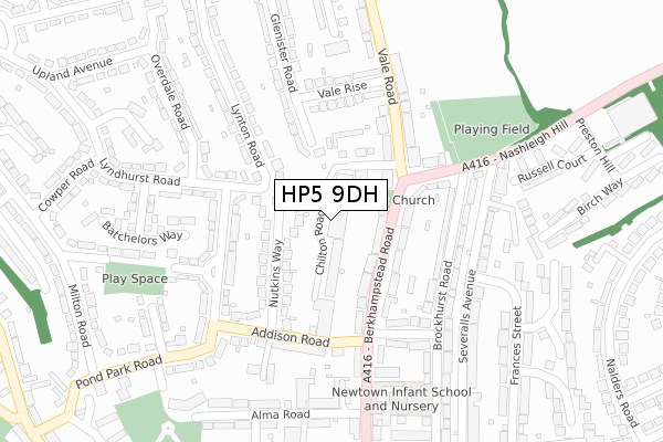
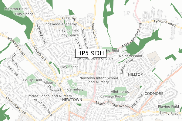
HP5 9DH is located in the Chesham electoral ward, within the unitary authority of Buckinghamshire and the English Parliamentary constituency of Chesham and Amersham. The Sub Integrated Care Board (ICB) Location is NHS Buckinghamshire, Oxfordshire and Berkshire West ICB - 14Y and the police force is Thames Valley. This postcode has been in use since July 2018.


GetTheData
Source: OS Open Zoomstack (Ordnance Survey)
Licence: Open Government Licence (requires attribution)
Attribution: Contains OS data © Crown copyright and database right 2024
Source: Open Postcode Geo
Licence: Open Government Licence (requires attribution)
Attribution: Contains OS data © Crown copyright and database right 2024; Contains Royal Mail data © Royal Mail copyright and database right 2024; Source: Office for National Statistics licensed under the Open Government Licence v.3.0
| Easting | 496214 |
| Northing | 202860 |
| Latitude | 51.716232 |
| Longitude | -0.608671 |
GetTheData
Source: Open Postcode Geo
Licence: Open Government Licence
| Country | England |
| Postcode District | HP5 |
➜ See where HP5 is on a map ➜ Where is Chesham? | |
GetTheData
Source: Land Registry Price Paid Data
Licence: Open Government Licence
| Ward | Chesham |
| Constituency | Chesham And Amersham |
GetTheData
Source: ONS Postcode Database
Licence: Open Government Licence
| The Nash Arms Ph (Berkhampstead Road) | Chesham | 95m |
| The Nash Arms Ph (Berkhampstead Road) | Chesham | 103m |
| Addison Road | Chesham | 180m |
| Lansdowne Road | Chesham | 204m |
| Lansdowne Road | Chesham | 212m |
| Chesham Underground Station | Chesham | 1,233m |
| Amersham Station | 4.7km |
GetTheData
Source: NaPTAN
Licence: Open Government Licence
GetTheData
Source: ONS Postcode Database
Licence: Open Government Licence


➜ Get more ratings from the Food Standards Agency
GetTheData
Source: Food Standards Agency
Licence: FSA terms & conditions
| Last Collection | |||
|---|---|---|---|
| Location | Mon-Fri | Sat | Distance |
| The Vale | 17:15 | 12:00 | 125m |
| Greenway | 17:15 | 12:00 | 516m |
| Bellingdon Road | 17:15 | 11:45 | 570m |
GetTheData
Source: Dracos
Licence: Creative Commons Attribution-ShareAlike
The below table lists the International Territorial Level (ITL) codes (formerly Nomenclature of Territorial Units for Statistics (NUTS) codes) and Local Administrative Units (LAU) codes for HP5 9DH:
| ITL 1 Code | Name |
|---|---|
| TLJ | South East (England) |
| ITL 2 Code | Name |
| TLJ1 | Berkshire, Buckinghamshire and Oxfordshire |
| ITL 3 Code | Name |
| TLJ13 | Buckinghamshire |
| LAU 1 Code | Name |
| E06000060 | Buckinghamshire |
GetTheData
Source: ONS Postcode Directory
Licence: Open Government Licence
The below table lists the Census Output Area (OA), Lower Layer Super Output Area (LSOA), and Middle Layer Super Output Area (MSOA) for HP5 9DH:
| Code | Name | |
|---|---|---|
| OA | E00089792 | |
| LSOA | E01017795 | Chiltern 002F |
| MSOA | E02003677 | Chiltern 002 |
GetTheData
Source: ONS Postcode Directory
Licence: Open Government Licence
| HP5 3HQ | Berkhampstead Road | 74m |
| HP5 2BE | Nutkins Way | 94m |
| HP5 3HG | Berkhampstead Road | 111m |
| HP5 2AT | Chilton Road | 113m |
| HP5 3AU | Berkhampstead Road | 119m |
| HP5 2AX | Glenister Road | 150m |
| HP5 2BA | Lansdowne Road | 158m |
| HP5 3JF | Nashleigh Hill | 161m |
| HP5 2DY | Lyndhurst Road | 168m |
| HP5 3JE | Brockhurst Road | 170m |
GetTheData
Source: Open Postcode Geo; Land Registry Price Paid Data
Licence: Open Government Licence