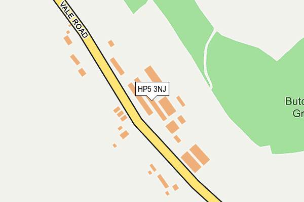
HP5 3NJ is located in the Chiltern Ridges electoral ward, within the unitary authority of Buckinghamshire and the English Parliamentary constituency of Chesham and Amersham. The Sub Integrated Care Board (ICB) Location is NHS Buckinghamshire, Oxfordshire and Berkshire West ICB - 14Y and the police force is Thames Valley. This postcode has been in use since December 2000.


GetTheData
Source: OS OpenMap – Local (Ordnance Survey)
Source: OS VectorMap District (Ordnance Survey)
Licence: Open Government Licence (requires attribution)
| Easting | 496007 |
| Northing | 205063 |
| Latitude | 51.736070 |
| Longitude | -0.611059 |
GetTheData
Source: Open Postcode Geo
Licence: Open Government Licence
| Country | England |
| Postcode District | HP5 |
➜ See where HP5 is on a map | |
GetTheData
Source: Land Registry Price Paid Data
Licence: Open Government Licence
Elevation or altitude of HP5 3NJ as distance above sea level:
| Metres | Feet | |
|---|---|---|
| Elevation | 130m | 427ft |
Elevation is measured from the approximate centre of the postcode, to the nearest point on an OS contour line from OS Terrain 50, which has contour spacing of ten vertical metres.
➜ How high above sea level am I? Find the elevation of your current position using your device's GPS.
GetTheData
Source: Open Postcode Elevation
Licence: Open Government Licence
| Ward | Chiltern Ridges |
| Constituency | Chesham And Amersham |
GetTheData
Source: ONS Postcode Database
Licence: Open Government Licence
| Savecroft Farm (Chesham Road) | Bellingdon | 1,199m |
| Savecroft Farm (Chesham Road) | Bellingdon | 1,226m |
| Johnson's Farm (Chesham Road) | Bellingdon | 1,296m |
| Little Hivings | Great Hivings | 1,335m |
| Greencroft Cottages (Mount Nugent) | Great Hivings | 1,388m |
| Berkhamsted Station | 4.5km |
GetTheData
Source: NaPTAN
Licence: Open Government Licence
GetTheData
Source: ONS Postcode Database
Licence: Open Government Licence


➜ Get more ratings from the Food Standards Agency
GetTheData
Source: Food Standards Agency
Licence: FSA terms & conditions
| Last Collection | |||
|---|---|---|---|
| Location | Mon-Fri | Sat | Distance |
| The Vale | 15:15 | 06:45 | 622m |
| Bellingdon Village | 15:00 | 08:30 | 1,241m |
| Bellingdon | 15:00 | 08:30 | 1,389m |
GetTheData
Source: Dracos
Licence: Creative Commons Attribution-ShareAlike
The below table lists the International Territorial Level (ITL) codes (formerly Nomenclature of Territorial Units for Statistics (NUTS) codes) and Local Administrative Units (LAU) codes for HP5 3NJ:
| ITL 1 Code | Name |
|---|---|
| TLJ | South East (England) |
| ITL 2 Code | Name |
| TLJ1 | Berkshire, Buckinghamshire and Oxfordshire |
| ITL 3 Code | Name |
| TLJ13 | Buckinghamshire |
| LAU 1 Code | Name |
| E06000060 | Buckinghamshire |
GetTheData
Source: ONS Postcode Directory
Licence: Open Government Licence
The below table lists the Census Output Area (OA), Lower Layer Super Output Area (LSOA), and Middle Layer Super Output Area (MSOA) for HP5 3NJ:
| Code | Name | |
|---|---|---|
| OA | E00089647 | |
| LSOA | E01017766 | Chiltern 001C |
| MSOA | E02003676 | Chiltern 001 |
GetTheData
Source: ONS Postcode Directory
Licence: Open Government Licence
| HP5 3NT | The Vale | 68m |
| HP5 3NS | The Vale | 501m |
| HP5 3NY | The Vale | 639m |
| HP5 3NR | The Vale | 813m |
| HP5 3NP | Vale Road | 1011m |
| HP5 3PY | Hog Lane | 1111m |
| HP5 2XN | 1212m | |
| HP5 2XL | 1248m | |
| HP5 2LX | Copse Way | 1274m |
| HP5 2LZ | Meadow Close | 1291m |
GetTheData
Source: Open Postcode Geo; Land Registry Price Paid Data
Licence: Open Government Licence