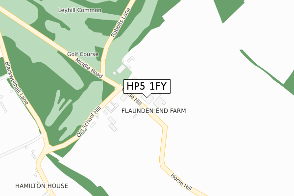
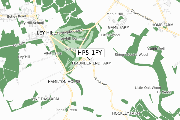
HP5 1FY is located in the Chess Valley electoral ward, within the unitary authority of Buckinghamshire and the English Parliamentary constituency of Chesham and Amersham. The Sub Integrated Care Board (ICB) Location is NHS Buckinghamshire, Oxfordshire and Berkshire West ICB - 14Y and the police force is Thames Valley. This postcode has been in use since January 2018.


GetTheData
Source: OS Open Zoomstack (Ordnance Survey)
Licence: Open Government Licence (requires attribution)
Attribution: Contains OS data © Crown copyright and database right 2025
Source: Open Postcode Geo
Licence: Open Government Licence (requires attribution)
Attribution: Contains OS data © Crown copyright and database right 2025; Contains Royal Mail data © Royal Mail copyright and database right 2025; Source: Office for National Statistics licensed under the Open Government Licence v.3.0
| Easting | 499548 |
| Northing | 201628 |
| Latitude | 51.704577 |
| Longitude | -0.560780 |
GetTheData
Source: Open Postcode Geo
Licence: Open Government Licence
| Country | England |
| Postcode District | HP5 |
➜ See where HP5 is on a map | |
GetTheData
Source: Land Registry Price Paid Data
Licence: Open Government Licence
| Ward | Chess Valley |
| Constituency | Chesham And Amersham |
GetTheData
Source: ONS Postcode Database
Licence: Open Government Licence
| The Crown Ph (Ley Hill Road) | Ley Hill | 704m |
| Grooms Cottages (Botley Road) | Ley Hill | 1,028m |
| Grooms Cottages (Botley Road) | Ley Hill | 1,058m |
| Broomstick Lane (Botley Road) | Botley | 1,210m |
| Broomstick Lane (Botley Road) | Botley | 1,254m |
| Chalfont & Latimer Station | 4.1km |
| Amersham Station | 4.7km |
| Hemel Hempstead Station | 6.4km |
GetTheData
Source: NaPTAN
Licence: Open Government Licence
| Percentage of properties with Next Generation Access | 100.0% |
| Percentage of properties with Superfast Broadband | 0.0% |
| Percentage of properties with Ultrafast Broadband | 0.0% |
| Percentage of properties with Full Fibre Broadband | 0.0% |
Superfast Broadband is between 30Mbps and 300Mbps
Ultrafast Broadband is > 300Mbps
| Percentage of properties unable to receive 2Mbps | 0.0% |
| Percentage of properties unable to receive 5Mbps | 100.0% |
| Percentage of properties unable to receive 10Mbps | 100.0% |
| Percentage of properties unable to receive 30Mbps | 100.0% |
GetTheData
Source: Ofcom
Licence: Ofcom Terms of Use (requires attribution)
GetTheData
Source: ONS Postcode Database
Licence: Open Government Licence


➜ Get more ratings from the Food Standards Agency
GetTheData
Source: Food Standards Agency
Licence: FSA terms & conditions
| Last Collection | |||
|---|---|---|---|
| Location | Mon-Fri | Sat | Distance |
| Pudds Cross | 16:30 | 09:30 | 913m |
| Botley P.o. | 16:00 | 09:45 | 1,366m |
| Mauldens | 16:45 | 09:00 | 1,399m |
GetTheData
Source: Dracos
Licence: Creative Commons Attribution-ShareAlike
The below table lists the International Territorial Level (ITL) codes (formerly Nomenclature of Territorial Units for Statistics (NUTS) codes) and Local Administrative Units (LAU) codes for HP5 1FY:
| ITL 1 Code | Name |
|---|---|
| TLJ | South East (England) |
| ITL 2 Code | Name |
| TLJ1 | Berkshire, Buckinghamshire and Oxfordshire |
| ITL 3 Code | Name |
| TLJ13 | Buckinghamshire |
| LAU 1 Code | Name |
| E06000060 | Buckinghamshire |
GetTheData
Source: ONS Postcode Directory
Licence: Open Government Licence
The below table lists the Census Output Area (OA), Lower Layer Super Output Area (LSOA), and Middle Layer Super Output Area (MSOA) for HP5 1FY:
| Code | Name | |
|---|---|---|
| OA | E00089564 | |
| LSOA | E01017750 | Chiltern 001A |
| MSOA | E02003676 | Chiltern 001 |
GetTheData
Source: ONS Postcode Directory
Licence: Open Government Licence
| HP5 1UZ | 132m | |
| HP5 1UP | 152m | |
| HP5 1UR | Milton Cottages | 557m |
| HP5 1UT | 584m | |
| HP3 0NL | Maple Hill | 620m |
| HP5 1UY | Crown Cottages | 667m |
| HP5 1UN | 797m | |
| HP5 3QT | Holly Tree Close | 825m |
| HP5 3QS | Kiln Lane | 833m |
| HP5 3QR | 842m |
GetTheData
Source: Open Postcode Geo; Land Registry Price Paid Data
Licence: Open Government Licence