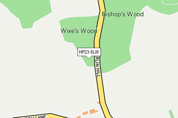
HP23 6LW is located in the Tring East electoral ward, within the local authority district of Dacorum and the English Parliamentary constituency of South West Hertfordshire. The Sub Integrated Care Board (ICB) Location is NHS Hertfordshire and West Essex ICB - 06N and the police force is Hertfordshire. This postcode has been in use since October 2013.


GetTheData
Source: OS OpenMap – Local (Ordnance Survey)
Source: OS VectorMap District (Ordnance Survey)
Licence: Open Government Licence (requires attribution)
| Easting | 492283 |
| Northing | 209632 |
| Latitude | 51.777757 |
| Longitude | -0.663784 |
GetTheData
Source: Open Postcode Geo
Licence: Open Government Licence
| Country | England |
| Postcode District | HP23 |
➜ See where HP23 is on a map | |
GetTheData
Source: Land Registry Price Paid Data
Licence: Open Government Licence
Elevation or altitude of HP23 6LW as distance above sea level:
| Metres | Feet | |
|---|---|---|
| Elevation | 220m | 722ft |
Elevation is measured from the approximate centre of the postcode, to the nearest point on an OS contour line from OS Terrain 50, which has contour spacing of ten vertical metres.
➜ How high above sea level am I? Find the elevation of your current position using your device's GPS.
GetTheData
Source: Open Postcode Elevation
Licence: Open Government Licence
| Ward | Tring East |
| Constituency | South West Hertfordshire |
GetTheData
Source: ONS Postcode Database
Licence: Open Government Licence
| Pollywick Road (Common Field) | Wigginton | 1,466m |
| St Joseph's (Western Road) | Tring | 1,474m |
| St Joseph's (Western Road) | Tring | 1,486m |
| Highfield Road (Fox Road) | Wigginton | 1,512m |
| Miswell Lane (Western Road) | Tring | 1,527m |
| Tring Station | 3.8km |
GetTheData
Source: NaPTAN
Licence: Open Government Licence
GetTheData
Source: ONS Postcode Database
Licence: Open Government Licence


➜ Get more ratings from the Food Standards Agency
GetTheData
Source: Food Standards Agency
Licence: FSA terms & conditions
| Last Collection | |||
|---|---|---|---|
| Location | Mon-Fri | Sat | Distance |
| Hastoe | 16:30 | 09:45 | 576m |
| Akeman Street | 17:15 | 11:00 | 1,490m |
| King Street | 17:15 | 11:00 | 1,533m |
GetTheData
Source: Dracos
Licence: Creative Commons Attribution-ShareAlike
The below table lists the International Territorial Level (ITL) codes (formerly Nomenclature of Territorial Units for Statistics (NUTS) codes) and Local Administrative Units (LAU) codes for HP23 6LW:
| ITL 1 Code | Name |
|---|---|
| TLH | East |
| ITL 2 Code | Name |
| TLH2 | Bedfordshire and Hertfordshire |
| ITL 3 Code | Name |
| TLH23 | Hertfordshire CC |
| LAU 1 Code | Name |
| E07000096 | Dacorum |
GetTheData
Source: ONS Postcode Directory
Licence: Open Government Licence
The below table lists the Census Output Area (OA), Lower Layer Super Output Area (LSOA), and Middle Layer Super Output Area (MSOA) for HP23 6LW:
| Code | Name | |
|---|---|---|
| OA | E00118976 | |
| LSOA | E01023422 | Dacorum 004C |
| MSOA | E02004859 | Dacorum 004 |
GetTheData
Source: ONS Postcode Directory
Licence: Open Government Licence
| HP23 6LU | Hastoe Row | 276m |
| HP23 6LR | Hastoe Hill | 464m |
| HP23 6QB | Church Lane | 532m |
| HP23 6QD | Browns Lane | 577m |
| HP23 6LX | Browns Lane | 609m |
| HP23 6LS | 656m | |
| HP23 6JJ | 1017m | |
| HP23 6PE | Kiln Road | 1046m |
| HP23 6JR | 1058m | |
| HP23 6BS | Park Road | 1192m |
GetTheData
Source: Open Postcode Geo; Land Registry Price Paid Data
Licence: Open Government Licence