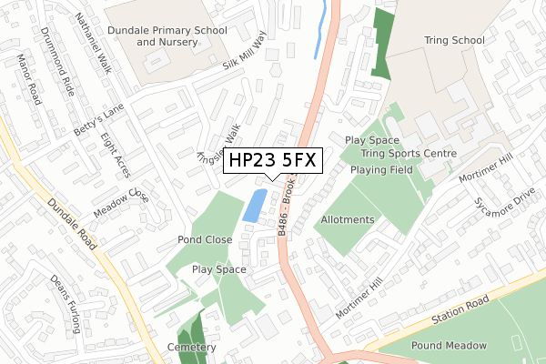
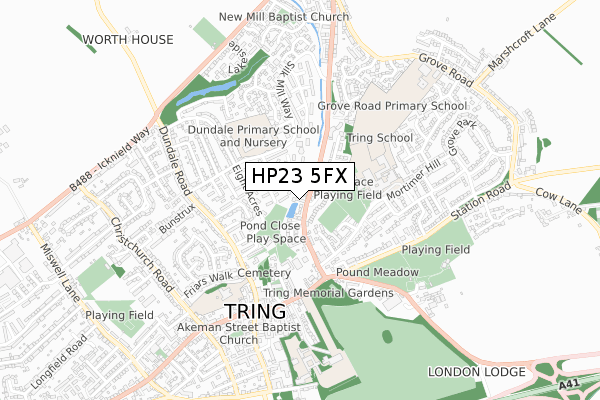
HP23 5FX is located in the Tring Central electoral ward, within the local authority district of Dacorum and the English Parliamentary constituency of South West Hertfordshire. The Sub Integrated Care Board (ICB) Location is NHS Hertfordshire and West Essex ICB - 06N and the police force is Hertfordshire. This postcode has been in use since July 2019.


GetTheData
Source: OS Open Zoomstack (Ordnance Survey)
Licence: Open Government Licence (requires attribution)
Attribution: Contains OS data © Crown copyright and database right 2025
Source: Open Postcode Geo
Licence: Open Government Licence (requires attribution)
Attribution: Contains OS data © Crown copyright and database right 2025; Contains Royal Mail data © Royal Mail copyright and database right 2025; Source: Office for National Statistics licensed under the Open Government Licence v.3.0
| Easting | 492541 |
| Northing | 211923 |
| Latitude | 51.798316 |
| Longitude | -0.659411 |
GetTheData
Source: Open Postcode Geo
Licence: Open Government Licence
| Country | England |
| Postcode District | HP23 |
➜ See where HP23 is on a map ➜ Where is Tring? | |
GetTheData
Source: Land Registry Price Paid Data
Licence: Open Government Licence
| Ward | Tring Central |
| Constituency | South West Hertfordshire |
GetTheData
Source: ONS Postcode Database
Licence: Open Government Licence
| Shugars Green (Brook Street) | Tring | 153m |
| Shugars Green (Brook Street) | Tring | 154m |
| Dundale School (Silk Mill Way) | Tring | 174m |
| Dundale School (Silk Mill Way) | Tring | 209m |
| Market Place (Brook Street) | Tring | 288m |
| Tring Station | 2.6km |
GetTheData
Source: NaPTAN
Licence: Open Government Licence
GetTheData
Source: ONS Postcode Database
Licence: Open Government Licence


➜ Get more ratings from the Food Standards Agency
GetTheData
Source: Food Standards Agency
Licence: FSA terms & conditions
| Last Collection | |||
|---|---|---|---|
| Location | Mon-Fri | Sat | Distance |
| Brook Street | 17:30 | 11:15 | 67m |
| Silk Mill Way | 17:15 | 11:00 | 156m |
| Westron Gardens | 17:15 | 11:00 | 303m |
GetTheData
Source: Dracos
Licence: Creative Commons Attribution-ShareAlike
| Risk of HP23 5FX flooding from rivers and sea | Medium |
| ➜ HP23 5FX flood map | |
GetTheData
Source: Open Flood Risk by Postcode
Licence: Open Government Licence
The below table lists the International Territorial Level (ITL) codes (formerly Nomenclature of Territorial Units for Statistics (NUTS) codes) and Local Administrative Units (LAU) codes for HP23 5FX:
| ITL 1 Code | Name |
|---|---|
| TLH | East |
| ITL 2 Code | Name |
| TLH2 | Bedfordshire and Hertfordshire |
| ITL 3 Code | Name |
| TLH23 | Hertfordshire CC |
| LAU 1 Code | Name |
| E07000096 | Dacorum |
GetTheData
Source: ONS Postcode Directory
Licence: Open Government Licence
The below table lists the Census Output Area (OA), Lower Layer Super Output Area (LSOA), and Middle Layer Super Output Area (MSOA) for HP23 5FX:
| Code | Name | |
|---|---|---|
| OA | E00118973 | |
| LSOA | E01023418 | Dacorum 003A |
| MSOA | E02004858 | Dacorum 003 |
GetTheData
Source: ONS Postcode Directory
Licence: Open Government Licence
| HP23 5EF | Brook Street | 42m |
| HP23 5DW | Kingsley Walk | 57m |
| HP23 5DP | Kingsley Walk | 66m |
| HP23 4ED | Brookfield Close | 121m |
| HP23 5DR | Kingsley Walk | 127m |
| HP23 5UJ | Evans Way | 144m |
| HP23 5EP | Silk Mill Way | 167m |
| HP23 5DN | Kingsley Walk | 172m |
| HP23 5ES | Mill Gardens | 181m |
| HP23 5DH | Eight Acres | 188m |
GetTheData
Source: Open Postcode Geo; Land Registry Price Paid Data
Licence: Open Government Licence