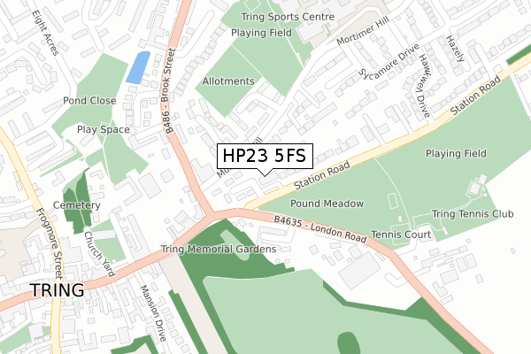
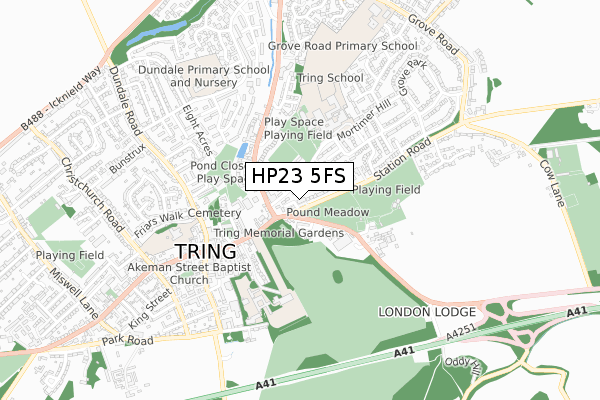
HP23 5FS is located in the Tring East electoral ward, within the local authority district of Dacorum and the English Parliamentary constituency of South West Hertfordshire. The Sub Integrated Care Board (ICB) Location is NHS Hertfordshire and West Essex ICB - 06N and the police force is Hertfordshire. This postcode has been in use since January 2018.


GetTheData
Source: OS Open Zoomstack (Ordnance Survey)
Licence: Open Government Licence (requires attribution)
Attribution: Contains OS data © Crown copyright and database right 2025
Source: Open Postcode Geo
Licence: Open Government Licence (requires attribution)
Attribution: Contains OS data © Crown copyright and database right 2025; Contains Royal Mail data © Royal Mail copyright and database right 2025; Source: Office for National Statistics licensed under the Open Government Licence v.3.0
| Easting | 492744 |
| Northing | 211605 |
| Latitude | 51.795424 |
| Longitude | -0.656553 |
GetTheData
Source: Open Postcode Geo
Licence: Open Government Licence
| Country | England |
| Postcode District | HP23 |
➜ See where HP23 is on a map ➜ Where is Tring? | |
GetTheData
Source: Land Registry Price Paid Data
Licence: Open Government Licence
| Ward | Tring East |
| Constituency | South West Hertfordshire |
GetTheData
Source: ONS Postcode Database
Licence: Open Government Licence
| Market Place (Brook Street) | Tring | 149m |
| Pound Meadow (Station Road) | Upper Dunsley | 155m |
| Market Place (Brook Street) | Tring | 156m |
| School (Mortimer Hill) | Tring | 187m |
| Pound Meadow (Station Road) | Upper Dunsley | 204m |
| Tring Station | 2.4km |
GetTheData
Source: NaPTAN
Licence: Open Government Licence
| Percentage of properties with Next Generation Access | 100.0% |
| Percentage of properties with Superfast Broadband | 100.0% |
| Percentage of properties with Ultrafast Broadband | 100.0% |
| Percentage of properties with Full Fibre Broadband | 0.0% |
Superfast Broadband is between 30Mbps and 300Mbps
Ultrafast Broadband is > 300Mbps
| Percentage of properties unable to receive 2Mbps | 0.0% |
| Percentage of properties unable to receive 5Mbps | 0.0% |
| Percentage of properties unable to receive 10Mbps | 0.0% |
| Percentage of properties unable to receive 30Mbps | 0.0% |
GetTheData
Source: Ofcom
Licence: Ofcom Terms of Use (requires attribution)
GetTheData
Source: ONS Postcode Database
Licence: Open Government Licence


➜ Get more ratings from the Food Standards Agency
GetTheData
Source: Food Standards Agency
Licence: FSA terms & conditions
| Last Collection | |||
|---|---|---|---|
| Location | Mon-Fri | Sat | Distance |
| High Street | 17:30 | 11:15 | 45m |
| Westron Gardens | 17:15 | 11:00 | 110m |
| Church Square | 17:30 | 11:00 | 328m |
GetTheData
Source: Dracos
Licence: Creative Commons Attribution-ShareAlike
The below table lists the International Territorial Level (ITL) codes (formerly Nomenclature of Territorial Units for Statistics (NUTS) codes) and Local Administrative Units (LAU) codes for HP23 5FS:
| ITL 1 Code | Name |
|---|---|
| TLH | East |
| ITL 2 Code | Name |
| TLH2 | Bedfordshire and Hertfordshire |
| ITL 3 Code | Name |
| TLH23 | Hertfordshire CC |
| LAU 1 Code | Name |
| E07000096 | Dacorum |
GetTheData
Source: ONS Postcode Directory
Licence: Open Government Licence
The below table lists the Census Output Area (OA), Lower Layer Super Output Area (LSOA), and Middle Layer Super Output Area (MSOA) for HP23 5FS:
| Code | Name | |
|---|---|---|
| OA | E00118974 | |
| LSOA | E01023422 | Dacorum 004C |
| MSOA | E02004859 | Dacorum 004 |
GetTheData
Source: ONS Postcode Directory
Licence: Open Government Licence
| HP23 5JA | Mortimer Hill | 45m |
| HP23 5NE | Mortimer Rise | 65m |
| HP23 5ND | London Road | 99m |
| HP23 6JL | Dunsley Place | 105m |
| HP23 5HZ | Nursery Gardens | 137m |
| HP23 5FN | Thomas Gardens | 163m |
| HP23 5SH | Wellbrook Mews | 177m |
| HP23 5ED | Brook Street | 183m |
| HP23 5NG | Station Road | 183m |
| HP23 5HW | The Hollies | 185m |
GetTheData
Source: Open Postcode Geo; Land Registry Price Paid Data
Licence: Open Government Licence