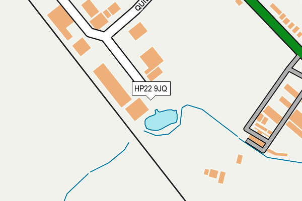
HP22 9JQ is located in the Wendover, Halton and Stoke Mandeville electoral ward, within the unitary authority of Buckinghamshire and the English Parliamentary constituency of Aylesbury. The Sub Integrated Care Board (ICB) Location is NHS Buckinghamshire, Oxfordshire and Berkshire West ICB - 14Y and the police force is Thames Valley. This postcode has been in use since November 2014.


GetTheData
Source: OS OpenMap – Local (Ordnance Survey)
Source: OS VectorMap District (Ordnance Survey)
Licence: Open Government Licence (requires attribution)
| Easting | 484842 |
| Northing | 209552 |
| Latitude | 51.778221 |
| Longitude | -0.771607 |
GetTheData
Source: Open Postcode Geo
Licence: Open Government Licence
| Country | England |
| Postcode District | HP22 |
➜ See where HP22 is on a map ➜ Where is Stoke Mandeville? | |
GetTheData
Source: Land Registry Price Paid Data
Licence: Open Government Licence
Elevation or altitude of HP22 9JQ as distance above sea level:
| Metres | Feet | |
|---|---|---|
| Elevation | 110m | 361ft |
Elevation is measured from the approximate centre of the postcode, to the nearest point on an OS contour line from OS Terrain 50, which has contour spacing of ten vertical metres.
➜ How high above sea level am I? Find the elevation of your current position using your device's GPS.
GetTheData
Source: Open Postcode Elevation
Licence: Open Government Licence
| Ward | Wendover, Halton And Stoke Mandeville |
| Constituency | Aylesbury |
GetTheData
Source: ONS Postcode Database
Licence: Open Government Licence
| Quilters Way (Wendover Road) | Weston Turville | 305m |
| Quilters Way (Wendover Road) | Weston Turville | 321m |
| Wendover Road | Weston Turville | 531m |
| Wendover Road | Weston Turville | 569m |
| Marroway Junction (Wendover Road) | Stoke Mandeville | 758m |
| Stoke Mandeville Station | 1.4km |
| Wendover Station | 2.5km |
| Little Kimble Station | 3.8km |
GetTheData
Source: NaPTAN
Licence: Open Government Licence
GetTheData
Source: ONS Postcode Database
Licence: Open Government Licence


➜ Get more ratings from the Food Standards Agency
GetTheData
Source: Food Standards Agency
Licence: FSA terms & conditions
| Last Collection | |||
|---|---|---|---|
| Location | Mon-Fri | Sat | Distance |
| Aylesbury Vale Do | 18:00 | 12:00 | 21m |
| Nash Lee Road | 16:30 | 07:00 | 753m |
| Worlds End Lane | 17:15 | 08:30 | 930m |
GetTheData
Source: Dracos
Licence: Creative Commons Attribution-ShareAlike
The below table lists the International Territorial Level (ITL) codes (formerly Nomenclature of Territorial Units for Statistics (NUTS) codes) and Local Administrative Units (LAU) codes for HP22 9JQ:
| ITL 1 Code | Name |
|---|---|
| TLJ | South East (England) |
| ITL 2 Code | Name |
| TLJ1 | Berkshire, Buckinghamshire and Oxfordshire |
| ITL 3 Code | Name |
| TLJ13 | Buckinghamshire |
| LAU 1 Code | Name |
| E06000060 | Buckinghamshire |
GetTheData
Source: ONS Postcode Directory
Licence: Open Government Licence
The below table lists the Census Output Area (OA), Lower Layer Super Output Area (LSOA), and Middle Layer Super Output Area (MSOA) for HP22 9JQ:
| Code | Name | |
|---|---|---|
| OA | E00088991 | |
| LSOA | E01017631 | Aylesbury Vale 021E |
| MSOA | E02003672 | Aylesbury Vale 021 |
GetTheData
Source: ONS Postcode Directory
Licence: Open Government Licence
| HP22 5TN | Wendover Road | 359m |
| HP22 5TR | Wendover Road | 402m |
| HP22 5TJ | Wendover Road | 632m |
| HP22 6BG | Nash Lee Lane | 717m |
| HP22 5TQ | Marroway | 918m |
| HP22 5RX | Worlds End Lane | 928m |
| HP22 5RZ | Worlds End Lane | 992m |
| HP22 5SA | Worlds End Lane | 1017m |
| HP22 5SB | Worlds End Lane | 1110m |
| HP22 5QX | William Burt Close | 1140m |
GetTheData
Source: Open Postcode Geo; Land Registry Price Paid Data
Licence: Open Government Licence