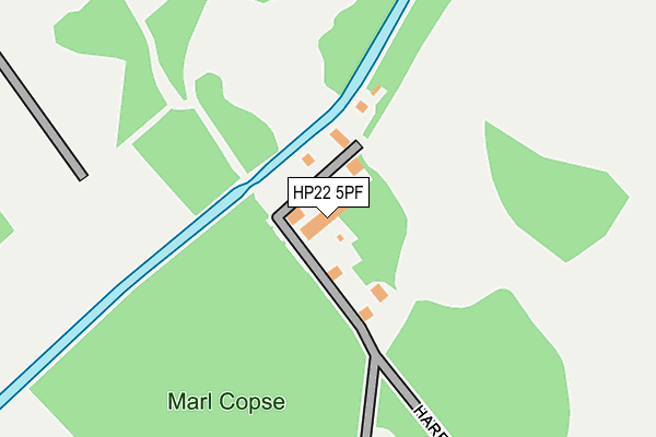
HP22 5PF is located in the Aston Clinton and Bierton electoral ward, within the unitary authority of Buckinghamshire and the English Parliamentary constituency of Aylesbury. The Sub Integrated Care Board (ICB) Location is NHS Buckinghamshire, Oxfordshire and Berkshire West ICB - 14Y and the police force is Thames Valley. This postcode has been in use since June 1981.


GetTheData
Source: OS OpenMap – Local (Ordnance Survey)
Source: OS VectorMap District (Ordnance Survey)
Licence: Open Government Licence (requires attribution)
| Easting | 488056 |
| Northing | 210673 |
| Latitude | 51.787802 |
| Longitude | -0.724748 |
GetTheData
Source: Open Postcode Geo
Licence: Open Government Licence
| Country | England |
| Postcode District | HP22 |
➜ See where HP22 is on a map | |
GetTheData
Source: Land Registry Price Paid Data
Licence: Open Government Licence
Elevation or altitude of HP22 5PF as distance above sea level:
| Metres | Feet | |
|---|---|---|
| Elevation | 130m | 427ft |
Elevation is measured from the approximate centre of the postcode, to the nearest point on an OS contour line from OS Terrain 50, which has contour spacing of ten vertical metres.
➜ How high above sea level am I? Find the elevation of your current position using your device's GPS.
GetTheData
Source: Open Postcode Elevation
Licence: Open Government Licence
| Ward | Aston Clinton And Bierton |
| Constituency | Aylesbury |
GetTheData
Source: ONS Postcode Database
Licence: Open Government Licence
| Wendover Woods (Upper Icknield Way) | Aston Clinton | 627m |
| Wendover Woods (Upper Icknield Way) | Aston Clinton | 633m |
| St Michael & All Angels Church (Halton Lane) | Halton | 894m |
| St Michael & All Angels Church (Halton Lane) | Halton | 910m |
| Airfield (Halton Lane) | Halton | 926m |
| Wendover Station | 3.3km |
| Stoke Mandeville Station | 4.1km |
GetTheData
Source: NaPTAN
Licence: Open Government Licence
| Median download speed | 4.3Mbps |
| Average download speed | 15.5Mbps |
| Maximum download speed | 79.65Mbps |
| Median upload speed | 0.8Mbps |
| Average upload speed | 3.2Mbps |
| Maximum upload speed | 20.00Mbps |
GetTheData
Source: Ofcom
Licence: Ofcom Terms of Use (requires attribution)
GetTheData
Source: ONS Postcode Database
Licence: Open Government Licence


➜ Get more ratings from the Food Standards Agency
GetTheData
Source: Food Standards Agency
Licence: FSA terms & conditions
| Last Collection | |||
|---|---|---|---|
| Location | Mon-Fri | Sat | Distance |
| Aston Clinton P.o. | 17:30 | 09:30 | 1,302m |
| Milton Road | 16:45 | 07:00 | 1,524m |
| Wenwell Close | 17:00 | 08:00 | 1,550m |
GetTheData
Source: Dracos
Licence: Creative Commons Attribution-ShareAlike
The below table lists the International Territorial Level (ITL) codes (formerly Nomenclature of Territorial Units for Statistics (NUTS) codes) and Local Administrative Units (LAU) codes for HP22 5PF:
| ITL 1 Code | Name |
|---|---|
| TLJ | South East (England) |
| ITL 2 Code | Name |
| TLJ1 | Berkshire, Buckinghamshire and Oxfordshire |
| ITL 3 Code | Name |
| TLJ13 | Buckinghamshire |
| LAU 1 Code | Name |
| E06000060 | Buckinghamshire |
GetTheData
Source: ONS Postcode Directory
Licence: Open Government Licence
The below table lists the Census Output Area (OA), Lower Layer Super Output Area (LSOA), and Middle Layer Super Output Area (MSOA) for HP22 5PF:
| Code | Name | |
|---|---|---|
| OA | E00088981 | |
| LSOA | E01017627 | Aylesbury Vale 021A |
| MSOA | E02003672 | Aylesbury Vale 021 |
GetTheData
Source: ONS Postcode Directory
Licence: Open Government Licence
| HP22 5NJ | The Close | 461m |
| HP22 5NH | Chiltern Way | 563m |
| HP22 5NF | Upper Icknield Way | 719m |
| HP22 5PA | Church View | 786m |
| HP22 5NG | Old School Close | 823m |
| HP22 5NS | 904m | |
| HP22 5GH | The Leys | 914m |
| HP22 5PB | Brookside | 934m |
| HP22 5PQ | 949m | |
| HP22 5PD | Chestnut End | 992m |
GetTheData
Source: Open Postcode Geo; Land Registry Price Paid Data
Licence: Open Government Licence