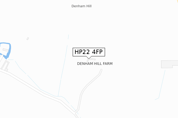
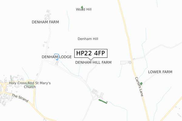
HP22 4FP is located in the Great Brickhill electoral ward, within the unitary authority of Buckinghamshire and the English Parliamentary constituency of Buckingham. The Sub Integrated Care Board (ICB) Location is NHS Buckinghamshire, Oxfordshire and Berkshire West ICB - 14Y and the police force is Thames Valley. This postcode has been in use since November 2019.


GetTheData
Source: OS Open Zoomstack (Ordnance Survey)
Licence: Open Government Licence (requires attribution)
Attribution: Contains OS data © Crown copyright and database right 2025
Source: Open Postcode Geo
Licence: Open Government Licence (requires attribution)
Attribution: Contains OS data © Crown copyright and database right 2025; Contains Royal Mail data © Royal Mail copyright and database right 2025; Source: Office for National Statistics licensed under the Open Government Licence v.3.0
| Easting | 475884 |
| Northing | 220451 |
| Latitude | 51.877480 |
| Longitude | -0.899042 |
GetTheData
Source: Open Postcode Geo
Licence: Open Government Licence
| Country | England |
| Postcode District | HP22 |
➜ See where HP22 is on a map | |
GetTheData
Source: Land Registry Price Paid Data
Licence: Open Government Licence
| Ward | Great Brickhill |
| Constituency | Buckingham |
GetTheData
Source: ONS Postcode Database
Licence: Open Government Licence
| The Green | Quainton | 1,250m |
| Memorial Hall (Station Road) | Quainton | 1,393m |
| Memorial Hall (Station Road) | Quainton | 1,418m |
| Upper Street | Quainton | 1,460m |
| Winwood Cottages (Station Road) | Quainton | 1,635m |
GetTheData
Source: NaPTAN
Licence: Open Government Licence
GetTheData
Source: ONS Postcode Database
Licence: Open Government Licence


➜ Get more ratings from the Food Standards Agency
GetTheData
Source: Food Standards Agency
Licence: FSA terms & conditions
| Last Collection | |||
|---|---|---|---|
| Location | Mon-Fri | Sat | Distance |
| Lay-by Church Street | 17:00 | 10:00 | 1,200m |
| The Green Quainton | 17:00 | 10:00 | 1,314m |
| Pitchcott | 16:40 | 09:30 | 1,697m |
GetTheData
Source: Dracos
Licence: Creative Commons Attribution-ShareAlike
The below table lists the International Territorial Level (ITL) codes (formerly Nomenclature of Territorial Units for Statistics (NUTS) codes) and Local Administrative Units (LAU) codes for HP22 4FP:
| ITL 1 Code | Name |
|---|---|
| TLJ | South East (England) |
| ITL 2 Code | Name |
| TLJ1 | Berkshire, Buckinghamshire and Oxfordshire |
| ITL 3 Code | Name |
| TLJ13 | Buckinghamshire |
| LAU 1 Code | Name |
| E06000060 | Buckinghamshire |
GetTheData
Source: ONS Postcode Directory
Licence: Open Government Licence
The below table lists the Census Output Area (OA), Lower Layer Super Output Area (LSOA), and Middle Layer Super Output Area (MSOA) for HP22 4FP:
| Code | Name | |
|---|---|---|
| OA | E00089343 | |
| LSOA | E01017703 | Aylesbury Vale 008A |
| MSOA | E02003659 | Aylesbury Vale 008 |
GetTheData
Source: ONS Postcode Directory
Licence: Open Government Licence
| HP22 4AN | Denham | 459m |
| HP22 4AL | Denham | 701m |
| HP22 4AH | Blackgrove Road | 1016m |
| HP22 4AP | Church Street | 1078m |
| HP22 4AJ | The Pyghtles | 1107m |
| HP22 4AW | Church Street | 1120m |
| HP22 4AT | White Hart Field | 1232m |
| HP22 4AS | The Strand | 1234m |
| HP22 4AR | The Green | 1248m |
| HP22 4FD | Dymock Court | 1286m |
GetTheData
Source: Open Postcode Geo; Land Registry Price Paid Data
Licence: Open Government Licence