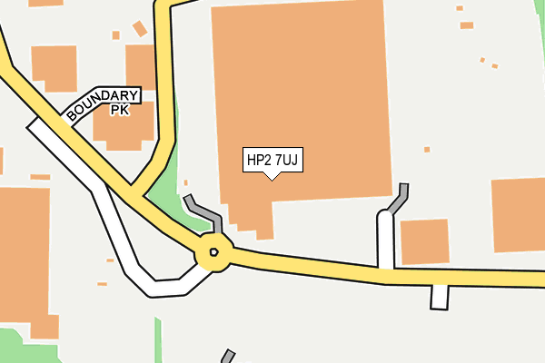
HP2 7UJ is located in the Adeyfield East electoral ward, within the local authority district of Dacorum and the English Parliamentary constituency of Hemel Hempstead. The Sub Integrated Care Board (ICB) Location is NHS Hertfordshire and West Essex ICB - 06N and the police force is Hertfordshire. This postcode has been in use since May 2012.


GetTheData
Source: OS OpenMap – Local (Ordnance Survey)
Source: OS VectorMap District (Ordnance Survey)
Licence: Open Government Licence (requires attribution)
| Easting | 508592 |
| Northing | 208126 |
| Latitude | 51.761299 |
| Longitude | -0.427949 |
GetTheData
Source: Open Postcode Geo
Licence: Open Government Licence
| Country | England |
| Postcode District | HP2 |
➜ See where HP2 is on a map ➜ Where is Hemel Hempstead? | |
GetTheData
Source: Land Registry Price Paid Data
Licence: Open Government Licence
Elevation or altitude of HP2 7UJ as distance above sea level:
| Metres | Feet | |
|---|---|---|
| Elevation | 130m | 427ft |
Elevation is measured from the approximate centre of the postcode, to the nearest point on an OS contour line from OS Terrain 50, which has contour spacing of ten vertical metres.
➜ How high above sea level am I? Find the elevation of your current position using your device's GPS.
GetTheData
Source: Open Postcode Elevation
Licence: Open Government Licence
| Ward | Adeyfield East |
| Constituency | Hemel Hempstead |
GetTheData
Source: ONS Postcode Database
Licence: Open Government Licence
| Woodwells Cemetery (Buncefield Lane) | Maylands Business Park | 402m |
| Thamesfield House (Boundary Way) | Maylands Business Park | 502m |
| Green Lane (Breakspear Way) | Leverstock Green | 593m |
| Breakspear Park (Breakspear Way) | Leverstock Green | 593m |
| Peoples Building (Maylands Business Park) | Maylands Business Park | 705m |
| Apsley Station | 4km |
| Hemel Hempstead Station | 4.8km |
GetTheData
Source: NaPTAN
Licence: Open Government Licence
GetTheData
Source: ONS Postcode Database
Licence: Open Government Licence


➜ Get more ratings from the Food Standards Agency
GetTheData
Source: Food Standards Agency
Licence: FSA terms & conditions
| Last Collection | |||
|---|---|---|---|
| Location | Mon-Fri | Sat | Distance |
| Maylands Avenue | 17:30 | 12:00 | 753m |
| Mail Centre Boxes | 18:30 | 15:00 | 770m |
| Cleveland Road | 18:30 | 772m | |
GetTheData
Source: Dracos
Licence: Creative Commons Attribution-ShareAlike
The below table lists the International Territorial Level (ITL) codes (formerly Nomenclature of Territorial Units for Statistics (NUTS) codes) and Local Administrative Units (LAU) codes for HP2 7UJ:
| ITL 1 Code | Name |
|---|---|
| TLH | East |
| ITL 2 Code | Name |
| TLH2 | Bedfordshire and Hertfordshire |
| ITL 3 Code | Name |
| TLH23 | Hertfordshire CC |
| LAU 1 Code | Name |
| E07000096 | Dacorum |
GetTheData
Source: ONS Postcode Directory
Licence: Open Government Licence
The below table lists the Census Output Area (OA), Lower Layer Super Output Area (LSOA), and Middle Layer Super Output Area (MSOA) for HP2 7UJ:
| Code | Name | |
|---|---|---|
| OA | E00118608 | |
| LSOA | E01023345 | Dacorum 013A |
| MSOA | E02004868 | Dacorum 013 |
GetTheData
Source: ONS Postcode Directory
Licence: Open Government Licence
| HP2 4QB | Holme Place | 395m |
| HP2 4RF | Wood Lane End | 437m |
| HP2 7TE | Grovelands Business Centre | 440m |
| HP2 4SR | Crest Park | 449m |
| HP2 4RH | Hales Park | 466m |
| HP2 4XF | Romany Court | 486m |
| HP2 4XE | Welkin Green | 519m |
| HP2 4QA | Wood End Close | 537m |
| HP2 4TJ | Hales Park Close | 537m |
| HP2 7BE | Maxted Road | 635m |
GetTheData
Source: Open Postcode Geo; Land Registry Price Paid Data
Licence: Open Government Licence