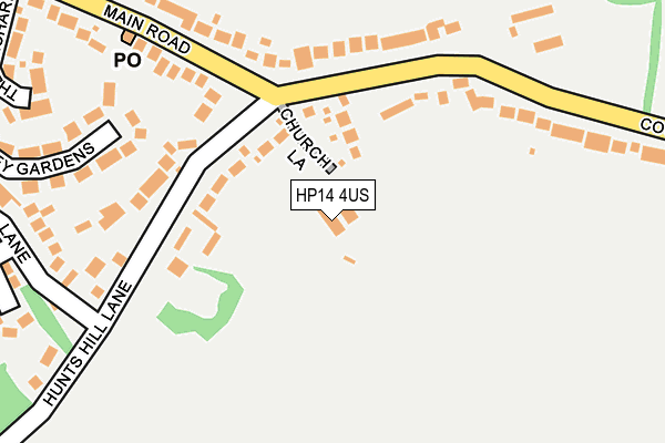
HP14 4US is located in the Ridgeway East electoral ward, within the unitary authority of Buckinghamshire and the English Parliamentary constituency of Aylesbury. The Sub Integrated Care Board (ICB) Location is NHS Buckinghamshire, Oxfordshire and Berkshire West ICB - 14Y and the police force is Thames Valley. This postcode has been in use since June 1998.


GetTheData
Source: OS OpenMap – Local (Ordnance Survey)
Source: OS VectorMap District (Ordnance Survey)
Licence: Open Government Licence (requires attribution)
| Easting | 485434 |
| Northing | 196591 |
| Latitude | 51.661618 |
| Longitude | -0.766227 |
GetTheData
Source: Open Postcode Geo
Licence: Open Government Licence
| Country | England |
| Postcode District | HP14 |
➜ See where HP14 is on a map ➜ Where is Naphill? | |
GetTheData
Source: Land Registry Price Paid Data
Licence: Open Government Licence
Elevation or altitude of HP14 4US as distance above sea level:
| Metres | Feet | |
|---|---|---|
| Elevation | 170m | 558ft |
Elevation is measured from the approximate centre of the postcode, to the nearest point on an OS contour line from OS Terrain 50, which has contour spacing of ten vertical metres.
➜ How high above sea level am I? Find the elevation of your current position using your device's GPS.
GetTheData
Source: Open Postcode Elevation
Licence: Open Government Licence
| Ward | Ridgeway East |
| Constituency | Aylesbury |
GetTheData
Source: ONS Postcode Database
Licence: Open Government Licence
| Hunts Hill Lane (Main Road) | Naphill | 193m |
| Hunts Hill Lane (Main Road) | Naphill | 231m |
| Coombe Farm (Coombe Lane) | Naphill | 280m |
| Coombe Farm (Coombe Lane) | Naphill | 292m |
| Louches Lane (Main Road) | Naphill | 593m |
| High Wycombe Station | 3.8km |
| Saunderton Station | 4.4km |
| Great Missenden Station | 6.1km |
GetTheData
Source: NaPTAN
Licence: Open Government Licence
GetTheData
Source: ONS Postcode Database
Licence: Open Government Licence


➜ Get more ratings from the Food Standards Agency
GetTheData
Source: Food Standards Agency
Licence: FSA terms & conditions
| Last Collection | |||
|---|---|---|---|
| Location | Mon-Fri | Sat | Distance |
| Church Lane | 16:30 | 09:30 | 108m |
| Naphill P.o. | 16:30 | 11:30 | 859m |
| Hughenden Valley | 16:45 | 10:30 | 984m |
GetTheData
Source: Dracos
Licence: Creative Commons Attribution-ShareAlike
The below table lists the International Territorial Level (ITL) codes (formerly Nomenclature of Territorial Units for Statistics (NUTS) codes) and Local Administrative Units (LAU) codes for HP14 4US:
| ITL 1 Code | Name |
|---|---|
| TLJ | South East (England) |
| ITL 2 Code | Name |
| TLJ1 | Berkshire, Buckinghamshire and Oxfordshire |
| ITL 3 Code | Name |
| TLJ13 | Buckinghamshire |
| LAU 1 Code | Name |
| E06000060 | Buckinghamshire |
GetTheData
Source: ONS Postcode Directory
Licence: Open Government Licence
The below table lists the Census Output Area (OA), Lower Layer Super Output Area (LSOA), and Middle Layer Super Output Area (MSOA) for HP14 4US:
| Code | Name | |
|---|---|---|
| OA | E00090168 | |
| LSOA | E01017872 | Wycombe 003D |
| MSOA | E02003698 | Wycombe 003 |
GetTheData
Source: ONS Postcode Directory
Licence: Open Government Licence
| HP14 4RS | Church Lane | 92m |
| HP14 4RL | Hunts Hill Lane | 168m |
| HP14 4QR | Coombe Lane | 173m |
| HP14 4QX | Coombe Lane | 233m |
| HP14 4QW | Bayley Gardens | 261m |
| HP14 4QD | Main Road | 315m |
| HP14 4QJ | Louches Lane | 321m |
| HP14 4QP | Wellhouse Way | 324m |
| HP14 4QZ | The Orchard | 328m |
| HP14 4QB | Main Road | 358m |
GetTheData
Source: Open Postcode Geo; Land Registry Price Paid Data
Licence: Open Government Licence