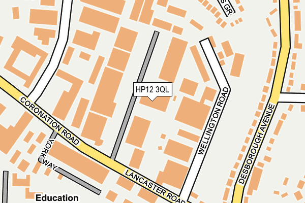
HP12 3QL is located in the Abbey electoral ward, within the unitary authority of Buckinghamshire and the English Parliamentary constituency of Wycombe. The Sub Integrated Care Board (ICB) Location is NHS Buckinghamshire, Oxfordshire and Berkshire West ICB - 14Y and the police force is Thames Valley. This postcode has been in use since December 1995.


GetTheData
Source: OS OpenMap – Local (Ordnance Survey)
Source: OS VectorMap District (Ordnance Survey)
Licence: Open Government Licence (requires attribution)
| Easting | 485269 |
| Northing | 192072 |
| Latitude | 51.621020 |
| Longitude | -0.769712 |
GetTheData
Source: Open Postcode Geo
Licence: Open Government Licence
| Country | England |
| Postcode District | HP12 |
➜ See where HP12 is on a map ➜ Where is High Wycombe? | |
GetTheData
Source: Land Registry Price Paid Data
Licence: Open Government Licence
Elevation or altitude of HP12 3QL as distance above sea level:
| Metres | Feet | |
|---|---|---|
| Elevation | 150m | 492ft |
Elevation is measured from the approximate centre of the postcode, to the nearest point on an OS contour line from OS Terrain 50, which has contour spacing of ten vertical metres.
➜ How high above sea level am I? Find the elevation of your current position using your device's GPS.
GetTheData
Source: Open Postcode Elevation
Licence: Open Government Licence
| Ward | Abbey |
| Constituency | Wycombe |
GetTheData
Source: ONS Postcode Database
Licence: Open Government Licence
| Lancaster Road | Cressex | 177m |
| Lancaster Road | Cressex | 180m |
| Shackleton Road (Lincoln Road) | High Wycombe | 200m |
| Shackleton Road (Lincoln Road) | High Wycombe | 231m |
| Lincoln Road (Coronation Road) | Cressex | 275m |
| High Wycombe Station | 1.9km |
| Bourne End Station | 6.4km |
GetTheData
Source: NaPTAN
Licence: Open Government Licence
GetTheData
Source: ONS Postcode Database
Licence: Open Government Licence


➜ Get more ratings from the Food Standards Agency
GetTheData
Source: Food Standards Agency
Licence: FSA terms & conditions
| Last Collection | |||
|---|---|---|---|
| Location | Mon-Fri | Sat | Distance |
| Lancaster Road | 18:30 | 143m | |
| Carverhill Road | 18:30 | 12:00 | 230m |
| Coronation Road | 18:30 | 12:00 | 269m |
GetTheData
Source: Dracos
Licence: Creative Commons Attribution-ShareAlike
The below table lists the International Territorial Level (ITL) codes (formerly Nomenclature of Territorial Units for Statistics (NUTS) codes) and Local Administrative Units (LAU) codes for HP12 3QL:
| ITL 1 Code | Name |
|---|---|
| TLJ | South East (England) |
| ITL 2 Code | Name |
| TLJ1 | Berkshire, Buckinghamshire and Oxfordshire |
| ITL 3 Code | Name |
| TLJ13 | Buckinghamshire |
| LAU 1 Code | Name |
| E06000060 | Buckinghamshire |
GetTheData
Source: ONS Postcode Directory
Licence: Open Government Licence
The below table lists the Census Output Area (OA), Lower Layer Super Output Area (LSOA), and Middle Layer Super Output Area (MSOA) for HP12 3QL:
| Code | Name | |
|---|---|---|
| OA | E00090002 | |
| LSOA | E01017838 | Wycombe 015C |
| MSOA | E02003710 | Wycombe 015 |
GetTheData
Source: ONS Postcode Directory
Licence: Open Government Licence
| HP12 3PR | Wellington Road | 158m |
| HP12 3RE | Lincolns Inn | 197m |
| HP12 3PY | York Way | 213m |
| HP11 2TJ | Desborough Avenue | 213m |
| HP12 3NY | Deeds Grove | 223m |
| HP12 3NN | Lancaster Road | 241m |
| HP12 3NH | Shelburne Court | 246m |
| HP11 2TH | Desborough Avenue | 248m |
| HP12 3NJ | Shelburne Road | 283m |
| HP12 3RH | Lincoln Road | 297m |
GetTheData
Source: Open Postcode Geo; Land Registry Price Paid Data
Licence: Open Government Licence