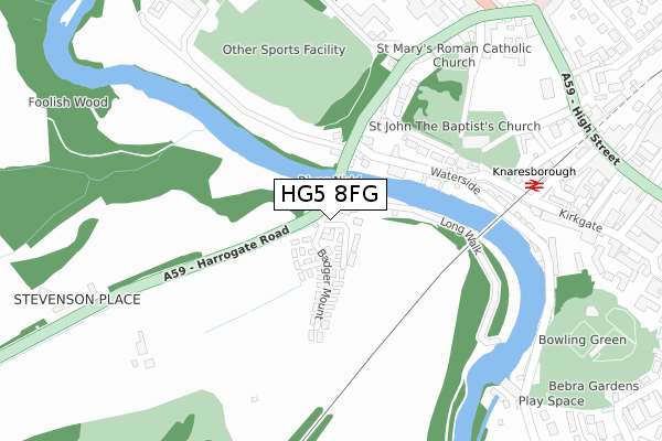
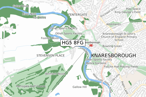
HG5 8FG is located in the Knaresborough West electoral ward, within the unitary authority of North Yorkshire and the English Parliamentary constituency of Harrogate and Knaresborough. The Sub Integrated Care Board (ICB) Location is NHS Humber and North Yorkshire ICB - 42D and the police force is North Yorkshire. This postcode has been in use since October 2019.


GetTheData
Source: OS Open Zoomstack (Ordnance Survey)
Licence: Open Government Licence (requires attribution)
Attribution: Contains OS data © Crown copyright and database right 2025
Source: Open Postcode Geo
Licence: Open Government Licence (requires attribution)
Attribution: Contains OS data © Crown copyright and database right 2025; Contains Royal Mail data © Royal Mail copyright and database right 2025; Source: Office for National Statistics licensed under the Open Government Licence v.3.0
| Easting | 434495 |
| Northing | 457048 |
| Latitude | 54.008321 |
| Longitude | -1.475161 |
GetTheData
Source: Open Postcode Geo
Licence: Open Government Licence
| Country | England |
| Postcode District | HG5 |
➜ See where HG5 is on a map ➜ Where is Knaresborough? | |
GetTheData
Source: Land Registry Price Paid Data
Licence: Open Government Licence
| Ward | Knaresborough West |
| Constituency | Harrogate And Knaresborough |
GetTheData
Source: ONS Postcode Database
Licence: Open Government Licence
| High Bridge (Harrogate Road) | Knaresborough | 43m |
| High Bridge (Harrogate Road) | Knaresborough | 51m |
| Henshaws (Bond End) | Knaresborough | 282m |
| Council Offices (High Street) | Knaresborough | 428m |
| Bond End (High Street) | Knaresborough | 434m |
| Knaresborough Station | 0.3km |
| Starbeck Station | 2km |
| Harrogate Station | 4.4km |
GetTheData
Source: NaPTAN
Licence: Open Government Licence
GetTheData
Source: ONS Postcode Database
Licence: Open Government Licence


➜ Get more ratings from the Food Standards Agency
GetTheData
Source: Food Standards Agency
Licence: FSA terms & conditions
| Last Collection | |||
|---|---|---|---|
| Location | Mon-Fri | Sat | Distance |
| Market Place (Double Box) | 17:00 | 10:45 | 514m |
| York Place | 16:00 | 10:45 | 909m |
| 21 Princess Ave/Off Chain Lane | 16:45 | 13:30 | 1,215m |
GetTheData
Source: Dracos
Licence: Creative Commons Attribution-ShareAlike
The below table lists the International Territorial Level (ITL) codes (formerly Nomenclature of Territorial Units for Statistics (NUTS) codes) and Local Administrative Units (LAU) codes for HG5 8FG:
| ITL 1 Code | Name |
|---|---|
| TLE | Yorkshire and The Humber |
| ITL 2 Code | Name |
| TLE2 | North Yorkshire |
| ITL 3 Code | Name |
| TLE22 | North Yorkshire CC |
| LAU 1 Code | Name |
| E07000165 | Harrogate |
GetTheData
Source: ONS Postcode Directory
Licence: Open Government Licence
The below table lists the Census Output Area (OA), Lower Layer Super Output Area (LSOA), and Middle Layer Super Output Area (MSOA) for HG5 8FG:
| Code | Name | |
|---|---|---|
| OA | E00140936 | |
| LSOA | E01027673 | Harrogate 009C |
| MSOA | E02005769 | Harrogate 009 |
GetTheData
Source: ONS Postcode Directory
Licence: Open Government Licence
| HG5 8DA | Harrogate Road | 57m |
| HG5 9AZ | Waterside | 162m |
| HG5 9AE | The Parsonage | 195m |
| HG5 9AU | Bond End | 204m |
| HG5 9AT | Conyngham View | 235m |
| HG5 9AD | Water Bag Bank | 253m |
| HG5 9AB | Kirkgate | 277m |
| HG5 9AA | Station Road | 328m |
| HG5 8BZ | Kirkgate | 332m |
| HG5 9AF | Vicarage Lane | 335m |
GetTheData
Source: Open Postcode Geo; Land Registry Price Paid Data
Licence: Open Government Licence