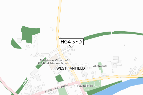
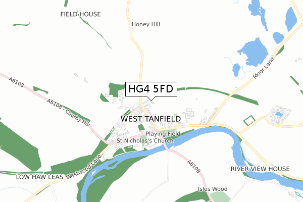
HG4 5FD is located in the Bedale electoral ward, within the unitary authority of North Yorkshire and the English Parliamentary constituency of Richmond (Yorks). The Sub Integrated Care Board (ICB) Location is NHS Humber and North Yorkshire ICB - 42D and the police force is North Yorkshire. This postcode has been in use since October 2019.


GetTheData
Source: OS Open Zoomstack (Ordnance Survey)
Licence: Open Government Licence (requires attribution)
Attribution: Contains OS data © Crown copyright and database right 2025
Source: Open Postcode Geo
Licence: Open Government Licence (requires attribution)
Attribution: Contains OS data © Crown copyright and database right 2025; Contains Royal Mail data © Royal Mail copyright and database right 2025; Source: Office for National Statistics licensed under the Open Government Licence v.3.0
| Easting | 426875 |
| Northing | 479108 |
| Latitude | 54.207028 |
| Longitude | -1.589475 |
GetTheData
Source: Open Postcode Geo
Licence: Open Government Licence
| Country | England |
| Postcode District | HG4 |
➜ See where HG4 is on a map ➜ Where is West Tanfield? | |
GetTheData
Source: Land Registry Price Paid Data
Licence: Open Government Licence
| Ward | Bedale |
| Constituency | Richmond (Yorks) |
GetTheData
Source: ONS Postcode Database
Licence: Open Government Licence
24, REGENCY PLACE, WEST TANFIELD, RIPON, HG4 5FD 2024 18 DEC £325,000 |
39, REGENCY PLACE, WEST TANFIELD, RIPON, HG4 5FD 2024 30 MAY £337,000 |
2024 30 MAY £373,000 |
9, REGENCY PLACE, WEST TANFIELD, RIPON, HG4 5FD 2023 28 JUL £369,995 |
34, REGENCY PLACE, WEST TANFIELD, RIPON, HG4 5FD 2023 24 FEB £299,995 |
24, REGENCY PLACE, WEST TANFIELD, RIPON, HG4 5FD 2022 17 NOV £309,995 |
41, REGENCY PLACE, WEST TANFIELD, RIPON, HG4 5FD 2022 29 SEP £279,995 |
39, REGENCY PLACE, WEST TANFIELD, RIPON, HG4 5FD 2022 23 SEP £284,995 |
28, REGENCY PLACE, WEST TANFIELD, RIPON, HG4 5FD 2022 31 AUG £389,995 |
26, REGENCY PLACE, WEST TANFIELD, RIPON, HG4 5FD 2022 26 AUG £364,995 |
GetTheData
Source: HM Land Registry Price Paid Data
Licence: Contains HM Land Registry data © Crown copyright and database right 2025. This data is licensed under the Open Government Licence v3.0.
| The Bull Inn (Church Street) | West Tanfield | 312m |
| The Bull Inn (A6108) | West Tanfield | 313m |
| Nosterfield Road End (Main Street) | West Tanfield | 448m |
| Nosterfield Road End (Main Street) | West Tanfield | 462m |
| Sleningford Watermill (A6108) | West Tanfield | 1,024m |
GetTheData
Source: NaPTAN
Licence: Open Government Licence
GetTheData
Source: ONS Postcode Database
Licence: Open Government Licence


➜ Get more ratings from the Food Standards Agency
GetTheData
Source: Food Standards Agency
Licence: FSA terms & conditions
| Last Collection | |||
|---|---|---|---|
| Location | Mon-Fri | Sat | Distance |
| Nosterfield | 16:30 | 09:15 | 1,652m |
| Thornborough | 16:15 | 09:45 | 2,537m |
GetTheData
Source: Dracos
Licence: Creative Commons Attribution-ShareAlike
The below table lists the International Territorial Level (ITL) codes (formerly Nomenclature of Territorial Units for Statistics (NUTS) codes) and Local Administrative Units (LAU) codes for HG4 5FD:
| ITL 1 Code | Name |
|---|---|
| TLE | Yorkshire and The Humber |
| ITL 2 Code | Name |
| TLE2 | North Yorkshire |
| ITL 3 Code | Name |
| TLE22 | North Yorkshire CC |
| LAU 1 Code | Name |
| E07000164 | Hambleton |
GetTheData
Source: ONS Postcode Directory
Licence: Open Government Licence
The below table lists the Census Output Area (OA), Lower Layer Super Output Area (LSOA), and Middle Layer Super Output Area (MSOA) for HG4 5FD:
| Code | Name | |
|---|---|---|
| OA | E00140691 | |
| LSOA | E01027628 | Hambleton 007B |
| MSOA | E02005756 | Hambleton 007 |
GetTheData
Source: ONS Postcode Directory
Licence: Open Government Licence
| HG4 5JW | Station Road | 99m |
| HG4 5JP | 104m | |
| HG4 5JN | Mowbray Terrace | 136m |
| HG4 5JD | Mowbray Court | 188m |
| HG4 5JR | 288m | |
| HG4 5JQ | Church Street | 352m |
| HG4 5JH | Main Street | 378m |
| HG4 5JJ | Main Street | 392m |
| HG4 5JY | 424m | |
| HG4 5JZ | Nosterfield Road | 495m |
GetTheData
Source: Open Postcode Geo; Land Registry Price Paid Data
Licence: Open Government Licence