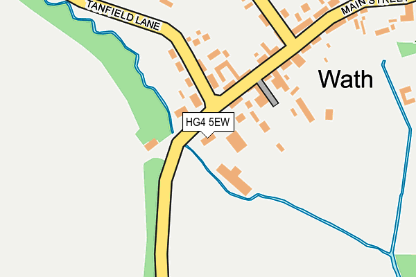
HG4 5EW is located in the Wathvale & Bishop Monkton electoral ward, within the unitary authority of North Yorkshire and the English Parliamentary constituency of Skipton and Ripon. The Sub Integrated Care Board (ICB) Location is NHS Humber and North Yorkshire ICB - 42D and the police force is North Yorkshire. This postcode has been in use since January 1980.


GetTheData
Source: OS OpenMap – Local (Ordnance Survey)
Source: OS VectorMap District (Ordnance Survey)
Licence: Open Government Licence (requires attribution)
| Easting | 432229 |
| Northing | 476921 |
| Latitude | 54.187054 |
| Longitude | -1.507620 |
GetTheData
Source: Open Postcode Geo
Licence: Open Government Licence
| Country | England |
| Postcode District | HG4 |
➜ See where HG4 is on a map ➜ Where is Wath? | |
GetTheData
Source: Land Registry Price Paid Data
Licence: Open Government Licence
Elevation or altitude of HG4 5EW as distance above sea level:
| Metres | Feet | |
|---|---|---|
| Elevation | 30m | 98ft |
Elevation is measured from the approximate centre of the postcode, to the nearest point on an OS contour line from OS Terrain 50, which has contour spacing of ten vertical metres.
➜ How high above sea level am I? Find the elevation of your current position using your device's GPS.
GetTheData
Source: Open Postcode Elevation
Licence: Open Government Licence
| Ward | Wathvale & Bishop Monkton |
| Constituency | Skipton And Ripon |
GetTheData
Source: ONS Postcode Database
Licence: Open Government Licence
| The George Country Inn (Main Street) | Wath | 153m |
| The George Country Inn (Main Street) | Wath | 156m |
| Station House (N/A) | Melmerby | 834m |
| Station House (N/A) | Melmerby | 840m |
| Wobeck Lane (Main Street) | Melmerby | 1,243m |
GetTheData
Source: NaPTAN
Licence: Open Government Licence
GetTheData
Source: ONS Postcode Database
Licence: Open Government Licence

➜ Get more ratings from the Food Standards Agency
GetTheData
Source: Food Standards Agency
Licence: FSA terms & conditions
| Last Collection | |||
|---|---|---|---|
| Location | Mon-Fri | Sat | Distance |
| Nunwick Grange/Oak Road | 17:30 | 11:30 | 2,396m |
| North Lees Farm | 16:45 | 13:30 | 3,785m |
| Thornborough | 16:15 | 09:45 | 4,103m |
GetTheData
Source: Dracos
Licence: Creative Commons Attribution-ShareAlike
The below table lists the International Territorial Level (ITL) codes (formerly Nomenclature of Territorial Units for Statistics (NUTS) codes) and Local Administrative Units (LAU) codes for HG4 5EW:
| ITL 1 Code | Name |
|---|---|
| TLE | Yorkshire and The Humber |
| ITL 2 Code | Name |
| TLE2 | North Yorkshire |
| ITL 3 Code | Name |
| TLE22 | North Yorkshire CC |
| LAU 1 Code | Name |
| E07000165 | Harrogate |
GetTheData
Source: ONS Postcode Directory
Licence: Open Government Licence
The below table lists the Census Output Area (OA), Lower Layer Super Output Area (LSOA), and Middle Layer Super Output Area (MSOA) for HG4 5EW:
| Code | Name | |
|---|---|---|
| OA | E00141258 | |
| LSOA | E01027736 | Harrogate 003C |
| MSOA | E02005763 | Harrogate 003 |
GetTheData
Source: ONS Postcode Directory
Licence: Open Government Licence
| HG4 5EP | Tanfield Road | 115m |
| HG4 5NZ | Norton Close | 118m |
| HG4 5EN | 122m | |
| HG4 5EL | 178m | |
| HG4 5ES | West View | 245m |
| HG4 5ET | 267m | |
| HG4 5ER | Bedale Lane | 288m |
| HG4 5EU | South View | 303m |
| HG4 5EJ | 440m | |
| HG4 5EX | Station Cottages | 832m |
GetTheData
Source: Open Postcode Geo; Land Registry Price Paid Data
Licence: Open Government Licence