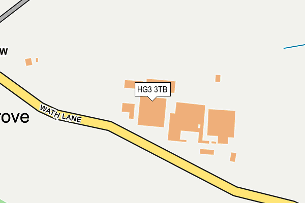
HG3 3TB is located in the Boroughbridge & Claro electoral ward, within the unitary authority of North Yorkshire and the English Parliamentary constituency of Harrogate and Knaresborough. The Sub Integrated Care Board (ICB) Location is NHS Humber and North Yorkshire ICB - 42D and the police force is North Yorkshire. This postcode has been in use since January 1980.


GetTheData
Source: OS OpenMap – Local (Ordnance Survey)
Source: OS VectorMap District (Ordnance Survey)
Licence: Open Government Licence (requires attribution)
| Easting | 434968 |
| Northing | 463133 |
| Latitude | 54.062977 |
| Longitude | -1.467247 |
GetTheData
Source: Open Postcode Geo
Licence: Open Government Licence
| Country | England |
| Postcode District | HG3 |
➜ See where HG3 is on a map ➜ Where is Copgrove? | |
GetTheData
Source: Land Registry Price Paid Data
Licence: Open Government Licence
Elevation or altitude of HG3 3TB as distance above sea level:
| Metres | Feet | |
|---|---|---|
| Elevation | 40m | 131ft |
Elevation is measured from the approximate centre of the postcode, to the nearest point on an OS contour line from OS Terrain 50, which has contour spacing of ten vertical metres.
➜ How high above sea level am I? Find the elevation of your current position using your device's GPS.
GetTheData
Source: Open Postcode Elevation
Licence: Open Government Licence
| Ward | Boroughbridge & Claro |
| Constituency | Harrogate And Knaresborough |
GetTheData
Source: ONS Postcode Database
Licence: Open Government Licence
| Jubilee Business Park (Wath Lane) | Copgrove | 57m |
| Jubilee Business Park (Wath Lane) | Copgrove | 62m |
| St Michael & All Angels Church (Wath Lane) | Copgrove | 384m |
| St Michael & All Angels Ch (Wath Lane) | Copgrove | 386m |
| Occaney Farm (Occaney Lane) | Occaney | 1,357m |
GetTheData
Source: NaPTAN
Licence: Open Government Licence
GetTheData
Source: ONS Postcode Database
Licence: Open Government Licence

➜ Get more ratings from the Food Standards Agency
GetTheData
Source: Food Standards Agency
Licence: FSA terms & conditions
| Last Collection | |||
|---|---|---|---|
| Location | Mon-Fri | Sat | Distance |
| West Garth Main St Roecliffe | 16:45 | 12:30 | 3,844m |
| Miniskip Village | 17:00 | 12:45 | 4,066m |
| Wormald Green | 16:15 | 11:30 | 4,808m |
GetTheData
Source: Dracos
Licence: Creative Commons Attribution-ShareAlike
The below table lists the International Territorial Level (ITL) codes (formerly Nomenclature of Territorial Units for Statistics (NUTS) codes) and Local Administrative Units (LAU) codes for HG3 3TB:
| ITL 1 Code | Name |
|---|---|
| TLE | Yorkshire and The Humber |
| ITL 2 Code | Name |
| TLE2 | North Yorkshire |
| ITL 3 Code | Name |
| TLE22 | North Yorkshire CC |
| LAU 1 Code | Name |
| E07000165 | Harrogate |
GetTheData
Source: ONS Postcode Directory
Licence: Open Government Licence
The below table lists the Census Output Area (OA), Lower Layer Super Output Area (LSOA), and Middle Layer Super Output Area (MSOA) for HG3 3TB:
| Code | Name | |
|---|---|---|
| OA | E00140793 | |
| LSOA | E01027646 | Harrogate 007B |
| MSOA | E02005767 | Harrogate 007 |
GetTheData
Source: ONS Postcode Directory
Licence: Open Government Licence
| HG3 3TY | St Mongahs Court | 488m |
| HG3 3SZ | 545m | |
| HG3 3TD | Copgrove Lane | 1325m |
| HG5 9NJ | Main Street | 1421m |
| HG3 3SY | 1442m | |
| HG5 9LD | Main Street | 1524m |
| HG5 9LG | Park View | 1709m |
| HG5 9JY | Main Street | 1762m |
| HG5 9LH | Spellow Grove | 1781m |
| HG5 9LJ | Spellow Crescent | 1826m |
GetTheData
Source: Open Postcode Geo; Land Registry Price Paid Data
Licence: Open Government Licence