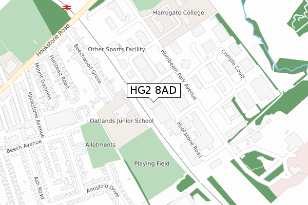
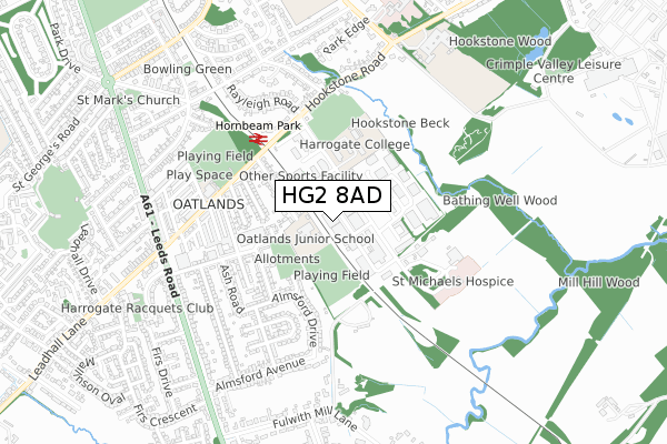
HG2 8AD is located in the Oatlands & Pannal electoral ward, within the unitary authority of North Yorkshire and the English Parliamentary constituency of Harrogate and Knaresborough. The Sub Integrated Care Board (ICB) Location is NHS Humber and North Yorkshire ICB - 42D and the police force is North Yorkshire. This postcode has been in use since April 2019.


GetTheData
Source: OS Open Zoomstack (Ordnance Survey)
Licence: Open Government Licence (requires attribution)
Attribution: Contains OS data © Crown copyright and database right 2025
Source: Open Postcode Geo
Licence: Open Government Licence (requires attribution)
Attribution: Contains OS data © Crown copyright and database right 2025; Contains Royal Mail data © Royal Mail copyright and database right 2025; Source: Office for National Statistics licensed under the Open Government Licence v.3.0
| Easting | 431346 |
| Northing | 453604 |
| Latitude | 53.977569 |
| Longitude | -1.523561 |
GetTheData
Source: Open Postcode Geo
Licence: Open Government Licence
| Country | England |
| Postcode District | HG2 |
➜ See where HG2 is on a map ➜ Where is Harrogate? | |
GetTheData
Source: Land Registry Price Paid Data
Licence: Open Government Licence
| Ward | Oatlands & Pannal |
| Constituency | Harrogate And Knaresborough |
GetTheData
Source: ONS Postcode Database
Licence: Open Government Licence
| Hornbeam Park Ave | Oatlands | 116m |
| Hornbeam Park B (Hornbeam Square West) | Oatlands | 190m |
| Hornbeam Park D (Hornbeam Square East) | Oatlands | 206m |
| Hornbeam Park C (N/A) | Oatlands | 253m |
| Harrogate College (Hornbeam Park Avenue) | Oatlands | 285m |
| Hornbeam Park Station | 0.3km |
| Harrogate Station | 2km |
| Pannal Station | 2.2km |
GetTheData
Source: NaPTAN
Licence: Open Government Licence
GetTheData
Source: ONS Postcode Database
Licence: Open Government Licence


➜ Get more ratings from the Food Standards Agency
GetTheData
Source: Food Standards Agency
Licence: FSA terms & conditions
| Last Collection | |||
|---|---|---|---|
| Location | Mon-Fri | Sat | Distance |
| Hornbeam Business Box | 18:30 | 12:30 | 307m |
| Oatlands Mount P.o. | 18:15 | 12:15 | 684m |
| Firs Ave/Leeds Road | 18:00 | 11:30 | 715m |
GetTheData
Source: Dracos
Licence: Creative Commons Attribution-ShareAlike
The below table lists the International Territorial Level (ITL) codes (formerly Nomenclature of Territorial Units for Statistics (NUTS) codes) and Local Administrative Units (LAU) codes for HG2 8AD:
| ITL 1 Code | Name |
|---|---|
| TLE | Yorkshire and The Humber |
| ITL 2 Code | Name |
| TLE2 | North Yorkshire |
| ITL 3 Code | Name |
| TLE22 | North Yorkshire CC |
| LAU 1 Code | Name |
| E07000165 | Harrogate |
GetTheData
Source: ONS Postcode Directory
Licence: Open Government Licence
The below table lists the Census Output Area (OA), Lower Layer Super Output Area (LSOA), and Middle Layer Super Output Area (MSOA) for HG2 8AD:
| Code | Name | |
|---|---|---|
| OA | E00140872 | |
| LSOA | E01027662 | Harrogate 017C |
| MSOA | E02005777 | Harrogate 017 |
GetTheData
Source: ONS Postcode Directory
Licence: Open Government Licence
| HG2 8QT | Hornbeam Park | 112m |
| HG2 8NB | Hornbeam Square South | 244m |
| HG2 8EF | Almsford Close | 247m |
| HG2 8DN | Birchwood Mews | 257m |
| HG2 8QP | Beechwood Grove | 259m |
| HG2 8PB | Hornbeam Square North | 269m |
| HG2 8EN | Almsford Drive | 306m |
| HG2 8ED | Almsford Drive | 314m |
| HG2 8NA | Hornbeam Park Avenue | 321m |
| HG2 8BP | Halstead Road | 324m |
GetTheData
Source: Open Postcode Geo; Land Registry Price Paid Data
Licence: Open Government Licence