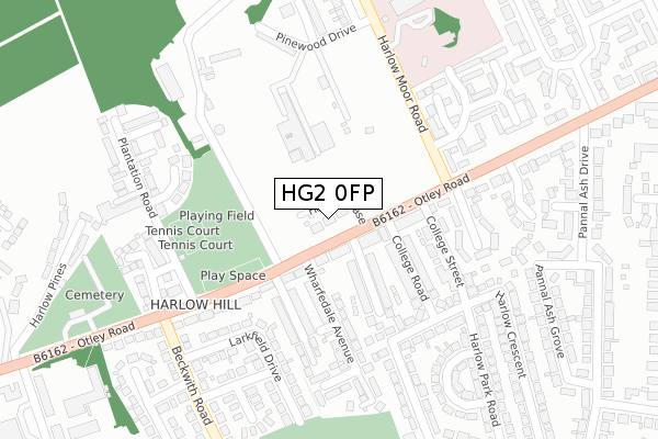
HG2 0FP is located in the Harlow & St. Georges electoral ward, within the unitary authority of North Yorkshire and the English Parliamentary constituency of Harrogate and Knaresborough. The Sub Integrated Care Board (ICB) Location is NHS Humber and North Yorkshire ICB - 42D and the police force is North Yorkshire. This postcode has been in use since August 2019.


GetTheData
Source: OS Open Zoomstack (Ordnance Survey)
Licence: Open Government Licence (requires attribution)
Attribution: Contains OS data © Crown copyright and database right 2025
Source: Open Postcode Geo
Licence: Open Government Licence (requires attribution)
Attribution: Contains OS data © Crown copyright and database right 2025; Contains Royal Mail data © Royal Mail copyright and database right 2025; Source: Office for National Statistics licensed under the Open Government Licence v.3.0
| Easting | 429004 |
| Northing | 454063 |
| Latitude | 53.981830 |
| Longitude | -1.559224 |
GetTheData
Source: Open Postcode Geo
Licence: Open Government Licence
| Country | England |
| Postcode District | HG2 |
➜ See where HG2 is on a map ➜ Where is Harrogate? | |
GetTheData
Source: Land Registry Price Paid Data
Licence: Open Government Licence
| Ward | Harlow & St. Georges |
| Constituency | Harrogate And Knaresborough |
GetTheData
Source: ONS Postcode Database
Licence: Open Government Licence
| Shepherds Dog (Otley Road) | Harlow Moor | 36m |
| Shepherds Dog (Otley Road) | Harlow Moor | 81m |
| College Street (Otley Road) | Harlow Moor | 152m |
| College Street (Otley Road) | Harlow Moor | 158m |
| Plantation Road (Otley Road) | Harlow Moor | 225m |
| Harrogate Station | 1.9km |
| Hornbeam Park Station | 2.1km |
| Pannal Station | 3.1km |
GetTheData
Source: NaPTAN
Licence: Open Government Licence
GetTheData
Source: ONS Postcode Database
Licence: Open Government Licence


➜ Get more ratings from the Food Standards Agency
GetTheData
Source: Food Standards Agency
Licence: FSA terms & conditions
| Last Collection | |||
|---|---|---|---|
| Location | Mon-Fri | Sat | Distance |
| Swinton Court | 17:45 | 12:30 | 211m |
| 2 Park Ave | 17:30 | 13:15 | 1,072m |
| Trinity Road | 17:30 | 13:15 | 1,340m |
GetTheData
Source: Dracos
Licence: Creative Commons Attribution-ShareAlike
The below table lists the International Territorial Level (ITL) codes (formerly Nomenclature of Territorial Units for Statistics (NUTS) codes) and Local Administrative Units (LAU) codes for HG2 0FP:
| ITL 1 Code | Name |
|---|---|
| TLE | Yorkshire and The Humber |
| ITL 2 Code | Name |
| TLE2 | North Yorkshire |
| ITL 3 Code | Name |
| TLE22 | North Yorkshire CC |
| LAU 1 Code | Name |
| E07000165 | Harrogate |
GetTheData
Source: ONS Postcode Directory
Licence: Open Government Licence
The below table lists the Census Output Area (OA), Lower Layer Super Output Area (LSOA), and Middle Layer Super Output Area (MSOA) for HG2 0FP:
| Code | Name | |
|---|---|---|
| OA | E00140822 | |
| LSOA | E01027653 | Harrogate 020A |
| MSOA | E02005780 | Harrogate 020 |
GetTheData
Source: ONS Postcode Directory
Licence: Open Government Licence
| HG2 0AG | Otley Road | 64m |
| HG2 0AT | West Lea Avenue | 110m |
| HG2 0AQ | College Road | 143m |
| HG2 0AY | Wharfedale Place | 177m |
| HG2 0AU | Wharfedale Avenue | 188m |
| HG2 0AH | College Street | 200m |
| HG2 0FG | Pendragon Way | 225m |
| HG2 0AP | Harlow Crescent | 226m |
| HG2 0DF | Plantation Close | 227m |
| HG2 0AX | Wharfedale Crescent | 236m |
GetTheData
Source: Open Postcode Geo; Land Registry Price Paid Data
Licence: Open Government Licence