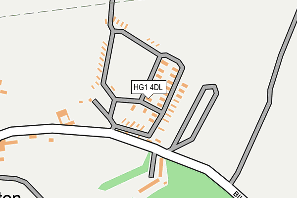
HG1 4DL is located in the Bilton & Nidd Gorge electoral ward, within the unitary authority of North Yorkshire and the English Parliamentary constituency of Harrogate and Knaresborough. The Sub Integrated Care Board (ICB) Location is NHS Humber and North Yorkshire ICB - 42D and the police force is North Yorkshire. This postcode has been in use since October 1985.


GetTheData
Source: OS OpenMap – Local (Ordnance Survey)
Source: OS VectorMap District (Ordnance Survey)
Licence: Open Government Licence (requires attribution)
| Easting | 432020 |
| Northing | 457804 |
| Latitude | 54.015274 |
| Longitude | -1.512845 |
GetTheData
Source: Open Postcode Geo
Licence: Open Government Licence
| Country | England |
| Postcode District | HG1 |
➜ See where HG1 is on a map ➜ Where is Old Bilton? | |
GetTheData
Source: Land Registry Price Paid Data
Licence: Open Government Licence
Elevation or altitude of HG1 4DL as distance above sea level:
| Metres | Feet | |
|---|---|---|
| Elevation | 90m | 295ft |
Elevation is measured from the approximate centre of the postcode, to the nearest point on an OS contour line from OS Terrain 50, which has contour spacing of ten vertical metres.
➜ How high above sea level am I? Find the elevation of your current position using your device's GPS.
GetTheData
Source: Open Postcode Elevation
Licence: Open Government Licence
| Ward | Bilton & Nidd Gorge |
| Constituency | Harrogate And Knaresborough |
GetTheData
Source: ONS Postcode Database
Licence: Open Government Licence
| Sandhill Drive | Bilton | 742m |
| Sandhill Drive | Bilton | 744m |
| Sandhill Drive | Bilton | 788m |
| Woodfield Road | Bilton | 820m |
| Sandhill Way (Sandhill Drive) | Bilton | 832m |
| Starbeck Station | 2km |
| Knaresborough Station | 2.9km |
| Harrogate Station | 2.9km |
GetTheData
Source: NaPTAN
Licence: Open Government Licence
| Median download speed | 21.4Mbps |
| Average download speed | 18.7Mbps |
| Maximum download speed | 33.59Mbps |
| Median upload speed | 3.5Mbps |
| Average upload speed | 3.4Mbps |
| Maximum upload speed | 6.39Mbps |
GetTheData
Source: Ofcom
Licence: Ofcom Terms of Use (requires attribution)
GetTheData
Source: ONS Postcode Database
Licence: Open Government Licence


➜ Get more ratings from the Food Standards Agency
GetTheData
Source: Food Standards Agency
Licence: FSA terms & conditions
| Last Collection | |||
|---|---|---|---|
| Location | Mon-Fri | Sat | Distance |
| Far Bilton | 17:30 | 13:30 | 410m |
| Royal Mail Harrogate | 19:00 | 13:30 | 1,526m |
| Kinglsey Road | 17:45 | 13:00 | 1,871m |
GetTheData
Source: Dracos
Licence: Creative Commons Attribution-ShareAlike
The below table lists the International Territorial Level (ITL) codes (formerly Nomenclature of Territorial Units for Statistics (NUTS) codes) and Local Administrative Units (LAU) codes for HG1 4DL:
| ITL 1 Code | Name |
|---|---|
| TLE | Yorkshire and The Humber |
| ITL 2 Code | Name |
| TLE2 | North Yorkshire |
| ITL 3 Code | Name |
| TLE22 | North Yorkshire CC |
| LAU 1 Code | Name |
| E07000165 | Harrogate |
GetTheData
Source: ONS Postcode Directory
Licence: Open Government Licence
The below table lists the Census Output Area (OA), Lower Layer Super Output Area (LSOA), and Middle Layer Super Output Area (MSOA) for HG1 4DL:
| Code | Name | |
|---|---|---|
| OA | E00171015 | |
| LSOA | E01027639 | Harrogate 010B |
| MSOA | E02005770 | Harrogate 010 |
GetTheData
Source: ONS Postcode Directory
Licence: Open Government Licence
| HG1 4DH | Bilton Lane | 230m |
| HG1 4DJ | Bilton Lane | 567m |
| HG1 4JG | Woodfield Road | 669m |
| HG1 4JQ | Woodfield Road | 704m |
| HG1 4DN | Bilton Lane | 733m |
| HG1 4JJ | Woodhall Grove | 735m |
| HG1 4JH | Woodhall Drive | 771m |
| HG1 4JN | Sandhill Way | 781m |
| HG1 4JL | Sandhill Drive | 783m |
| HG1 4JS | Sandhill Drive | 819m |
GetTheData
Source: Open Postcode Geo; Land Registry Price Paid Data
Licence: Open Government Licence