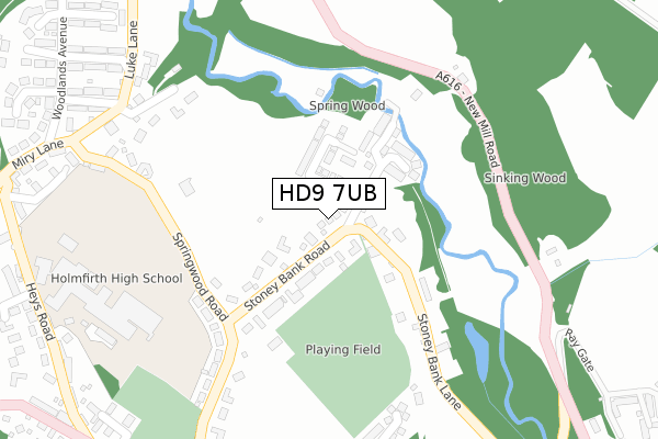
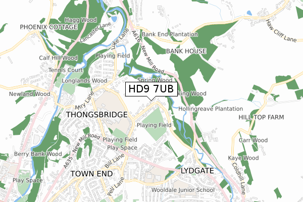
HD9 7UB is located in the Holme Valley South electoral ward, within the metropolitan district of Kirklees and the English Parliamentary constituency of Colne Valley. The Sub Integrated Care Board (ICB) Location is NHS West Yorkshire ICB - X2C4Y and the police force is West Yorkshire. This postcode has been in use since June 2019.


GetTheData
Source: OS Open Zoomstack (Ordnance Survey)
Licence: Open Government Licence (requires attribution)
Attribution: Contains OS data © Crown copyright and database right 2025
Source: Open Postcode Geo
Licence: Open Government Licence (requires attribution)
Attribution: Contains OS data © Crown copyright and database right 2025; Contains Royal Mail data © Royal Mail copyright and database right 2025; Source: Office for National Statistics licensed under the Open Government Licence v.3.0
| Easting | 415585 |
| Northing | 409726 |
| Latitude | 53.583910 |
| Longitude | -1.766062 |
GetTheData
Source: Open Postcode Geo
Licence: Open Government Licence
| Country | England |
| Postcode District | HD9 |
➜ See where HD9 is on a map ➜ Where is Thongsbridge? | |
GetTheData
Source: Land Registry Price Paid Data
Licence: Open Government Licence
| Ward | Holme Valley South |
| Constituency | Colne Valley |
GetTheData
Source: ONS Postcode Database
Licence: Open Government Licence
THE SYCAMORES, 3, WOOLLENS DRIVE, THONGSBRIDGE, HOLMFIRTH, HD9 7UB 2022 7 JAN £439,950 |
2, WOOLLENS DRIVE, THONGSBRIDGE, HOLMFIRTH, HD9 7UB 2021 4 JUN £420,000 |
1, WOOLLENS DRIVE, THONGSBRIDGE, HOLMFIRTH, HD9 7UB 2021 28 MAY £479,950 |
GetTheData
Source: HM Land Registry Price Paid Data
Licence: Contains HM Land Registry data © Crown copyright and database right 2025. This data is licensed under the Open Government Licence v3.0.
| Springwood Road | Thongsbridge | 225m |
| Springwood Road | Thongsbridge | 250m |
| New Mill Road Sinking Wood (New Mill Road) | Thongsbridge | 278m |
| New Mill Road Sinking Wood (New Mill Road) | Thongsbridge | 288m |
| Springwood Rd Luke Lane (Springwood Road) | Thongsbridge | 352m |
| Brockholes Station | 1.5km |
| Honley Station | 2.9km |
| Stocksmoor Station | 3.1km |
GetTheData
Source: NaPTAN
Licence: Open Government Licence
GetTheData
Source: ONS Postcode Database
Licence: Open Government Licence


➜ Get more ratings from the Food Standards Agency
GetTheData
Source: Food Standards Agency
Licence: FSA terms & conditions
| Last Collection | |||
|---|---|---|---|
| Location | Mon-Fri | Sat | Distance |
| Sycamore | 17:00 | 12:00 | 489m |
| Thongsbridge Station | 17:15 | 12:00 | 489m |
| Lydgate New Mill | 17:00 | 11:45 | 636m |
GetTheData
Source: Dracos
Licence: Creative Commons Attribution-ShareAlike
The below table lists the International Territorial Level (ITL) codes (formerly Nomenclature of Territorial Units for Statistics (NUTS) codes) and Local Administrative Units (LAU) codes for HD9 7UB:
| ITL 1 Code | Name |
|---|---|
| TLE | Yorkshire and The Humber |
| ITL 2 Code | Name |
| TLE4 | West Yorkshire |
| ITL 3 Code | Name |
| TLE44 | Calderdale and Kirklees |
| LAU 1 Code | Name |
| E08000034 | Kirklees |
GetTheData
Source: ONS Postcode Directory
Licence: Open Government Licence
The below table lists the Census Output Area (OA), Lower Layer Super Output Area (LSOA), and Middle Layer Super Output Area (MSOA) for HD9 7UB:
| Code | Name | |
|---|---|---|
| OA | E00056342 | |
| LSOA | E01011189 | Kirklees 059G |
| MSOA | E02002329 | Kirklees 059 |
GetTheData
Source: ONS Postcode Directory
Licence: Open Government Licence
| HD9 7SL | Stoneybank Road | 95m |
| HD9 7LZ | Stoney Bank Lane | 128m |
| HD9 7LW | Stoney Bank Lane | 151m |
| HD9 7LS | Old Mill Lane | 154m |
| HD9 7SJ | Springwood Road | 286m |
| HD9 7TH | Morefield Bank | 308m |
| HD9 7SN | Springwood Road | 311m |
| HD9 7SZ | Luke Lane | 359m |
| HD9 7SR | Larch Avenue | 413m |
| HD9 7TJ | Sycamore Rise | 420m |
GetTheData
Source: Open Postcode Geo; Land Registry Price Paid Data
Licence: Open Government Licence