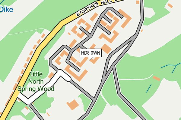
HD8 0WN is located in the Kirkburton electoral ward, within the metropolitan district of Kirklees and the English Parliamentary constituency of Dewsbury. The Sub Integrated Care Board (ICB) Location is NHS West Yorkshire ICB - X2C4Y and the police force is West Yorkshire. This postcode has been in use since December 1995.


GetTheData
Source: OS OpenMap – Local (Ordnance Survey)
Source: OS VectorMap District (Ordnance Survey)
Licence: Open Government Licence (requires attribution)
| Easting | 418070 |
| Northing | 412735 |
| Latitude | 53.610860 |
| Longitude | -1.728353 |
GetTheData
Source: Open Postcode Geo
Licence: Open Government Licence
| Country | England |
| Postcode District | HD8 |
➜ See where HD8 is on a map | |
GetTheData
Source: Land Registry Price Paid Data
Licence: Open Government Licence
Elevation or altitude of HD8 0WN as distance above sea level:
| Metres | Feet | |
|---|---|---|
| Elevation | 170m | 558ft |
Elevation is measured from the approximate centre of the postcode, to the nearest point on an OS contour line from OS Terrain 50, which has contour spacing of ten vertical metres.
➜ How high above sea level am I? Find the elevation of your current position using your device's GPS.
GetTheData
Source: Open Postcode Elevation
Licence: Open Government Licence
| Ward | Kirkburton |
| Constituency | Dewsbury |
GetTheData
Source: ONS Postcode Database
Licence: Open Government Licence
| Storthes Hall Park University Campus (University Of Huddersfield Campus Road) | Storthes Hall | 86m |
| Farnley Road Storthes Hall Ln (Farnley Road) | Storthes Hall | 907m |
| Farnley Road Storthes Hall Ln (Farnley Road) | Storthes Hall | 918m |
| Penistone Rd Lee Lane (Penistone Road) | Kirkburton | 965m |
| Penistone Rd Lee Lane (Penistone Road) | Kirkburton | 997m |
| Stocksmoor Station | 1.9km |
| Shepley Station | 2.9km |
| Brockholes Station | 3.1km |
GetTheData
Source: NaPTAN
Licence: Open Government Licence
GetTheData
Source: ONS Postcode Database
Licence: Open Government Licence


➜ Get more ratings from the Food Standards Agency
GetTheData
Source: Food Standards Agency
Licence: FSA terms & conditions
| Last Collection | |||
|---|---|---|---|
| Location | Mon-Fri | Sat | Distance |
| 66 Storthes Hall Lane Kirkburton | 17:30 | 12:00 | 275m |
| Spring Grove Pub | 17:30 | 12:00 | 1,058m |
| North Road | 17:30 | 12:00 | 1,223m |
GetTheData
Source: Dracos
Licence: Creative Commons Attribution-ShareAlike
The below table lists the International Territorial Level (ITL) codes (formerly Nomenclature of Territorial Units for Statistics (NUTS) codes) and Local Administrative Units (LAU) codes for HD8 0WN:
| ITL 1 Code | Name |
|---|---|
| TLE | Yorkshire and The Humber |
| ITL 2 Code | Name |
| TLE4 | West Yorkshire |
| ITL 3 Code | Name |
| TLE44 | Calderdale and Kirklees |
| LAU 1 Code | Name |
| E08000034 | Kirklees |
GetTheData
Source: ONS Postcode Directory
Licence: Open Government Licence
The below table lists the Census Output Area (OA), Lower Layer Super Output Area (LSOA), and Middle Layer Super Output Area (MSOA) for HD8 0WN:
| Code | Name | |
|---|---|---|
| OA | E00056380 | |
| LSOA | E01011195 | Kirklees 051B |
| MSOA | E02002321 | Kirklees 051 |
GetTheData
Source: ONS Postcode Directory
Licence: Open Government Licence
| HD8 0PT | Storthes Hall Lane | 251m |
| HD8 0PD | Woodside Lodge | 482m |
| HD8 0PJ | Woodsome Lees | 890m |
| HD8 0PE | Penistone Road | 973m |
| HD8 0PF | Penistone Road | 1015m |
| HD8 0PQ | Penistone Road | 1025m |
| HD8 0PG | Lee Lane | 1041m |
| HD8 0PN | Spring Grove | 1051m |
| HD8 0PZ | Woodsome Lees Lane | 1054m |
| HD8 0NP | The Park | 1085m |
GetTheData
Source: Open Postcode Geo; Land Registry Price Paid Data
Licence: Open Government Licence