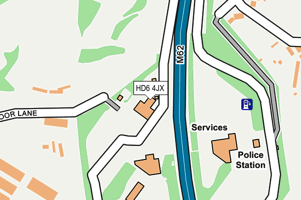
HD6 4JX is located in the Brighouse electoral ward, within the metropolitan district of Calderdale and the English Parliamentary constituency of Calder Valley. The Sub Integrated Care Board (ICB) Location is NHS West Yorkshire ICB - 02T and the police force is West Yorkshire. This postcode has been in use since January 1980.


GetTheData
Source: OS OpenMap – Local (Ordnance Survey)
Source: OS VectorMap District (Ordnance Survey)
Licence: Open Government Licence (requires attribution)
| Easting | 416831 |
| Northing | 424242 |
| Latitude | 53.714327 |
| Longitude | -1.746460 |
GetTheData
Source: Open Postcode Geo
Licence: Open Government Licence
| Country | England |
| Postcode District | HD6 |
➜ See where HD6 is on a map | |
GetTheData
Source: Land Registry Price Paid Data
Licence: Open Government Licence
Elevation or altitude of HD6 4JX as distance above sea level:
| Metres | Feet | |
|---|---|---|
| Elevation | 140m | 459ft |
Elevation is measured from the approximate centre of the postcode, to the nearest point on an OS contour line from OS Terrain 50, which has contour spacing of ten vertical metres.
➜ How high above sea level am I? Find the elevation of your current position using your device's GPS.
GetTheData
Source: Open Postcode Elevation
Licence: Open Government Licence
| Ward | Brighouse |
| Constituency | Calder Valley |
GetTheData
Source: ONS Postcode Database
Licence: Open Government Licence
| Hartshead Moor Service Station | Hartshead Moor | 157m |
| Old Pack Horse Ph (Halifax Road) | Hartshead Moor | 517m |
| Old Pack Horse Ph (Halifax Road) | Hartshead Moor | 560m |
| Old Pack Horse Ph (Moorside) | Hartshead Moor | 582m |
| Halifax Road Scholes Ln (Halifax Road) | Hartshead Moor | 601m |
| Brighouse Station | 2.8km |
| Low Moor Station | 4km |
| Mirfield Station | 6km |
GetTheData
Source: NaPTAN
Licence: Open Government Licence
GetTheData
Source: ONS Postcode Database
Licence: Open Government Licence


➜ Get more ratings from the Food Standards Agency
GetTheData
Source: Food Standards Agency
Licence: FSA terms & conditions
| Last Collection | |||
|---|---|---|---|
| Location | Mon-Fri | Sat | Distance |
| Moor Top | 17:30 | 12:30 | 575m |
| The Moor | 17:30 | 12:30 | 744m |
| Buttershaw Lane/Twelth Ave | 16:45 | 11:15 | 934m |
GetTheData
Source: Dracos
Licence: Creative Commons Attribution-ShareAlike
The below table lists the International Territorial Level (ITL) codes (formerly Nomenclature of Territorial Units for Statistics (NUTS) codes) and Local Administrative Units (LAU) codes for HD6 4JX:
| ITL 1 Code | Name |
|---|---|
| TLE | Yorkshire and The Humber |
| ITL 2 Code | Name |
| TLE4 | West Yorkshire |
| ITL 3 Code | Name |
| TLE44 | Calderdale and Kirklees |
| LAU 1 Code | Name |
| E08000033 | Calderdale |
GetTheData
Source: ONS Postcode Directory
Licence: Open Government Licence
The below table lists the Census Output Area (OA), Lower Layer Super Output Area (LSOA), and Middle Layer Super Output Area (MSOA) for HD6 4JX:
| Code | Name | |
|---|---|---|
| OA | E00054815 | |
| LSOA | E01010879 | Calderdale 015B |
| MSOA | E02002258 | Calderdale 015 |
GetTheData
Source: ONS Postcode Directory
Licence: Open Government Licence
| BD19 6LW | Highmoor Lane | 357m |
| BD19 6LR | Halifax Road | 534m |
| BD19 6ND | Brier Hill Close | 570m |
| BD19 6LJ | Halifax Road | 576m |
| BD19 6LL | Halifax Road | 579m |
| BD19 6LE | Moorside | 610m |
| BD19 6LF | Stonefield Street | 643m |
| BD19 6LN | Moorside | 665m |
| BD19 6LH | Halifax Road | 673m |
| BD19 6LG | New Lane | 683m |
GetTheData
Source: Open Postcode Geo; Land Registry Price Paid Data
Licence: Open Government Licence