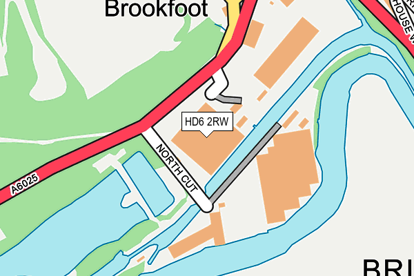
HD6 2RW is located in the Brighouse electoral ward, within the metropolitan district of Calderdale and the English Parliamentary constituency of Calder Valley. The Sub Integrated Care Board (ICB) Location is NHS West Yorkshire ICB - 02T and the police force is West Yorkshire. This postcode has been in use since March 1982.


GetTheData
Source: OS OpenMap – Local (Ordnance Survey)
Source: OS VectorMap District (Ordnance Survey)
Licence: Open Government Licence (requires attribution)
| Easting | 413565 |
| Northing | 422970 |
| Latitude | 53.702989 |
| Longitude | -1.796000 |
GetTheData
Source: Open Postcode Geo
Licence: Open Government Licence
| Country | England |
| Postcode District | HD6 |
➜ See where HD6 is on a map ➜ Where is Brighouse? | |
GetTheData
Source: Land Registry Price Paid Data
Licence: Open Government Licence
Elevation or altitude of HD6 2RW as distance above sea level:
| Metres | Feet | |
|---|---|---|
| Elevation | 60m | 197ft |
Elevation is measured from the approximate centre of the postcode, to the nearest point on an OS contour line from OS Terrain 50, which has contour spacing of ten vertical metres.
➜ How high above sea level am I? Find the elevation of your current position using your device's GPS.
GetTheData
Source: Open Postcode Elevation
Licence: Open Government Licence
| Ward | Brighouse |
| Constituency | Calder Valley |
GetTheData
Source: ONS Postcode Database
Licence: Open Government Licence
| Elland Road North Cut (Elland Road) | Brookfoot | 84m |
| Elland Road North Cut (Elland Road) | Brookfoot | 115m |
| Elland Road Wilton St (Elland Road) | Brookfoot | 307m |
| Elland Road Wilton St (Elland Road) | Brookfoot | 320m |
| Brighouse Wood Road (Elland Road) | Brookfoot | 354m |
| Brighouse Station | 1.2km |
| Halifax Station | 4.3km |
| Deighton Station | 4.8km |
GetTheData
Source: NaPTAN
Licence: Open Government Licence
GetTheData
Source: ONS Postcode Database
Licence: Open Government Licence


➜ Get more ratings from the Food Standards Agency
GetTheData
Source: Food Standards Agency
Licence: FSA terms & conditions
| Last Collection | |||
|---|---|---|---|
| Location | Mon-Fri | Sat | Distance |
| Slead Syke | 17:15 | 12:15 | 681m |
| Bonegate Road | 18:30 | 11:45 | 684m |
| Church Lane | 18:30 | 12:30 | 843m |
GetTheData
Source: Dracos
Licence: Creative Commons Attribution-ShareAlike
| Risk of HD6 2RW flooding from rivers and sea | Low |
| ➜ HD6 2RW flood map | |
GetTheData
Source: Open Flood Risk by Postcode
Licence: Open Government Licence
The below table lists the International Territorial Level (ITL) codes (formerly Nomenclature of Territorial Units for Statistics (NUTS) codes) and Local Administrative Units (LAU) codes for HD6 2RW:
| ITL 1 Code | Name |
|---|---|
| TLE | Yorkshire and The Humber |
| ITL 2 Code | Name |
| TLE4 | West Yorkshire |
| ITL 3 Code | Name |
| TLE44 | Calderdale and Kirklees |
| LAU 1 Code | Name |
| E08000033 | Calderdale |
GetTheData
Source: ONS Postcode Directory
Licence: Open Government Licence
The below table lists the Census Output Area (OA), Lower Layer Super Output Area (LSOA), and Middle Layer Super Output Area (MSOA) for HD6 2RW:
| Code | Name | |
|---|---|---|
| OA | E00054820 | |
| LSOA | E01010877 | Calderdale 019C |
| MSOA | E02002262 | Calderdale 019 |
GetTheData
Source: ONS Postcode Directory
Licence: Open Government Licence
| HD6 2RB | Elland Road | 58m |
| HD6 2QR | Elland Road | 333m |
| HD6 2QT | Brighouse Wood Row | 339m |
| HD6 2QU | Brighouse Wood Lane | 340m |
| HD6 2QX | Helen Terrace | 346m |
| HD6 2RE | Grove Cottages | 348m |
| HD6 2QY | Wilton Street | 363m |
| HD6 2RF | Grove Terrace | 372m |
| HD6 2RL | Bowling Court | 412m |
| HD6 2AP | Elmwood Drive | 414m |
GetTheData
Source: Open Postcode Geo; Land Registry Price Paid Data
Licence: Open Government Licence