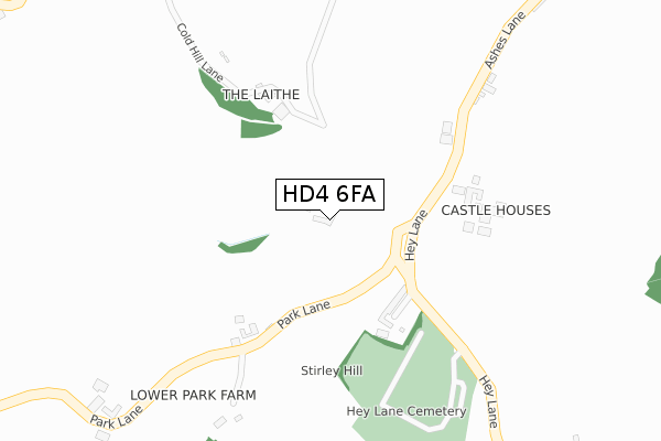
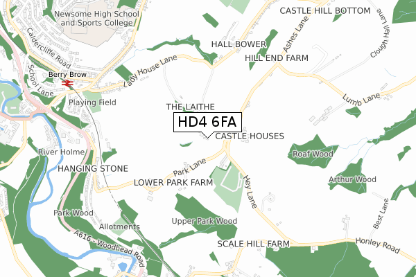
HD4 6FA is located in the Newsome electoral ward, within the metropolitan district of Kirklees and the English Parliamentary constituency of Huddersfield. The Sub Integrated Care Board (ICB) Location is NHS West Yorkshire ICB - X2C4Y and the police force is West Yorkshire. This postcode has been in use since September 2019.


GetTheData
Source: OS Open Zoomstack (Ordnance Survey)
Licence: Open Government Licence (requires attribution)
Attribution: Contains OS data © Crown copyright and database right 2025
Source: Open Postcode Geo
Licence: Open Government Licence (requires attribution)
Attribution: Contains OS data © Crown copyright and database right 2025; Contains Royal Mail data © Royal Mail copyright and database right 2025; Source: Office for National Statistics licensed under the Open Government Licence v.3.0
| Easting | 414603 |
| Northing | 413513 |
| Latitude | 53.617976 |
| Longitude | -1.780719 |
GetTheData
Source: Open Postcode Geo
Licence: Open Government Licence
| Country | England |
| Postcode District | HD4 |
➜ See where HD4 is on a map | |
GetTheData
Source: Land Registry Price Paid Data
Licence: Open Government Licence
| Ward | Newsome |
| Constituency | Huddersfield |
GetTheData
Source: ONS Postcode Database
Licence: Open Government Licence
| Hey Lane Park Ln (Hey Lane) | Berry Brow | 160m |
| Hey Lane | Berry Brow | 167m |
| Ashes Lane Castle Houses (Ashes Lane) | Berry Brow | 212m |
| Ashes Lane Castle Houses (Ashes Lane) | Berry Brow | 274m |
| Hey Lane Stirley Hill (Hey Lane) | Berry Brow | 328m |
| Berry Brow Station | 0.9km |
| Honley Station | 1.1km |
| Lockwood Station | 2.3km |
GetTheData
Source: NaPTAN
Licence: Open Government Licence
GetTheData
Source: ONS Postcode Database
Licence: Open Government Licence


➜ Get more ratings from the Food Standards Agency
GetTheData
Source: Food Standards Agency
Licence: FSA terms & conditions
| Last Collection | |||
|---|---|---|---|
| Location | Mon-Fri | Sat | Distance |
| Stirley Hill | 16:30 | 10:45 | 119m |
| 43 Robin Hood Hill | 16:30 | 11:45 | 714m |
| Plantation Drive | 17:15 | 12:15 | 770m |
GetTheData
Source: Dracos
Licence: Creative Commons Attribution-ShareAlike
The below table lists the International Territorial Level (ITL) codes (formerly Nomenclature of Territorial Units for Statistics (NUTS) codes) and Local Administrative Units (LAU) codes for HD4 6FA:
| ITL 1 Code | Name |
|---|---|
| TLE | Yorkshire and The Humber |
| ITL 2 Code | Name |
| TLE4 | West Yorkshire |
| ITL 3 Code | Name |
| TLE44 | Calderdale and Kirklees |
| LAU 1 Code | Name |
| E08000034 | Kirklees |
GetTheData
Source: ONS Postcode Directory
Licence: Open Government Licence
The below table lists the Census Output Area (OA), Lower Layer Super Output Area (LSOA), and Middle Layer Super Output Area (MSOA) for HD4 6FA:
| Code | Name | |
|---|---|---|
| OA | E00056584 | |
| LSOA | E01011226 | Kirklees 048B |
| MSOA | E02002318 | Kirklees 048 |
GetTheData
Source: ONS Postcode Directory
Licence: Open Government Licence
| HD4 6TX | Stirley Hill | 159m |
| HD4 6TU | Cold Hill | 211m |
| HD4 6TS | Ashes Lane | 228m |
| HD4 6TR | Lower Park | 431m |
| HD4 6TT | Ashes Lane | 463m |
| HD4 6RP | Hall Bower Lane | 487m |
| HD4 7QE | Ladyhouse Lane | 531m |
| HD4 6RW | Hall Bower Lane | 592m |
| HD4 6RR | Hall Bower | 623m |
| HD4 7QP | Robin Hood Hill | 688m |
GetTheData
Source: Open Postcode Geo; Land Registry Price Paid Data
Licence: Open Government Licence