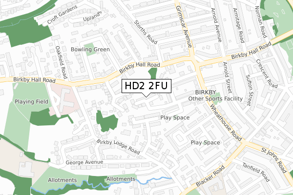
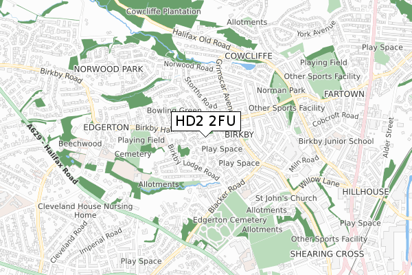
HD2 2FU is located in the Greenhead electoral ward, within the metropolitan district of Kirklees and the English Parliamentary constituency of Huddersfield. The Sub Integrated Care Board (ICB) Location is NHS West Yorkshire ICB - X2C4Y and the police force is West Yorkshire. This postcode has been in use since April 2018.


GetTheData
Source: OS Open Zoomstack (Ordnance Survey)
Licence: Open Government Licence (requires attribution)
Attribution: Contains OS data © Crown copyright and database right 2025
Source: Open Postcode Geo
Licence: Open Government Licence (requires attribution)
Attribution: Contains OS data © Crown copyright and database right 2025; Contains Royal Mail data © Royal Mail copyright and database right 2025; Source: Office for National Statistics licensed under the Open Government Licence v.3.0
| Easting | 413606 |
| Northing | 418082 |
| Latitude | 53.659069 |
| Longitude | -1.795593 |
GetTheData
Source: Open Postcode Geo
Licence: Open Government Licence
| Country | England |
| Postcode District | HD2 |
➜ See where HD2 is on a map ➜ Where is Huddersfield? | |
GetTheData
Source: Land Registry Price Paid Data
Licence: Open Government Licence
| Ward | Greenhead |
| Constituency | Huddersfield |
GetTheData
Source: ONS Postcode Database
Licence: Open Government Licence
2020 23 OCT £319,995 |
2, OLD HOPKINSON DRIVE, HUDDERSFIELD, HD2 2FU 2019 19 DEC £399,000 |
6, OLD HOPKINSON DRIVE, HUDDERSFIELD, HD2 2FU 2019 30 AUG £286,000 |
4, OLD HOPKINSON DRIVE, HUDDERSFIELD, HD2 2FU 2019 8 AUG £292,000 |
10, OLD HOPKINSON DRIVE, HUDDERSFIELD, HD2 2FU 2019 9 APR £350,000 |
3, OLD HOPKINSON DRIVE, HUDDERSFIELD, HD2 2FU 2018 16 NOV £335,000 |
1, OLD HOPKINSON DRIVE, HUDDERSFIELD, HD2 2FU 2018 31 OCT £275,000 |
2018 31 OCT £290,000 |
7, OLD HOPKINSON DRIVE, HUDDERSFIELD, HD2 2FU 2018 14 SEP £289,000 |
8, OLD HOPKINSON DRIVE, HUDDERSFIELD, HD2 2FU 2018 8 JUN £280,000 |
GetTheData
Source: HM Land Registry Price Paid Data
Licence: Contains HM Land Registry data © Crown copyright and database right 2025. This data is licensed under the Open Government Licence v3.0.
| Birkby Lodge Road Una Pl (Birkby Lodge Road) | Birkby | 184m |
| Wheathouse Rd Newland Avenue (Wheathouse Road) | Birkby | 190m |
| Wheathouse Rd Newland Avenue (Wheathouse Road) | Birkby | 201m |
| Birkby Lodge Road George Ave (Birkby Lodge Road) | Birkby | 213m |
| Birkby Lodge Road Una Pl (Birkby Lodge Road) | Birkby | 219m |
| Huddersfield Station | 1.4km |
| Lockwood Station | 2.7km |
| Deighton Station | 3.1km |
GetTheData
Source: NaPTAN
Licence: Open Government Licence
| Percentage of properties with Next Generation Access | 100.0% |
| Percentage of properties with Superfast Broadband | 100.0% |
| Percentage of properties with Ultrafast Broadband | 0.0% |
| Percentage of properties with Full Fibre Broadband | 0.0% |
Superfast Broadband is between 30Mbps and 300Mbps
Ultrafast Broadband is > 300Mbps
| Median download speed | 11.4Mbps |
| Average download speed | 26.6Mbps |
| Maximum download speed | 73.21Mbps |
| Median upload speed | 1.3Mbps |
| Average upload speed | 6.3Mbps |
| Maximum upload speed | 19.53Mbps |
| Percentage of properties unable to receive 2Mbps | 0.0% |
| Percentage of properties unable to receive 5Mbps | 0.0% |
| Percentage of properties unable to receive 10Mbps | 0.0% |
| Percentage of properties unable to receive 30Mbps | 0.0% |
GetTheData
Source: Ofcom
Licence: Ofcom Terms of Use (requires attribution)
GetTheData
Source: ONS Postcode Database
Licence: Open Government Licence


➜ Get more ratings from the Food Standards Agency
GetTheData
Source: Food Standards Agency
Licence: FSA terms & conditions
| Last Collection | |||
|---|---|---|---|
| Location | Mon-Fri | Sat | Distance |
| Vernon Avenue | 17:30 | 12:00 | 995m |
| Marsh P.o. Box | 17:30 | 12:00 | 1,109m |
| 132 Alder Street | 17:15 | 12:00 | 1,162m |
GetTheData
Source: Dracos
Licence: Creative Commons Attribution-ShareAlike
The below table lists the International Territorial Level (ITL) codes (formerly Nomenclature of Territorial Units for Statistics (NUTS) codes) and Local Administrative Units (LAU) codes for HD2 2FU:
| ITL 1 Code | Name |
|---|---|
| TLE | Yorkshire and The Humber |
| ITL 2 Code | Name |
| TLE4 | West Yorkshire |
| ITL 3 Code | Name |
| TLE44 | Calderdale and Kirklees |
| LAU 1 Code | Name |
| E08000034 | Kirklees |
GetTheData
Source: ONS Postcode Directory
Licence: Open Government Licence
The below table lists the Census Output Area (OA), Lower Layer Super Output Area (LSOA), and Middle Layer Super Output Area (MSOA) for HD2 2FU:
| Code | Name | |
|---|---|---|
| OA | E00055627 | |
| LSOA | E01011044 | Kirklees 031C |
| MSOA | E02002301 | Kirklees 031 |
GetTheData
Source: ONS Postcode Directory
Licence: Open Government Licence
| HD2 2UT | Northbank Road | 71m |
| HD2 2US | Macaulay Road | 110m |
| HD2 2UU | Newland Avenue | 119m |
| HD2 2BF | Ponyfield Close | 126m |
| HD2 2RH | Platnam Grove | 128m |
| HD2 2XA | Birkby Hall Road | 135m |
| HD2 2XL | Storths Place | 163m |
| HD2 2GD | Annie Smith Way | 164m |
| HD2 2UZ | Birkby Hall Road | 173m |
| HD2 2UX | Wheathouse Road | 176m |
GetTheData
Source: Open Postcode Geo; Land Registry Price Paid Data
Licence: Open Government Licence