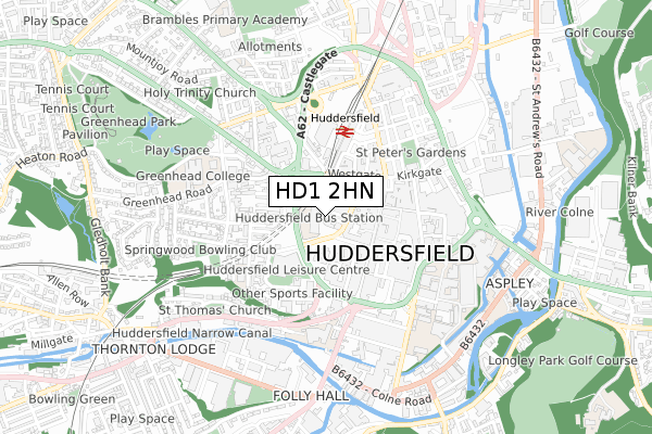
HD1 2HN is located in the Newsome electoral ward, within the metropolitan district of Kirklees and the English Parliamentary constituency of Huddersfield. The Sub Integrated Care Board (ICB) Location is NHS West Yorkshire ICB - X2C4Y and the police force is West Yorkshire. This postcode has been in use since September 2019.


GetTheData
Source: OS Open Zoomstack (Ordnance Survey)
Licence: Open Government Licence (requires attribution)
Attribution: Contains OS data © Crown copyright and database right 2025
Source: Open Postcode Geo
Licence: Open Government Licence (requires attribution)
Attribution: Contains OS data © Crown copyright and database right 2025; Contains Royal Mail data © Royal Mail copyright and database right 2025; Source: Office for National Statistics licensed under the Open Government Licence v.3.0
| Easting | 414250 |
| Northing | 416579 |
| Latitude | 53.645543 |
| Longitude | -1.785917 |
GetTheData
Source: Open Postcode Geo
Licence: Open Government Licence
| Country | England |
| Postcode District | HD1 |
➜ See where HD1 is on a map ➜ Where is Huddersfield? | |
GetTheData
Source: Land Registry Price Paid Data
Licence: Open Government Licence
| Ward | Newsome |
| Constituency | Huddersfield |
GetTheData
Source: ONS Postcode Database
Licence: Open Government Licence
| Market Street | Huddersfield Town Centre | 65m |
| Market Street | Huddersfield Town Centre | 68m |
| Market Street | Huddersfield Town Centre | 111m |
| High Street | Huddersfield Town Centre | 134m |
| High Street | Huddersfield Town Centre | 154m |
| Huddersfield Station | 0.3km |
| Lockwood Station | 1.6km |
| Berry Brow Station | 2.8km |
GetTheData
Source: NaPTAN
Licence: Open Government Licence
GetTheData
Source: ONS Postcode Database
Licence: Open Government Licence


➜ Get more ratings from the Food Standards Agency
GetTheData
Source: Food Standards Agency
Licence: FSA terms & conditions
| Last Collection | |||
|---|---|---|---|
| Location | Mon-Fri | Sat | Distance |
| Bus Station | 18:30 | 12:00 | 20m |
| Market Street | 18:30 | 12:30 | 82m |
| Market Street Business Box | 186m | ||
GetTheData
Source: Dracos
Licence: Creative Commons Attribution-ShareAlike
The below table lists the International Territorial Level (ITL) codes (formerly Nomenclature of Territorial Units for Statistics (NUTS) codes) and Local Administrative Units (LAU) codes for HD1 2HN:
| ITL 1 Code | Name |
|---|---|
| TLE | Yorkshire and The Humber |
| ITL 2 Code | Name |
| TLE4 | West Yorkshire |
| ITL 3 Code | Name |
| TLE44 | Calderdale and Kirklees |
| LAU 1 Code | Name |
| E08000034 | Kirklees |
GetTheData
Source: ONS Postcode Directory
Licence: Open Government Licence
The below table lists the Census Output Area (OA), Lower Layer Super Output Area (LSOA), and Middle Layer Super Output Area (MSOA) for HD1 2HN:
| Code | Name | |
|---|---|---|
| OA | E00055983 | |
| LSOA | E01011107 | Kirklees 029D |
| MSOA | E02002299 | Kirklees 029 |
GetTheData
Source: ONS Postcode Directory
Licence: Open Government Licence
| HD1 4AA | Henry Street | 126m |
| HD1 2JD | Half Moon Street | 144m |
| HD1 4DA | Trinity Street | 156m |
| HD1 2LE | High Street | 159m |
| HD1 4BU | Old South Street | 174m |
| HD1 2EP | Brooks Yard | 181m |
| HD1 2BW | New Street | 182m |
| HD1 1NX | Westgate | 196m |
| HD1 2BQ | New Street | 212m |
| HD1 1NP | Westgate | 218m |
GetTheData
Source: Open Postcode Geo; Land Registry Price Paid Data
Licence: Open Government Licence