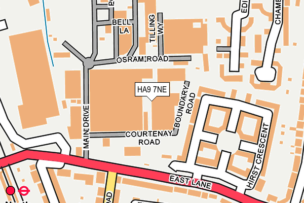
HA9 7NE is located in the Preston electoral ward, within the London borough of Brent and the English Parliamentary constituency of Brent North. The Sub Integrated Care Board (ICB) Location is NHS North West London ICB - W2U3Z and the police force is Metropolitan Police. This postcode has been in use since January 1993.


GetTheData
Source: OS OpenMap – Local (Ordnance Survey)
Source: OS VectorMap District (Ordnance Survey)
Licence: Open Government Licence (requires attribution)
| Easting | 517948 |
| Northing | 186375 |
| Latitude | 51.563929 |
| Longitude | -0.299756 |
GetTheData
Source: Open Postcode Geo
Licence: Open Government Licence
| Country | England |
| Postcode District | HA9 |
➜ See where HA9 is on a map ➜ Where is Wembley? | |
GetTheData
Source: Land Registry Price Paid Data
Licence: Open Government Licence
Elevation or altitude of HA9 7NE as distance above sea level:
| Metres | Feet | |
|---|---|---|
| Elevation | 40m | 131ft |
Elevation is measured from the approximate centre of the postcode, to the nearest point on an OS contour line from OS Terrain 50, which has contour spacing of ten vertical metres.
➜ How high above sea level am I? Find the elevation of your current position using your device's GPS.
GetTheData
Source: Open Postcode Elevation
Licence: Open Government Licence
| Ward | Preston |
| Constituency | Brent North |
GetTheData
Source: ONS Postcode Database
Licence: Open Government Licence
| Pembroke Road (Ha9) | North Wembley | 151m |
| Pembroke Road (Ha9) | North Wembley | 152m |
| Rosslyn Crescent | North Wembley | 269m |
| Rosslyn Crescent | North Wembley | 308m |
| North Wembley Station (East Lane) | North Wembley | 431m |
| North Wembley Underground Station | North Wembley | 330m |
| South Kenton Underground Station | South Kenton | 923m |
| Preston Road Underground Station | Preston | 952m |
| Wembley Central Underground Station | Wembley | 1,309m |
| Wembley Park Underground Station | Wembley Park | 1,425m |
| North Wembley Station | 0.3km |
| South Kenton Station | 0.9km |
| Wembley Central Station | 1.3km |
GetTheData
Source: NaPTAN
Licence: Open Government Licence
| Median download speed | 74.0Mbps |
| Average download speed | 49.9Mbps |
| Maximum download speed | 80.00Mbps |
| Median upload speed | 17.1Mbps |
| Average upload speed | 11.9Mbps |
| Maximum upload speed | 20.00Mbps |
GetTheData
Source: Ofcom
Licence: Ofcom Terms of Use (requires attribution)
GetTheData
Source: ONS Postcode Database
Licence: Open Government Licence


➜ Get more ratings from the Food Standards Agency
GetTheData
Source: Food Standards Agency
Licence: FSA terms & conditions
| Last Collection | |||
|---|---|---|---|
| Location | Mon-Fri | Sat | Distance |
| Gec Industrial Estate | 18:30 | 12:00 | 159m |
| Harrowdene Road | 17:45 | 12:45 | 369m |
| 76 Peel Road | 17:00 | 12:00 | 419m |
GetTheData
Source: Dracos
Licence: Creative Commons Attribution-ShareAlike
The below table lists the International Territorial Level (ITL) codes (formerly Nomenclature of Territorial Units for Statistics (NUTS) codes) and Local Administrative Units (LAU) codes for HA9 7NE:
| ITL 1 Code | Name |
|---|---|
| TLI | London |
| ITL 2 Code | Name |
| TLI7 | Outer London - West and North West |
| ITL 3 Code | Name |
| TLI72 | Brent |
| LAU 1 Code | Name |
| E09000005 | Brent |
GetTheData
Source: ONS Postcode Directory
Licence: Open Government Licence
The below table lists the Census Output Area (OA), Lower Layer Super Output Area (LSOA), and Middle Layer Super Output Area (MSOA) for HA9 7NE:
| Code | Name | |
|---|---|---|
| OA | E00174554 | |
| LSOA | E01000577 | Brent 007E |
| MSOA | E02000099 | Brent 007 |
GetTheData
Source: ONS Postcode Directory
Licence: Open Government Licence
| HA9 7HJ | Hirst Crescent | 113m |
| HA9 7HF | Hirst Crescent | 129m |
| HA9 7PB | East Lane | 183m |
| HA9 7PU | East Lane | 201m |
| HA9 7HH | Hirst Crescent | 212m |
| HA9 7HL | Hirst Crescent | 215m |
| HA9 8SU | Edison Drive | 217m |
| HA9 7PE | East Lane | 221m |
| HA9 8SS | Chamberlayne Avenue | 230m |
| HA9 7HE | Hirst Crescent | 231m |
GetTheData
Source: Open Postcode Geo; Land Registry Price Paid Data
Licence: Open Government Licence