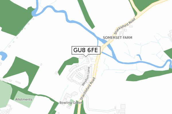
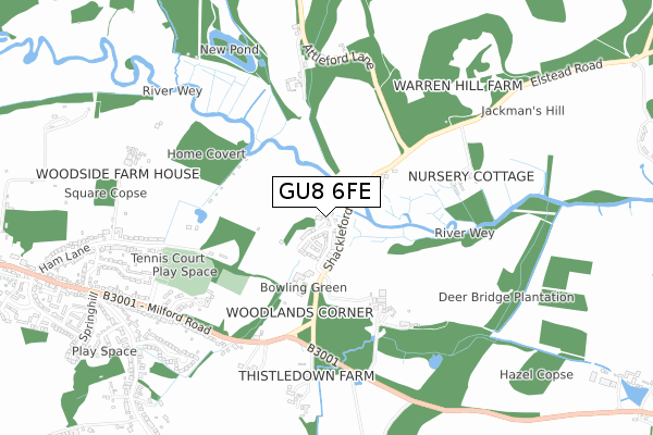
GU8 6FE is located in the Elstead & Peper Harow electoral ward, within the local authority district of Waverley and the English Parliamentary constituency of South West Surrey. The Sub Integrated Care Board (ICB) Location is NHS Surrey Heartlands ICB - 92A and the police force is Surrey. This postcode has been in use since October 2019.


GetTheData
Source: OS Open Zoomstack (Ordnance Survey)
Licence: Open Government Licence (requires attribution)
Attribution: Contains OS data © Crown copyright and database right 2025
Source: Open Postcode Geo
Licence: Open Government Licence (requires attribution)
Attribution: Contains OS data © Crown copyright and database right 2025; Contains Royal Mail data © Royal Mail copyright and database right 2025; Source: Office for National Statistics licensed under the Open Government Licence v.3.0
| Easting | 492054 |
| Northing | 143843 |
| Latitude | 51.186409 |
| Longitude | -0.684212 |
GetTheData
Source: Open Postcode Geo
Licence: Open Government Licence
| Country | England |
| Postcode District | GU8 |
➜ See where GU8 is on a map ➜ Where is Elstead? | |
GetTheData
Source: Land Registry Price Paid Data
Licence: Open Government Licence
| Ward | Elstead & Peper Harow |
| Constituency | South West Surrey |
GetTheData
Source: ONS Postcode Database
Licence: Open Government Licence
5, WATER MEADOW CLOSE, ELSTEAD, GODALMING, GU8 6FE 2021 13 JUL £675,000 |
1, WATER MEADOW CLOSE, ELSTEAD, GODALMING, GU8 6FE 2021 29 JUN £850,000 |
9, WATER MEADOW CLOSE, ELSTEAD, GODALMING, GU8 6FE 2020 18 DEC £695,000 |
GetTheData
Source: HM Land Registry Price Paid Data
Licence: Contains HM Land Registry data © Crown copyright and database right 2025. This data is licensed under the Open Government Licence v3.0.
| Shackleford Road | Peper Harow | 637m |
| Shackleford Road | Peper Harow | 639m |
| Milford Road | Elstead | 683m |
| Milford Road | Elstead | 695m |
| Hookley Lane (Milford Road) | Elstead | 940m |
| Milford (Surrey) Station | 4.2km |
| Godalming Station | 4.6km |
GetTheData
Source: NaPTAN
Licence: Open Government Licence
GetTheData
Source: ONS Postcode Database
Licence: Open Government Licence


➜ Get more ratings from the Food Standards Agency
GetTheData
Source: Food Standards Agency
Licence: FSA terms & conditions
| Last Collection | |||
|---|---|---|---|
| Location | Mon-Fri | Sat | Distance |
| Royal Common | 16:45 | 10:00 | 599m |
| Hookley Lane | 16:45 | 08:30 | 1,042m |
| Springfields Estate | 16:45 | 10:00 | 1,114m |
GetTheData
Source: Dracos
Licence: Creative Commons Attribution-ShareAlike
| Risk of GU8 6FE flooding from rivers and sea | Medium |
| ➜ GU8 6FE flood map | |
GetTheData
Source: Open Flood Risk by Postcode
Licence: Open Government Licence
The below table lists the International Territorial Level (ITL) codes (formerly Nomenclature of Territorial Units for Statistics (NUTS) codes) and Local Administrative Units (LAU) codes for GU8 6FE:
| ITL 1 Code | Name |
|---|---|
| TLJ | South East (England) |
| ITL 2 Code | Name |
| TLJ2 | Surrey, East and West Sussex |
| ITL 3 Code | Name |
| TLJ25 | West Surrey |
| LAU 1 Code | Name |
| E07000216 | Waverley |
GetTheData
Source: ONS Postcode Directory
Licence: Open Government Licence
The below table lists the Census Output Area (OA), Lower Layer Super Output Area (LSOA), and Middle Layer Super Output Area (MSOA) for GU8 6FE:
| Code | Name | |
|---|---|---|
| OA | E00157446 | |
| LSOA | E01030878 | Waverley 011B |
| MSOA | E02006449 | Waverley 011 |
GetTheData
Source: ONS Postcode Directory
Licence: Open Government Licence
| GU8 6LB | Shackleford Road | 228m |
| GU8 6HX | Milford Road | 531m |
| GU8 6HU | Burford Lodge | 560m |
| GU8 6HT | Burford Lea | 649m |
| GU8 6HZ | Milford Road | 650m |
| GU8 6HQ | Lower Ham Lane | 753m |
| GU8 6JA | Silver Birches Way | 770m |
| GU8 6HY | Milford Road | 786m |
| GU8 6HJ | Hazelwood | 788m |
| GU8 6HS | Milford Road | 839m |
GetTheData
Source: Open Postcode Geo; Land Registry Price Paid Data
Licence: Open Government Licence