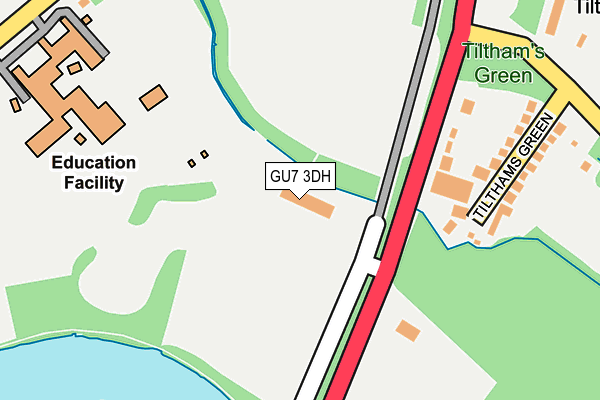
GU7 3DH is located in the Godalming Farncombe & Catteshall electoral ward, within the local authority district of Waverley and the English Parliamentary constituency of South West Surrey. The Sub Integrated Care Board (ICB) Location is NHS Surrey Heartlands ICB - 92A and the police force is Surrey. This postcode has been in use since December 1995.


GetTheData
Source: OS OpenMap – Local (Ordnance Survey)
Source: OS VectorMap District (Ordnance Survey)
Licence: Open Government Licence (requires attribution)
| Easting | 498580 |
| Northing | 145511 |
| Latitude | 51.200319 |
| Longitude | -0.590426 |
GetTheData
Source: Open Postcode Geo
Licence: Open Government Licence
| Country | England |
| Postcode District | GU7 |
➜ See where GU7 is on a map | |
GetTheData
Source: Land Registry Price Paid Data
Licence: Open Government Licence
Elevation or altitude of GU7 3DH as distance above sea level:
| Metres | Feet | |
|---|---|---|
| Elevation | 40m | 131ft |
Elevation is measured from the approximate centre of the postcode, to the nearest point on an OS contour line from OS Terrain 50, which has contour spacing of ten vertical metres.
➜ How high above sea level am I? Find the elevation of your current position using your device's GPS.
GetTheData
Source: Open Postcode Elevation
Licence: Open Government Licence
| Ward | Godalming Farncombe & Catteshall |
| Constituency | South West Surrey |
GetTheData
Source: ONS Postcode Database
Licence: Open Government Licence
| Tilthams Green (Old Portsmouth Road) | Peasmarsh | 191m |
| Tilthams Green (Old Portsmouth Road) | Peasmarsh | 207m |
| Broadwater School (Summers Road) | Farncombe | 313m |
| New Pond Road (Old Portsmouth Road) | Peasmarsh | 362m |
| Broadwater Park (Guildford Road) | Farncombe | 387m |
| Farncombe Station | 1km |
| Shalford (Surrey) Station | 2.3km |
| Godalming Station | 2.5km |
GetTheData
Source: NaPTAN
Licence: Open Government Licence
GetTheData
Source: ONS Postcode Database
Licence: Open Government Licence


➜ Get more ratings from the Food Standards Agency
GetTheData
Source: Food Standards Agency
Licence: FSA terms & conditions
| Last Collection | |||
|---|---|---|---|
| Location | Mon-Fri | Sat | Distance |
| Silo Road | 16:15 | 12:00 | 696m |
| Nursery Road | 16:00 | 12:00 | 856m |
| Northbourne | 16:15 | 11:45 | 894m |
GetTheData
Source: Dracos
Licence: Creative Commons Attribution-ShareAlike
| Risk of GU7 3DH flooding from rivers and sea | Medium |
| ➜ GU7 3DH flood map | |
GetTheData
Source: Open Flood Risk by Postcode
Licence: Open Government Licence
The below table lists the International Territorial Level (ITL) codes (formerly Nomenclature of Territorial Units for Statistics (NUTS) codes) and Local Administrative Units (LAU) codes for GU7 3DH:
| ITL 1 Code | Name |
|---|---|
| TLJ | South East (England) |
| ITL 2 Code | Name |
| TLJ2 | Surrey, East and West Sussex |
| ITL 3 Code | Name |
| TLJ25 | West Surrey |
| LAU 1 Code | Name |
| E07000216 | Waverley |
GetTheData
Source: ONS Postcode Directory
Licence: Open Government Licence
The below table lists the Census Output Area (OA), Lower Layer Super Output Area (LSOA), and Middle Layer Super Output Area (MSOA) for GU7 3DH:
| Code | Name | |
|---|---|---|
| OA | E00157633 | |
| LSOA | E01030920 | Waverley 005D |
| MSOA | E02006443 | Waverley 005 |
GetTheData
Source: ONS Postcode Directory
Licence: Open Government Licence
| GU7 3BU | Old Portsmouth Road | 155m |
| GU7 3BT | Tilthams Green | 224m |
| GU7 3BS | Old Portsmouth Road | 389m |
| GU7 3BH | Broadwater Park | 409m |
| GU7 3BX | Guildford Road | 415m |
| GU7 3NU | Birch Road | 470m |
| GU7 3BJ | Summers Road | 480m |
| GU7 3BN | Brookfield | 487m |
| GU7 3BL | Rush Croft | 512m |
| GU7 3BQ | Rowbury | 576m |
GetTheData
Source: Open Postcode Geo; Land Registry Price Paid Data
Licence: Open Government Licence