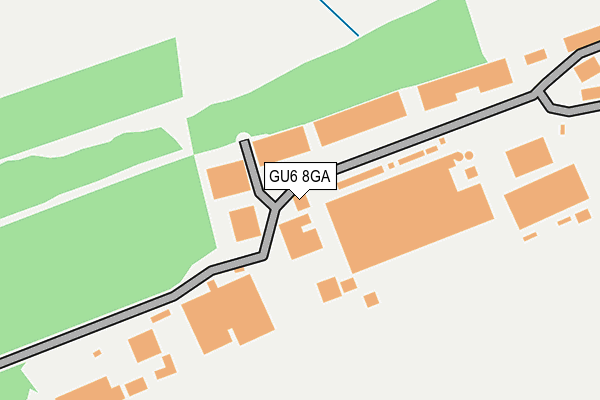
GU6 8GA is located in the Alfold, Dunsfold & Hascombe electoral ward, within the local authority district of Waverley and the English Parliamentary constituency of Guildford. The Sub Integrated Care Board (ICB) Location is NHS Surrey Heartlands ICB - 92A and the police force is Surrey. This postcode has been in use since July 2017.


GetTheData
Source: OS OpenMap – Local (Ordnance Survey)
Source: OS VectorMap District (Ordnance Survey)
Licence: Open Government Licence (requires attribution)
| Easting | 502531 |
| Northing | 136734 |
| Latitude | 51.120822 |
| Longitude | -0.535640 |
GetTheData
Source: Open Postcode Geo
Licence: Open Government Licence
| Country | England |
| Postcode District | GU6 |
➜ See where GU6 is on a map | |
GetTheData
Source: Land Registry Price Paid Data
Licence: Open Government Licence
| Ward | Alfold, Dunsfold & Hascombe |
| Constituency | Guildford |
GetTheData
Source: ONS Postcode Database
Licence: Open Government Licence
| Dunsfold Aerodrome (Stovolds Hill) | Dunsfold | 503m |
| Benbow Lane (Dunsfold Road) | Lakers Green | 1,234m |
| Benbow Lane (Dunsfold Road) | Lakers Green | 1,245m |
| Horsham Road | Smithbrook | 1,330m |
| Horsham Road | Smithbrook | 1,335m |
GetTheData
Source: NaPTAN
Licence: Open Government Licence
GetTheData
Source: ONS Postcode Database
Licence: Open Government Licence


➜ Get more ratings from the Food Standards Agency
GetTheData
Source: Food Standards Agency
Licence: FSA terms & conditions
| Last Collection | |||
|---|---|---|---|
| Location | Mon-Fri | Sat | Distance |
| Hall Place | 17:00 | 09:00 | 642m |
| Compasses | 16:00 | 09:30 | 1,284m |
| Dunsfold Grange | 16:30 | 10:00 | 1,855m |
GetTheData
Source: Dracos
Licence: Creative Commons Attribution-ShareAlike
The below table lists the International Territorial Level (ITL) codes (formerly Nomenclature of Territorial Units for Statistics (NUTS) codes) and Local Administrative Units (LAU) codes for GU6 8GA:
| ITL 1 Code | Name |
|---|---|
| TLJ | South East (England) |
| ITL 2 Code | Name |
| TLJ2 | Surrey, East and West Sussex |
| ITL 3 Code | Name |
| TLJ25 | West Surrey |
| LAU 1 Code | Name |
| E07000216 | Waverley |
GetTheData
Source: ONS Postcode Directory
Licence: Open Government Licence
The below table lists the Census Output Area (OA), Lower Layer Super Output Area (LSOA), and Middle Layer Super Output Area (MSOA) for GU6 8GA:
| Code | Name | |
|---|---|---|
| OA | E00157367 | |
| LSOA | E01030862 | Waverley 015A |
| MSOA | E02006453 | Waverley 015 |
GetTheData
Source: ONS Postcode Directory
Licence: Open Government Licence
| GU8 4BW | Dunsfold Road | 501m |
| GU6 8LE | Stovolds Hill | 788m |
| GU6 8LD | Hall Place | 791m |
| GU6 8LA | Springfield Cottages | 1284m |
| GU6 8HU | Tickners Heath | 1515m |
| GU8 4NP | Alfold Road | 1534m |
| GU6 8JA | Green Lane | 1691m |
| GU8 4NB | The Green | 1779m |
| GU8 4NW | Nugent Close | 1785m |
| GU8 4LA | The Common | 1808m |
GetTheData
Source: Open Postcode Geo; Land Registry Price Paid Data
Licence: Open Government Licence