Property/Postcode Data Search:
GU51 3TF maps, stats, and open data
GU51 3TF is located in the Fleet Central electoral ward, within the local authority district of Hart and the English Parliamentary constituency of North East Hampshire. The Sub Integrated Care Board (ICB) Location is NHS Frimley ICB - D4U1Y and the police force is Hampshire. This postcode has been in use since April 2020.
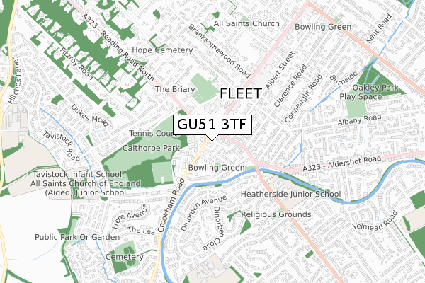
GU51 3TF maps


Source: OS Open Zoomstack (Ordnance Survey)
Licence: Open Government Licence (requires attribution)
Attribution: Contains OS data © Crown copyright and database right 2025
Source: Open Postcode Geo
Licence: Open Government Licence (requires attribution)
Attribution: Contains OS data © Crown copyright and database right 2025; Contains Royal Mail data © Royal Mail copyright and database right 2025; Source: Office for National Statistics licensed under the Open Government Licence v.3.0
Licence: Open Government Licence (requires attribution)
Attribution: Contains OS data © Crown copyright and database right 2025
Source: Open Postcode Geo
Licence: Open Government Licence (requires attribution)
Attribution: Contains OS data © Crown copyright and database right 2025; Contains Royal Mail data © Royal Mail copyright and database right 2025; Source: Office for National Statistics licensed under the Open Government Licence v.3.0
GU51 3TF geodata
| Easting | 480610 |
| Northing | 153809 |
| Latitude | 51.277732 |
| Longitude | -0.845683 |
Where is GU51 3TF?
| Country | England |
| Postcode District | GU51 |
Politics
| Ward | Fleet Central |
|---|---|
| Constituency | North East Hampshire |
Transport
Nearest bus stops to GU51 3TF
| The Oatsheaf (Crookham Road) | Fleet | 32m |
| The Oatsheaf (Reading Road South) | Fleet | 72m |
| The Oatsheaf (Reading Road North) | Fleet | 77m |
| The Oatsheaf (Fleet Road) | Fleet | 102m |
| High Street (Fleet Road) | Fleet | 247m |
Nearest railway stations to GU51 3TF
| Fleet Station | 1.8km |
| Winchfield Station | 4.3km |
Deprivation
4.9% of English postcodes are less deprived than GU51 3TF:Food Standards Agency
Three nearest food hygiene ratings to GU51 3TF (metres)
Water Sky Chinese Restaurants

Water Sky
49m
The Oatsheaf Public House

2 Crookham Road
56m
Yellow River

20 Reading Road South
56m
➜ Get more ratings from the Food Standards Agency
Nearest post box to GU51 3TF
| Last Collection | |||
|---|---|---|---|
| Location | Mon-Fri | Sat | Distance |
| Fleet Road | 17:15 | 12:15 | 150m |
| Reading Road North | 17:15 | 12:45 | 341m |
| Rochester Grove | 17:00 | 12:00 | 346m |
GU51 3TF ITL and GU51 3TF LAU
The below table lists the International Territorial Level (ITL) codes (formerly Nomenclature of Territorial Units for Statistics (NUTS) codes) and Local Administrative Units (LAU) codes for GU51 3TF:
| ITL 1 Code | Name |
|---|---|
| TLJ | South East (England) |
| ITL 2 Code | Name |
| TLJ3 | Hampshire and Isle of Wight |
| ITL 3 Code | Name |
| TLJ37 | North Hampshire |
| LAU 1 Code | Name |
| E07000089 | Hart |
GU51 3TF census areas
The below table lists the Census Output Area (OA), Lower Layer Super Output Area (LSOA), and Middle Layer Super Output Area (MSOA) for GU51 3TF:
| Code | Name | |
|---|---|---|
| OA | E00116226 | |
| LSOA | E01022872 | Hart 008C |
| MSOA | E02004758 | Hart 008 |
Nearest postcodes to GU51 3TF
| GU51 5DJ | Crookham Road | 18m |
| GU51 3FE | St James Road | 30m |
| GU51 5BG | St James Close | 35m |
| GU51 3QQ | Dumfries Cottages | 38m |
| GU51 5DR | Crookham Road | 53m |
| GU52 7QL | Reading Road South | 60m |
| GU51 3NT | Fleet Road | 70m |
| GU51 3QH | St James Road | 72m |
| GU51 5QG | Crookham Road | 79m |
| GU51 4BU | Oatsheaf Parade | 91m |