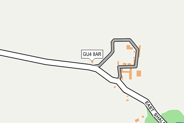
GU4 8AR is located in the Castle electoral ward, within the local authority district of Guildford and the English Parliamentary constituency of Guildford. The Sub Integrated Care Board (ICB) Location is NHS Surrey Heartlands ICB - 92A and the police force is Surrey. This postcode has been in use since January 1980.


GetTheData
Source: OS OpenMap – Local (Ordnance Survey)
Source: OS VectorMap District (Ordnance Survey)
Licence: Open Government Licence (requires attribution)
| Easting | 500939 |
| Northing | 147630 |
| Latitude | 51.218955 |
| Longitude | -0.556078 |
GetTheData
Source: Open Postcode Geo
Licence: Open Government Licence
| Country | England |
| Postcode District | GU4 |
➜ See where GU4 is on a map | |
GetTheData
Source: Land Registry Price Paid Data
Licence: Open Government Licence
Elevation or altitude of GU4 8AR as distance above sea level:
| Metres | Feet | |
|---|---|---|
| Elevation | 50m | 164ft |
Elevation is measured from the approximate centre of the postcode, to the nearest point on an OS contour line from OS Terrain 50, which has contour spacing of ten vertical metres.
➜ How high above sea level am I? Find the elevation of your current position using your device's GPS.
GetTheData
Source: Open Postcode Elevation
Licence: Open Government Licence
| Ward | Castle |
| Constituency | Guildford |
GetTheData
Source: ONS Postcode Database
Licence: Open Government Licence
| Tillingbourne Road | Shalford | 606m |
| Christmas Hill (Kings Road) | Shalford | 777m |
| Christmas Hill (Kings Road) | Shalford | 787m |
| Shalford County Infant School (Tillingbourne Road) | Shalford | 787m |
| Shalford County Infant School (Tillingbourne Road) | Shalford | 801m |
| Shalford (Surrey) Station | 0.9km |
| Chilworth Station | 2.2km |
| London Road (Guildford) Station | 2.5km |
GetTheData
Source: NaPTAN
Licence: Open Government Licence
GetTheData
Source: ONS Postcode Database
Licence: Open Government Licence


➜ Get more ratings from the Food Standards Agency
GetTheData
Source: Food Standards Agency
Licence: FSA terms & conditions
| Last Collection | |||
|---|---|---|---|
| Location | Mon-Fri | Sat | Distance |
| Upper Tillingbourne Road | 17:30 | 12:00 | 503m |
| Hornhatch | 17:00 | 12:15 | 825m |
| Tilehouse Road | 17:30 | 12:00 | 829m |
GetTheData
Source: Dracos
Licence: Creative Commons Attribution-ShareAlike
The below table lists the International Territorial Level (ITL) codes (formerly Nomenclature of Territorial Units for Statistics (NUTS) codes) and Local Administrative Units (LAU) codes for GU4 8AR:
| ITL 1 Code | Name |
|---|---|
| TLJ | South East (England) |
| ITL 2 Code | Name |
| TLJ2 | Surrey, East and West Sussex |
| ITL 3 Code | Name |
| TLJ25 | West Surrey |
| LAU 1 Code | Name |
| E07000209 | Guildford |
GetTheData
Source: ONS Postcode Directory
Licence: Open Government Licence
The below table lists the Census Output Area (OA), Lower Layer Super Output Area (LSOA), and Middle Layer Super Output Area (MSOA) for GU4 8AR:
| Code | Name | |
|---|---|---|
| OA | E00155354 | |
| LSOA | E01030454 | Guildford 016C |
| MSOA | E02006359 | Guildford 016 |
GetTheData
Source: ONS Postcode Directory
Licence: Open Government Licence
| GU4 8AS | East Shalford Lane | 433m |
| GU4 8ET | Tillingbourne Road | 440m |
| GU4 8EU | Tillingbourne Road | 473m |
| GU4 8ES | Tillingbourne Road | 515m |
| GU4 8EX | Tillingbourne Road | 589m |
| GU4 8HJ | Pound Place | 612m |
| GU4 8HL | Pound Place Close | 629m |
| GU4 8HP | Christmas Hill | 647m |
| GU4 8HH | Pound Place | 656m |
| GU4 8AF | East Shalford Lane | 675m |
GetTheData
Source: Open Postcode Geo; Land Registry Price Paid Data
Licence: Open Government Licence