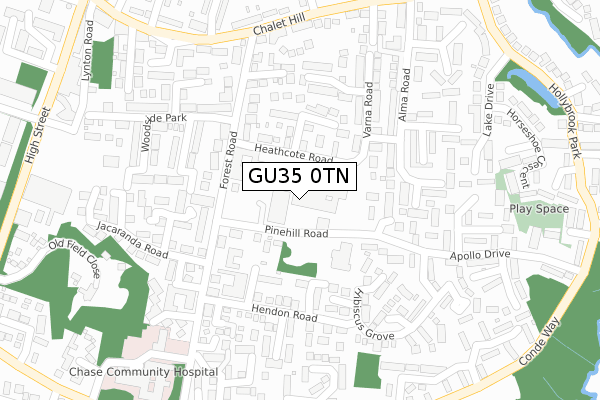
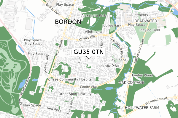
GU35 0TN lies on Forest Centre in Bordon. GU35 0TN is located in the Whitehill Chase electoral ward, within the local authority district of East Hampshire and the English Parliamentary constituency of East Hampshire. The Sub Integrated Care Board (ICB) Location is NHS Hampshire and Isle of Wight ICB - D9Y0V and the police force is Hampshire. This postcode has been in use since October 1984.


GetTheData
Source: OS Open Zoomstack (Ordnance Survey)
Licence: Open Government Licence (requires attribution)
Attribution: Contains OS data © Crown copyright and database right 2025
Source: Open Postcode Geo
Licence: Open Government Licence (requires attribution)
Attribution: Contains OS data © Crown copyright and database right 2025; Contains Royal Mail data © Royal Mail copyright and database right 2025; Source: Office for National Statistics licensed under the Open Government Licence v.3.0
| Easting | 480031 |
| Northing | 135016 |
| Latitude | 51.108858 |
| Longitude | -0.858164 |
GetTheData
Source: Open Postcode Geo
Licence: Open Government Licence
| Street | Forest Centre |
| Town/City | Bordon |
| Country | England |
| Postcode District | GU35 |
➜ See where GU35 is on a map ➜ Where is Bordon? | |
GetTheData
Source: Land Registry Price Paid Data
Licence: Open Government Licence
Elevation or altitude of GU35 0TN as distance above sea level:
| Metres | Feet | |
|---|---|---|
| Elevation | 80m | 262ft |
Elevation is measured from the approximate centre of the postcode, to the nearest point on an OS contour line from OS Terrain 50, which has contour spacing of ten vertical metres.
➜ How high above sea level am I? Find the elevation of your current position using your device's GPS.
GetTheData
Source: Open Postcode Elevation
Licence: Open Government Licence
| Ward | Whitehill Chase |
| Constituency | East Hampshire |
GetTheData
Source: ONS Postcode Database
Licence: Open Government Licence
| Forest Centre (Pinehill Road) | Bordon | 49m |
| Forest Centre (Pinehill Road) | Bordon | 57m |
| Jacaranda Road (Forest Road) | Bordon | 170m |
| Jacaranda Road (Forest Road) | Bordon | 188m |
| Saville Crescent (Chalet Hill) | Bordon | 296m |
| Liphook Station | 5.8km |
GetTheData
Source: NaPTAN
Licence: Open Government Licence
| Median download speed | 17.9Mbps |
| Average download speed | 25.7Mbps |
| Maximum download speed | 80.00Mbps |
| Median upload speed | 0.8Mbps |
| Average upload speed | 4.0Mbps |
| Maximum upload speed | 20.00Mbps |
GetTheData
Source: Ofcom
Licence: Ofcom Terms of Use (requires attribution)
GetTheData
Source: ONS Postcode Database
Licence: Open Government Licence


➜ Get more ratings from the Food Standards Agency
GetTheData
Source: Food Standards Agency
Licence: FSA terms & conditions
| Last Collection | |||
|---|---|---|---|
| Location | Mon-Fri | Sat | Distance |
| Forest Centre Post Office | 17:15 | 12:15 | 27m |
| Chalet Hill | 17:15 | 12:00 | 272m |
| Tesco | 16:45 | 12:00 | 433m |
GetTheData
Source: Dracos
Licence: Creative Commons Attribution-ShareAlike
The below table lists the International Territorial Level (ITL) codes (formerly Nomenclature of Territorial Units for Statistics (NUTS) codes) and Local Administrative Units (LAU) codes for GU35 0TN:
| ITL 1 Code | Name |
|---|---|
| TLJ | South East (England) |
| ITL 2 Code | Name |
| TLJ3 | Hampshire and Isle of Wight |
| ITL 3 Code | Name |
| TLJ36 | Central Hampshire |
| LAU 1 Code | Name |
| E07000085 | East Hampshire |
GetTheData
Source: ONS Postcode Directory
Licence: Open Government Licence
The below table lists the Census Output Area (OA), Lower Layer Super Output Area (LSOA), and Middle Layer Super Output Area (MSOA) for GU35 0TN:
| Code | Name | |
|---|---|---|
| OA | E00115066 | |
| LSOA | E01022634 | East Hampshire 004B |
| MSOA | E02004700 | East Hampshire 004 |
GetTheData
Source: ONS Postcode Directory
Licence: Open Government Licence
| GU35 0BS | Pinehill Road | 85m |
| GU35 0BN | Heathcote Road | 114m |
| GU35 0BW | Sunbury Close | 121m |
| GU35 0BD | Birch Close | 135m |
| GU35 0FG | Heathcote Road | 136m |
| GU35 0BJ | Forest Road | 143m |
| GU35 0XD | Foxglove Drive | 167m |
| GU35 0TS | Ferncote Road | 168m |
| GU35 0TR | Alma Road | 171m |
| GU35 0BP | Forest Road | 172m |
GetTheData
Source: Open Postcode Geo; Land Registry Price Paid Data
Licence: Open Government Licence