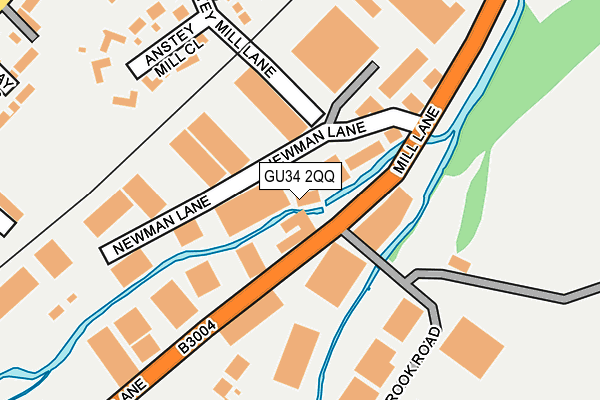
GU34 2QQ lies on Anstey Mill Lane in Alton. GU34 2QQ is located in the Alton Ashdell electoral ward, within the local authority district of East Hampshire and the English Parliamentary constituency of East Hampshire. The Sub Integrated Care Board (ICB) Location is NHS Hampshire and Isle of Wight ICB - D9Y0V and the police force is Hampshire. This postcode has been in use since January 1980.


GetTheData
Source: OS OpenMap – Local (Ordnance Survey)
Source: OS VectorMap District (Ordnance Survey)
Licence: Open Government Licence (requires attribution)
| Easting | 472891 |
| Northing | 139998 |
| Latitude | 51.154602 |
| Longitude | -0.959132 |
GetTheData
Source: Open Postcode Geo
Licence: Open Government Licence
| Street | Anstey Mill Lane |
| Town/City | Alton |
| Country | England |
| Postcode District | GU34 |
➜ See where GU34 is on a map ➜ Where is Alton? | |
GetTheData
Source: Land Registry Price Paid Data
Licence: Open Government Licence
Elevation or altitude of GU34 2QQ as distance above sea level:
| Metres | Feet | |
|---|---|---|
| Elevation | 100m | 328ft |
Elevation is measured from the approximate centre of the postcode, to the nearest point on an OS contour line from OS Terrain 50, which has contour spacing of ten vertical metres.
➜ How high above sea level am I? Find the elevation of your current position using your device's GPS.
GetTheData
Source: Open Postcode Elevation
Licence: Open Government Licence
| Ward | Alton Ashdell |
| Constituency | East Hampshire |
GetTheData
Source: ONS Postcode Database
Licence: Open Government Licence
WEY COTTAGE, ANSTEY MILL LANE, ALTON, GU34 2QQ 2022 1 JUN £370,000 |
SAYROSA HOUSE, ANSTEY MILL LANE, ALTON, GU34 2QQ 2010 28 MAY £249,950 |
WEY COTTAGE, ANSTEY MILL LANE, ALTON, GU34 2QQ 2007 10 DEC £270,000 |
WEY COTTAGE, ANSTEY MILL LANE, ALTON, GU34 2QQ 2006 2 JUN £205,000 |
ANSTEY MILL COTTAGE, ANSTEY MILL LANE, ALTON, GU34 2QQ 2005 20 MAY £312,000 |
WEY COTTAGE, ANSTEY MILL LANE, ALTON, GU34 2QQ 1995 30 JUN £79,500 |
GetTheData
Source: HM Land Registry Price Paid Data
Licence: Contains HM Land Registry data © Crown copyright and database right 2025. This data is licensed under the Open Government Licence v3.0.
| Rowan Industrial Park (Mill Lane) | Alton | 64m |
| Rowan Industrial Park (Mill Lane) | Alton | 79m |
| Anstey Lane | Holybourne | 371m |
| Anstey Lane (Anstey Road) | Holybourne | 371m |
| Alton Retail Park (Mill Lane) | Holybourne | 411m |
| Alton (Mid-hants Railway) | Alton | 618m |
| Alton Station | 0.6km |
GetTheData
Source: NaPTAN
Licence: Open Government Licence
GetTheData
Source: ONS Postcode Database
Licence: Open Government Licence


➜ Get more ratings from the Food Standards Agency
GetTheData
Source: Food Standards Agency
Licence: FSA terms & conditions
| Last Collection | |||
|---|---|---|---|
| Location | Mon-Fri | Sat | Distance |
| Newman Lane Industrial Estate | 18:30 | 12:00 | 47m |
| Newman Lane | 18:30 | 12:00 | 60m |
| Southview Rise | 17:15 | 10:45 | 604m |
GetTheData
Source: Dracos
Licence: Creative Commons Attribution-ShareAlike
| Risk of GU34 2QQ flooding from rivers and sea | Medium |
| ➜ GU34 2QQ flood map | |
GetTheData
Source: Open Flood Risk by Postcode
Licence: Open Government Licence
The below table lists the International Territorial Level (ITL) codes (formerly Nomenclature of Territorial Units for Statistics (NUTS) codes) and Local Administrative Units (LAU) codes for GU34 2QQ:
| ITL 1 Code | Name |
|---|---|
| TLJ | South East (England) |
| ITL 2 Code | Name |
| TLJ3 | Hampshire and Isle of Wight |
| ITL 3 Code | Name |
| TLJ36 | Central Hampshire |
| LAU 1 Code | Name |
| E07000085 | East Hampshire |
GetTheData
Source: ONS Postcode Directory
Licence: Open Government Licence
The below table lists the Census Output Area (OA), Lower Layer Super Output Area (LSOA), and Middle Layer Super Output Area (MSOA) for GU34 2QQ:
| Code | Name | |
|---|---|---|
| OA | E00114759 | |
| LSOA | E01022573 | East Hampshire 003C |
| MSOA | E02004699 | East Hampshire 003 |
GetTheData
Source: ONS Postcode Directory
Licence: Open Government Licence
| GU34 2QG | Mill Lane | 161m |
| GU34 2QH | Waterbrook Road | 165m |
| GU34 2QT | Anstey Mill Close | 230m |
| GU34 2QF | Caker Stream Road | 263m |
| GU34 4BL | Garstons Way | 289m |
| GU34 2QP | Anstey Mill Lane | 302m |
| GU34 4BQ | Garstons Way | 305m |
| GU34 4DN | Claines Street | 323m |
| GU34 2RL | Anstey Road | 340m |
| GU34 2QA | Caker Stream Road | 370m |
GetTheData
Source: Open Postcode Geo; Land Registry Price Paid Data
Licence: Open Government Licence