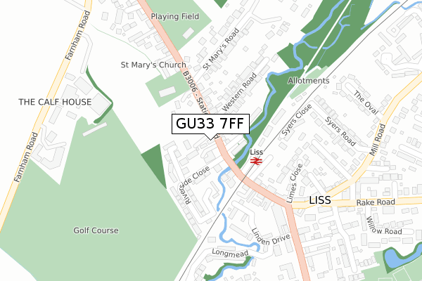
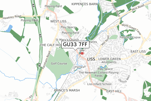
GU33 7FF is located in the Liss electoral ward, within the local authority district of East Hampshire and the English Parliamentary constituency of East Hampshire. The Sub Integrated Care Board (ICB) Location is NHS Hampshire and Isle of Wight ICB - D9Y0V and the police force is Hampshire. This postcode has been in use since August 2017.


GetTheData
Source: OS Open Zoomstack (Ordnance Survey)
Licence: Open Government Licence (requires attribution)
Attribution: Contains OS data © Crown copyright and database right 2024
Source: Open Postcode Geo
Licence: Open Government Licence (requires attribution)
Attribution: Contains OS data © Crown copyright and database right 2024; Contains Royal Mail data © Royal Mail copyright and database right 2024; Source: Office for National Statistics licensed under the Open Government Licence v.3.0
| Easting | 477600 |
| Northing | 127781 |
| Latitude | 51.044146 |
| Longitude | -0.894433 |
GetTheData
Source: Open Postcode Geo
Licence: Open Government Licence
| Country | England |
| Postcode District | GU33 |
➜ See where GU33 is on a map ➜ Where is Liss? | |
GetTheData
Source: Land Registry Price Paid Data
Licence: Open Government Licence
| Ward | Liss |
| Constituency | East Hampshire |
GetTheData
Source: ONS Postcode Database
Licence: Open Government Licence
| Liss Station (Station Road) | Liss | 144m |
| Liss Station (Station Road) | Liss | 148m |
| Whistle Stop (Station Road) | Liss | 255m |
| Whistle Stop (Hill Brow Road) | Liss | 263m |
| Whistle Stop (Hill Brow Road) | Liss | 291m |
| Liss Station | 0.1km |
| Petersfield Station | 5.3km |
GetTheData
Source: NaPTAN
Licence: Open Government Licence
| Percentage of properties with Next Generation Access | 100.0% |
| Percentage of properties with Superfast Broadband | 100.0% |
| Percentage of properties with Ultrafast Broadband | 100.0% |
| Percentage of properties with Full Fibre Broadband | 0.0% |
Superfast Broadband is between 30Mbps and 300Mbps
Ultrafast Broadband is > 300Mbps
| Percentage of properties unable to receive 2Mbps | 0.0% |
| Percentage of properties unable to receive 5Mbps | 0.0% |
| Percentage of properties unable to receive 10Mbps | 0.0% |
| Percentage of properties unable to receive 30Mbps | 0.0% |
GetTheData
Source: Ofcom
Licence: Ofcom Terms of Use (requires attribution)
GetTheData
Source: ONS Postcode Database
Licence: Open Government Licence


➜ Get more ratings from the Food Standards Agency
GetTheData
Source: Food Standards Agency
Licence: FSA terms & conditions
| Last Collection | |||
|---|---|---|---|
| Location | Mon-Fri | Sat | Distance |
| St Marys Road | 16:00 | 10:00 | 145m |
| Liss Post Office | 17:30 | 10:30 | 250m |
| Liss Post Office | 17:30 | 10:30 | 251m |
GetTheData
Source: Dracos
Licence: Creative Commons Attribution-ShareAlike
| Risk of GU33 7FF flooding from rivers and sea | High |
| ➜ GU33 7FF flood map | |
GetTheData
Source: Open Flood Risk by Postcode
Licence: Open Government Licence
The below table lists the International Territorial Level (ITL) codes (formerly Nomenclature of Territorial Units for Statistics (NUTS) codes) and Local Administrative Units (LAU) codes for GU33 7FF:
| ITL 1 Code | Name |
|---|---|
| TLJ | South East (England) |
| ITL 2 Code | Name |
| TLJ3 | Hampshire and Isle of Wight |
| ITL 3 Code | Name |
| TLJ36 | Central Hampshire |
| LAU 1 Code | Name |
| E07000085 | East Hampshire |
GetTheData
Source: ONS Postcode Directory
Licence: Open Government Licence
The below table lists the Census Output Area (OA), Lower Layer Super Output Area (LSOA), and Middle Layer Super Output Area (MSOA) for GU33 7FF:
| Code | Name | |
|---|---|---|
| OA | E00114975 | |
| LSOA | E01022617 | East Hampshire 010B |
| MSOA | E02004706 | East Hampshire 010 |
GetTheData
Source: ONS Postcode Directory
Licence: Open Government Licence
| GU33 7SA | Chilmark Court | 55m |
| GU33 7AF | Yorkwood | 77m |
| GU33 7AQ | Station Road | 102m |
| GU33 7AD | Station Road | 104m |
| GU33 7AG | Western Road | 144m |
| GU33 7AE | Riverside Close | 156m |
| GU33 7AA | Station Road | 162m |
| GU33 7DP | Station Road | 202m |
| GU33 7YZ | Syers Close | 202m |
| GU33 7JY | Bridge Meadows | 209m |
GetTheData
Source: Open Postcode Geo; Land Registry Price Paid Data
Licence: Open Government Licence