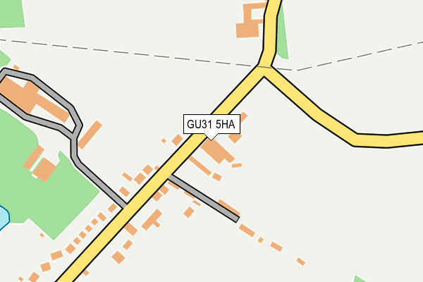
GU31 5HA is located in the Harting electoral ward, within the local authority district of Chichester and the English Parliamentary constituency of Chichester. The Sub Integrated Care Board (ICB) Location is NHS Sussex ICB - 70F and the police force is Sussex. This postcode has been in use since January 1992.


GetTheData
Source: OS OpenMap – Local (Ordnance Survey)
Source: OS VectorMap District (Ordnance Survey)
Licence: Open Government Licence (requires attribution)
| Easting | 480425 |
| Northing | 121904 |
| Latitude | 50.990926 |
| Longitude | -0.855464 |
GetTheData
Source: Open Postcode Geo
Licence: Open Government Licence
| Country | England |
| Postcode District | GU31 |
➜ See where GU31 is on a map ➜ Where is Nyewood? | |
GetTheData
Source: Land Registry Price Paid Data
Licence: Open Government Licence
Elevation or altitude of GU31 5HA as distance above sea level:
| Metres | Feet | |
|---|---|---|
| Elevation | 50m | 164ft |
Elevation is measured from the approximate centre of the postcode, to the nearest point on an OS contour line from OS Terrain 50, which has contour spacing of ten vertical metres.
➜ How high above sea level am I? Find the elevation of your current position using your device's GPS.
GetTheData
Source: Open Postcode Elevation
Licence: Open Government Licence
| Ward | Harting |
| Constituency | Chichester |
GetTheData
Source: ONS Postcode Database
Licence: Open Government Licence
| Trotton Turn (North Lane) | Nyewood | 91m |
| Green (North Lane) | Nyewood | 371m |
| Green (North Lane) | Nyewood | 401m |
| Habin Hill | Habin | 535m |
| Habin Hill | Habin | 546m |
GetTheData
Source: NaPTAN
Licence: Open Government Licence
GetTheData
Source: ONS Postcode Database
Licence: Open Government Licence


➜ Get more ratings from the Food Standards Agency
GetTheData
Source: Food Standards Agency
Licence: FSA terms & conditions
| Last Collection | |||
|---|---|---|---|
| Location | Mon-Fri | Sat | Distance |
| Nyewood Old Post Office | 16:00 | 08:00 | 358m |
| Nyewood House | 16:00 | 08:15 | 483m |
| Sandhill | 16:00 | 07:15 | 538m |
GetTheData
Source: Dracos
Licence: Creative Commons Attribution-ShareAlike
The below table lists the International Territorial Level (ITL) codes (formerly Nomenclature of Territorial Units for Statistics (NUTS) codes) and Local Administrative Units (LAU) codes for GU31 5HA:
| ITL 1 Code | Name |
|---|---|
| TLJ | South East (England) |
| ITL 2 Code | Name |
| TLJ2 | Surrey, East and West Sussex |
| ITL 3 Code | Name |
| TLJ27 | West Sussex (South West) |
| LAU 1 Code | Name |
| E07000225 | Chichester |
GetTheData
Source: ONS Postcode Directory
Licence: Open Government Licence
The below table lists the Census Output Area (OA), Lower Layer Super Output Area (LSOA), and Middle Layer Super Output Area (MSOA) for GU31 5HA:
| Code | Name | |
|---|---|---|
| OA | E00160761 | |
| LSOA | E01031520 | Chichester 003B |
| MSOA | E02006563 | Chichester 003 |
GetTheData
Source: ONS Postcode Directory
Licence: Open Government Licence
| GU31 5HX | 103m | |
| GU31 5JA | 147m | |
| GU31 5HY | 254m | |
| GU31 5HU | 394m | |
| GU31 5JD | 416m | |
| GU31 5JF | 476m | |
| GU31 5JG | 1911 Cottages | 507m |
| GU31 5JQ | Greenfields Close | 519m |
| GU31 5JH | Greenfields | 624m |
| GU31 5HT | Paddock Cottages | 721m |
GetTheData
Source: Open Postcode Geo; Land Registry Price Paid Data
Licence: Open Government Licence