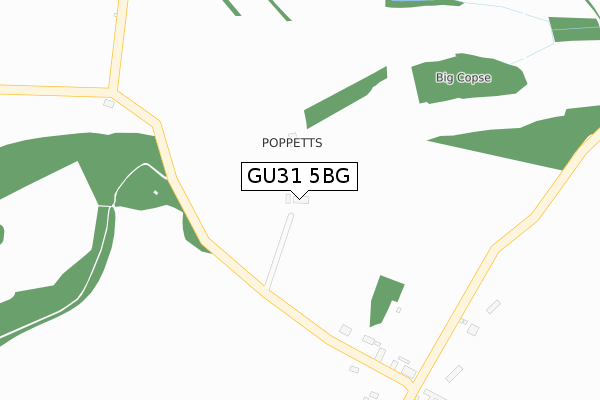
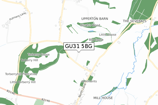
GU31 5BG is located in the Harting electoral ward, within the local authority district of Chichester and the English Parliamentary constituency of Chichester. The Sub Integrated Care Board (ICB) Location is NHS Sussex ICB - 70F and the police force is Sussex. This postcode has been in use since January 2018.


GetTheData
Source: OS Open Zoomstack (Ordnance Survey)
Licence: Open Government Licence (requires attribution)
Attribution: Contains OS data © Crown copyright and database right 2024
Source: Open Postcode Geo
Licence: Open Government Licence (requires attribution)
Attribution: Contains OS data © Crown copyright and database right 2024; Contains Royal Mail data © Royal Mail copyright and database right 2024; Source: Office for National Statistics licensed under the Open Government Licence v.3.0
| Easting | 478665 |
| Northing | 120434 |
| Latitude | 50.977947 |
| Longitude | -0.880835 |
GetTheData
Source: Open Postcode Geo
Licence: Open Government Licence
| Country | England |
| Postcode District | GU31 |
➜ See where GU31 is on a map | |
GetTheData
Source: Land Registry Price Paid Data
Licence: Open Government Licence
| Ward | Harting |
| Constituency | Chichester |
GetTheData
Source: ONS Postcode Database
Licence: Open Government Licence
| West Harting Road (Unnamed Road) | West Harting | 171m |
| West Harting Road (Unnamed Road) | West Harting | 179m |
| Manor House (North Lane) | South Harting | 374m |
| Manor House (North Lane) | South Harting | 382m |
| Pays Meadow (North Lane) | West Harting | 494m |
| Petersfield Station | 5.3km |
GetTheData
Source: NaPTAN
Licence: Open Government Licence
GetTheData
Source: ONS Postcode Database
Licence: Open Government Licence


➜ Get more ratings from the Food Standards Agency
GetTheData
Source: Food Standards Agency
Licence: FSA terms & conditions
| Last Collection | |||
|---|---|---|---|
| Location | Mon-Fri | Sat | Distance |
| Pays Farm | 16:00 | 08:15 | 376m |
| Harting Post Office | 17:00 | 11:30 | 874m |
| Old Manor House | 16:00 | 08:30 | 1,128m |
GetTheData
Source: Dracos
Licence: Creative Commons Attribution-ShareAlike
The below table lists the International Territorial Level (ITL) codes (formerly Nomenclature of Territorial Units for Statistics (NUTS) codes) and Local Administrative Units (LAU) codes for GU31 5BG:
| ITL 1 Code | Name |
|---|---|
| TLJ | South East (England) |
| ITL 2 Code | Name |
| TLJ2 | Surrey, East and West Sussex |
| ITL 3 Code | Name |
| TLJ27 | West Sussex (South West) |
| LAU 1 Code | Name |
| E07000225 | Chichester |
GetTheData
Source: ONS Postcode Directory
Licence: Open Government Licence
The below table lists the Census Output Area (OA), Lower Layer Super Output Area (LSOA), and Middle Layer Super Output Area (MSOA) for GU31 5BG:
| Code | Name | |
|---|---|---|
| OA | E00160685 | |
| LSOA | E01031508 | Chichester 003A |
| MSOA | E02006563 | Chichester 003 |
GetTheData
Source: ONS Postcode Directory
Licence: Open Government Licence
| GU31 5NR | North Lane | 388m |
| GU31 5NT | 534m | |
| GU31 5NN | North Lane | 535m |
| GU31 5NP | Mead Cottages | 542m |
| GU31 5NW | North Lane | 682m |
| GU31 5NY | 805m | |
| GU31 5PY | North Lane | 806m |
| GU31 5NU | 833m | |
| GU31 5LF | 837m | |
| GU31 5PZ | North Lane | 867m |
GetTheData
Source: Open Postcode Geo; Land Registry Price Paid Data
Licence: Open Government Licence