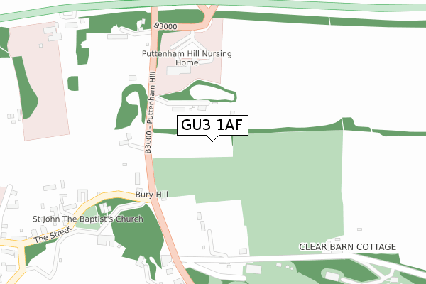
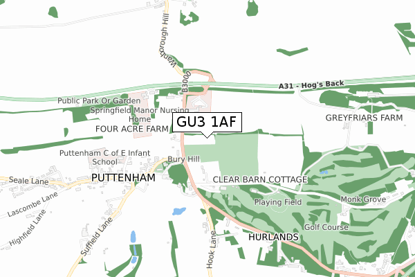
GU3 1AF is located in the Shalford electoral ward, within the local authority district of Guildford and the English Parliamentary constituency of Guildford. The Sub Integrated Care Board (ICB) Location is NHS Surrey Heartlands ICB - 92A and the police force is Surrey. This postcode has been in use since May 2019.


GetTheData
Source: OS Open Zoomstack (Ordnance Survey)
Licence: Open Government Licence (requires attribution)
Attribution: Contains OS data © Crown copyright and database right 2025
Source: Open Postcode Geo
Licence: Open Government Licence (requires attribution)
Attribution: Contains OS data © Crown copyright and database right 2025; Contains Royal Mail data © Royal Mail copyright and database right 2025; Source: Office for National Statistics licensed under the Open Government Licence v.3.0
| Easting | 498997 |
| Northing | 146097 |
| Latitude | 51.205511 |
| Longitude | -0.584277 |
GetTheData
Source: Open Postcode Geo
Licence: Open Government Licence
| Country | England |
| Postcode District | GU3 |
➜ See where GU3 is on a map ➜ Where is Peasmarsh? | |
GetTheData
Source: Land Registry Price Paid Data
Licence: Open Government Licence
| Ward | Shalford |
| Constituency | Guildford |
GetTheData
Source: ONS Postcode Database
Licence: Open Government Licence
| Filling Station (Old Portsmouth Road) | Peasmarsh | 104m |
| Filling Station (Old Portsmouth Road) | Peasmarsh | 117m |
| New Pond Road (Old Portsmouth Road) | Peasmarsh | 265m |
| New Pond Road (Old Portsmouth Road) | Peasmarsh | 360m |
| The Green (Old Portsmouth Road) | Peasmarsh | 366m |
| Shalford (Surrey) Station | 1.6km |
| Farncombe Station | 1.7km |
| Godalming Station | 3.2km |
GetTheData
Source: NaPTAN
Licence: Open Government Licence
GetTheData
Source: ONS Postcode Database
Licence: Open Government Licence


➜ Get more ratings from the Food Standards Agency
GetTheData
Source: Food Standards Agency
Licence: FSA terms & conditions
| Last Collection | |||
|---|---|---|---|
| Location | Mon-Fri | Sat | Distance |
| Oakdene Road | 17:00 | 12:00 | 347m |
| Broadford Road, Shalford | 17:00 | 12:00 | 1,071m |
| Northbourne | 16:15 | 11:45 | 1,217m |
GetTheData
Source: Dracos
Licence: Creative Commons Attribution-ShareAlike
The below table lists the International Territorial Level (ITL) codes (formerly Nomenclature of Territorial Units for Statistics (NUTS) codes) and Local Administrative Units (LAU) codes for GU3 1AF:
| ITL 1 Code | Name |
|---|---|
| TLJ | South East (England) |
| ITL 2 Code | Name |
| TLJ2 | Surrey, East and West Sussex |
| ITL 3 Code | Name |
| TLJ25 | West Surrey |
| LAU 1 Code | Name |
| E07000209 | Guildford |
GetTheData
Source: ONS Postcode Directory
Licence: Open Government Licence
The below table lists the Census Output Area (OA), Lower Layer Super Output Area (LSOA), and Middle Layer Super Output Area (MSOA) for GU3 1AF:
| Code | Name | |
|---|---|---|
| OA | E00155460 | |
| LSOA | E01030478 | Guildford 017C |
| MSOA | E02006360 | Guildford 017 |
GetTheData
Source: ONS Postcode Directory
Licence: Open Government Licence
| GU3 1LZ | Portsmouth Road | 115m |
| GU3 1NE | The Astolat Business Park | 128m |
| GU3 1NJ | Oakdene Place | 198m |
| GU3 1NB | Mill Lane | 224m |
| GU3 1ND | Oakdene Road | 279m |
| GU3 1NF | James Road | 295m |
| GU7 3BS | Old Portsmouth Road | 330m |
| GU3 1NG | Unstead Wood | 459m |
| GU3 1LY | Old Portsmouth Road | 491m |
| GU3 1LX | Old Portsmouth Road | 493m |
GetTheData
Source: Open Postcode Geo; Land Registry Price Paid Data
Licence: Open Government Licence