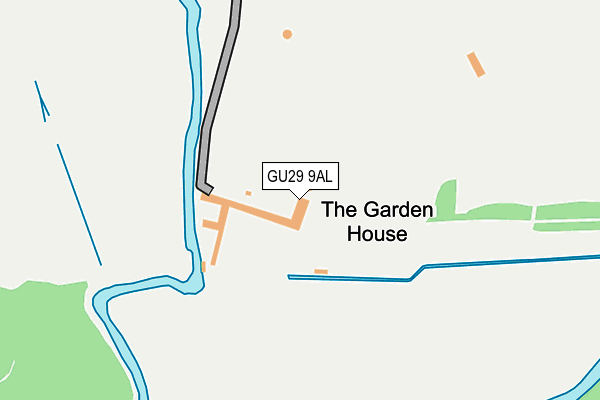
GU29 9AL is located in the Easebourne electoral ward, within the local authority district of Chichester and the English Parliamentary constituency of Chichester. The Sub Integrated Care Board (ICB) Location is NHS Sussex ICB - 70F and the police force is Sussex. This postcode has been in use since January 1980.


GetTheData
Source: OS OpenMap – Local (Ordnance Survey)
Source: OS VectorMap District (Ordnance Survey)
Licence: Open Government Licence (requires attribution)
| Easting | 489135 |
| Northing | 121634 |
| Latitude | 50.987218 |
| Longitude | -0.731459 |
GetTheData
Source: Open Postcode Geo
Licence: Open Government Licence
| Country | England |
| Postcode District | GU29 |
➜ See where GU29 is on a map | |
GetTheData
Source: Land Registry Price Paid Data
Licence: Open Government Licence
Elevation or altitude of GU29 9AL as distance above sea level:
| Metres | Feet | |
|---|---|---|
| Elevation | 20m | 66ft |
Elevation is measured from the approximate centre of the postcode, to the nearest point on an OS contour line from OS Terrain 50, which has contour spacing of ten vertical metres.
➜ How high above sea level am I? Find the elevation of your current position using your device's GPS.
GetTheData
Source: Open Postcode Elevation
Licence: Open Government Licence
| Ward | Easebourne |
| Constituency | Chichester |
GetTheData
Source: ONS Postcode Database
Licence: Open Government Licence
| The Wharf | Midhurst | 427m |
| Rother College (North Street) | Midhurst | 500m |
| Lamberts Lane (North Street) | Midhurst | 508m |
| Cowdray Court | Midhurst | 547m |
| Cottage Hospital (Dodsley Lane) | Easebourne | 591m |
GetTheData
Source: NaPTAN
Licence: Open Government Licence
Estimated total energy consumption in GU29 9AL by fuel type, 2015.
| Consumption (kWh) | 122,597 |
|---|---|
| Meter count | 6 |
| Mean (kWh/meter) | 20,433 |
| Median (kWh/meter) | 20,771 |
GetTheData
Source: Postcode level gas estimates: 2015 (experimental)
Source: Postcode level electricity estimates: 2015 (experimental)
Licence: Open Government Licence
GetTheData
Source: ONS Postcode Database
Licence: Open Government Licence


➜ Get more ratings from the Food Standards Agency
GetTheData
Source: Food Standards Agency
Licence: FSA terms & conditions
| Last Collection | |||
|---|---|---|---|
| Location | Mon-Fri | Sat | Distance |
| North Street Post Office | 17:30 | 12:00 | 483m |
| Orchard Way | 17:00 | 11:15 | 574m |
| Lutener Road | 17:00 | 11:30 | 586m |
GetTheData
Source: Dracos
Licence: Creative Commons Attribution-ShareAlike
| Risk of GU29 9AL flooding from rivers and sea | Medium |
| ➜ GU29 9AL flood map | |
GetTheData
Source: Open Flood Risk by Postcode
Licence: Open Government Licence
The below table lists the International Territorial Level (ITL) codes (formerly Nomenclature of Territorial Units for Statistics (NUTS) codes) and Local Administrative Units (LAU) codes for GU29 9AL:
| ITL 1 Code | Name |
|---|---|
| TLJ | South East (England) |
| ITL 2 Code | Name |
| TLJ2 | Surrey, East and West Sussex |
| ITL 3 Code | Name |
| TLJ27 | West Sussex (South West) |
| LAU 1 Code | Name |
| E07000225 | Chichester |
GetTheData
Source: ONS Postcode Directory
Licence: Open Government Licence
The below table lists the Census Output Area (OA), Lower Layer Super Output Area (LSOA), and Middle Layer Super Output Area (MSOA) for GU29 9AL:
| Code | Name | |
|---|---|---|
| OA | E00160632 | |
| LSOA | E01031498 | Chichester 005C |
| MSOA | E02006565 | Chichester 005 |
GetTheData
Source: ONS Postcode Directory
Licence: Open Government Licence
| GU29 9PX | The Wharf | 409m |
| GU29 9NT | Sheep Lane | 419m |
| GU29 9FN | Angel Yard | 437m |
| GU29 9NL | Edinburgh Square | 438m |
| GU29 9NJ | Market Square | 470m |
| GU29 9AJ | North Street | 470m |
| GU29 9DN | North Street | 473m |
| GU29 9DQ | Knockhundred Row | 474m |
| GU29 9NX | Church Hill | 479m |
| GU29 9DJ | North Street | 482m |
GetTheData
Source: Open Postcode Geo; Land Registry Price Paid Data
Licence: Open Government Licence