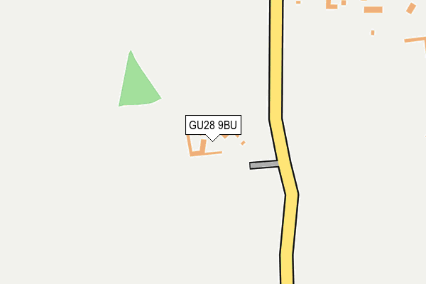
GU28 9BU is located in the Easebourne electoral ward, within the local authority district of Chichester and the English Parliamentary constituency of Chichester. The Sub Integrated Care Board (ICB) Location is NHS Sussex ICB - 70F and the police force is Sussex. This postcode has been in use since January 1980.


GetTheData
Source: OS OpenMap – Local (Ordnance Survey)
Source: OS VectorMap District (Ordnance Survey)
Licence: Open Government Licence (requires attribution)
| Easting | 492774 |
| Northing | 122532 |
| Latitude | 50.994711 |
| Longitude | -0.679379 |
GetTheData
Source: Open Postcode Geo
Licence: Open Government Licence
| Country | England |
| Postcode District | GU28 |
➜ See where GU28 is on a map | |
GetTheData
Source: Land Registry Price Paid Data
Licence: Open Government Licence
Elevation or altitude of GU28 9BU as distance above sea level:
| Metres | Feet | |
|---|---|---|
| Elevation | 50m | 164ft |
Elevation is measured from the approximate centre of the postcode, to the nearest point on an OS contour line from OS Terrain 50, which has contour spacing of ten vertical metres.
➜ How high above sea level am I? Find the elevation of your current position using your device's GPS.
GetTheData
Source: Open Postcode Elevation
Licence: Open Government Licence
| Ward | Easebourne |
| Constituency | Chichester |
GetTheData
Source: ONS Postcode Database
Licence: Open Government Licence
| Langham Stables (Unnamed Road) | Lodsworth | 120m |
| Langham Stables (Unnamed Road) | Lodsworth | 129m |
| The Hollist Arms Ph | Lodsworth | 497m |
| The Hollist Arms Ph | Lodsworth | 501m |
| Heathend Copse (Unnamed Road) | Lodsworth | 649m |
GetTheData
Source: NaPTAN
Licence: Open Government Licence
GetTheData
Source: ONS Postcode Database
Licence: Open Government Licence


➜ Get more ratings from the Food Standards Agency
GetTheData
Source: Food Standards Agency
Licence: FSA terms & conditions
| Last Collection | |||
|---|---|---|---|
| Location | Mon-Fri | Sat | Distance |
| Lodsworth | 16:15 | 10:00 | 508m |
| River Lane | 16:00 | 08:30 | 1,121m |
| Smithbrook | 16:00 | 10:00 | 1,451m |
GetTheData
Source: Dracos
Licence: Creative Commons Attribution-ShareAlike
The below table lists the International Territorial Level (ITL) codes (formerly Nomenclature of Territorial Units for Statistics (NUTS) codes) and Local Administrative Units (LAU) codes for GU28 9BU:
| ITL 1 Code | Name |
|---|---|
| TLJ | South East (England) |
| ITL 2 Code | Name |
| TLJ2 | Surrey, East and West Sussex |
| ITL 3 Code | Name |
| TLJ27 | West Sussex (South West) |
| LAU 1 Code | Name |
| E07000225 | Chichester |
GetTheData
Source: ONS Postcode Directory
Licence: Open Government Licence
The below table lists the Census Output Area (OA), Lower Layer Super Output Area (LSOA), and Middle Layer Super Output Area (MSOA) for GU28 9BU:
| Code | Name | |
|---|---|---|
| OA | E00160636 | |
| LSOA | E01031498 | Chichester 005C |
| MSOA | E02006565 | Chichester 005 |
GetTheData
Source: ONS Postcode Directory
Licence: Open Government Licence
| GU28 9DB | 283m | |
| GU28 9DD | Church Lane | 340m |
| GU28 9DE | 343m | |
| GU28 9DA | 417m | |
| GU28 9DF | Vicarage Lane | 458m |
| GU28 9BY | 551m | |
| GU28 9BW | The Croft | 610m |
| GU28 9BZ | The Street | 643m |
| GU28 9BP | Halfway Bridge | 661m |
| GU28 9DQ | School Lane | 670m |
GetTheData
Source: Open Postcode Geo; Land Registry Price Paid Data
Licence: Open Government Licence