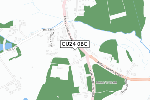
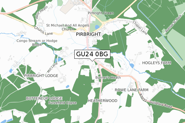
GU24 0BG is located in the Normandy & Pirbright electoral ward, within the local authority district of Guildford and the English Parliamentary constituency of Woking. The Sub Integrated Care Board (ICB) Location is NHS Surrey Heartlands ICB - 92A and the police force is Surrey. This postcode has been in use since July 2018.


GetTheData
Source: OS Open Zoomstack (Ordnance Survey)
Licence: Open Government Licence (requires attribution)
Attribution: Contains OS data © Crown copyright and database right 2025
Source: Open Postcode Geo
Licence: Open Government Licence (requires attribution)
Attribution: Contains OS data © Crown copyright and database right 2025; Contains Royal Mail data © Royal Mail copyright and database right 2025; Source: Office for National Statistics licensed under the Open Government Licence v.3.0
| Easting | 494597 |
| Northing | 155453 |
| Latitude | 51.290362 |
| Longitude | -0.644775 |
GetTheData
Source: Open Postcode Geo
Licence: Open Government Licence
| Country | England |
| Postcode District | GU24 |
➜ See where GU24 is on a map | |
GetTheData
Source: Land Registry Price Paid Data
Licence: Open Government Licence
| Ward | Normandy & Pirbright |
| Constituency | Woking |
GetTheData
Source: ONS Postcode Database
Licence: Open Government Licence
| Swallow Corner (Guildford Road) | Pirbright | 44m |
| Swallow Corner (Guildford Road) | Pirbright | 76m |
| White Hart (Guildford Road) | Pirbright | 384m |
| White Hart (Guildford Road) | Pirbright | 428m |
| School Lane (Dawney Hill) | Pirbright | 801m |
| Brookwood Station | 1.6km |
| Worplesdon Station | 4.3km |
| Ash Station | 6.6km |
GetTheData
Source: NaPTAN
Licence: Open Government Licence
GetTheData
Source: ONS Postcode Database
Licence: Open Government Licence


➜ Get more ratings from the Food Standards Agency
GetTheData
Source: Food Standards Agency
Licence: FSA terms & conditions
| Last Collection | |||
|---|---|---|---|
| Location | Mon-Fri | Sat | Distance |
| Swallow Corner | 16:30 | 09:00 | 43m |
| Rowe Lane | 16:30 | 07:30 | 765m |
| Chapel Lane | 16:15 | 09:00 | 799m |
GetTheData
Source: Dracos
Licence: Creative Commons Attribution-ShareAlike
The below table lists the International Territorial Level (ITL) codes (formerly Nomenclature of Territorial Units for Statistics (NUTS) codes) and Local Administrative Units (LAU) codes for GU24 0BG:
| ITL 1 Code | Name |
|---|---|
| TLJ | South East (England) |
| ITL 2 Code | Name |
| TLJ2 | Surrey, East and West Sussex |
| ITL 3 Code | Name |
| TLJ25 | West Surrey |
| LAU 1 Code | Name |
| E07000209 | Guildford |
GetTheData
Source: ONS Postcode Directory
Licence: Open Government Licence
The below table lists the Census Output Area (OA), Lower Layer Super Output Area (LSOA), and Middle Layer Super Output Area (MSOA) for GU24 0BG:
| Code | Name | |
|---|---|---|
| OA | E00155434 | |
| LSOA | E01030473 | Guildford 002C |
| MSOA | E02006345 | Guildford 002 |
GetTheData
Source: ONS Postcode Directory
Licence: Open Government Licence
| GU24 0BQ | Guildford Road | 0m |
| GU24 0BY | Aldershot Road | 72m |
| GU24 0DD | Collens Field | 75m |
| GU24 0LW | Guildford Road | 97m |
| GU24 0LT | Rapleys Field | 146m |
| GU24 0LS | Mill Lane | 200m |
| GU24 0JH | Cowbridge Meadow | 270m |
| GU24 0LR | Pirbright Terrace | 271m |
| GU24 0DJ | Aldershot Road | 317m |
| GU24 0LP | The Green | 343m |
GetTheData
Source: Open Postcode Geo; Land Registry Price Paid Data
Licence: Open Government Licence