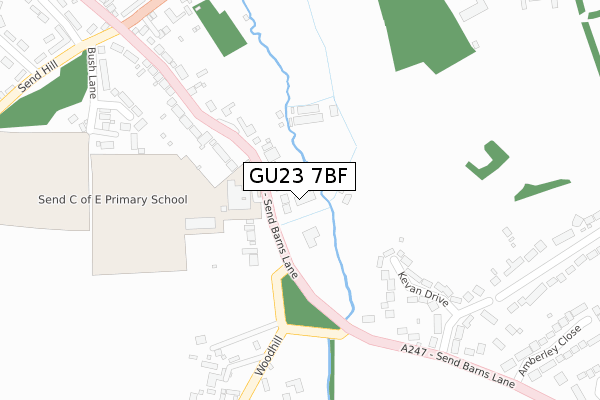
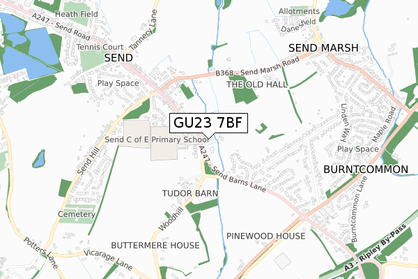
GU23 7BF is located in the Send & Lovelace electoral ward, within the local authority district of Guildford and the English Parliamentary constituency of Mole Valley. The Sub Integrated Care Board (ICB) Location is NHS Surrey Heartlands ICB - 92A and the police force is Surrey. This postcode has been in use since October 2019.


GetTheData
Source: OS Open Zoomstack (Ordnance Survey)
Licence: Open Government Licence (requires attribution)
Attribution: Contains OS data © Crown copyright and database right 2024
Source: Open Postcode Geo
Licence: Open Government Licence (requires attribution)
Attribution: Contains OS data © Crown copyright and database right 2024; Contains Royal Mail data © Royal Mail copyright and database right 2024; Source: Office for National Statistics licensed under the Open Government Licence v.3.0
| Easting | 503139 |
| Northing | 155141 |
| Latitude | 51.286075 |
| Longitude | -0.522404 |
GetTheData
Source: Open Postcode Geo
Licence: Open Government Licence
| Country | England |
| Postcode District | GU23 |
➜ See where GU23 is on a map ➜ Where is Send? | |
GetTheData
Source: Land Registry Price Paid Data
Licence: Open Government Licence
| Ward | Send & Lovelace |
| Constituency | Mole Valley |
GetTheData
Source: ONS Postcode Database
Licence: Open Government Licence
3, WITHYCOMBE CLOSE, SEND, WOKING, GU23 7BF 2020 19 OCT £775,000 |
4, WITHYCOMBE CLOSE, SEND, WOKING, GU23 7BF 2020 14 AUG £750,000 |
2020 3 JUL £795,000 |
2017 27 OCT £625,000 |
GetTheData
Source: HM Land Registry Price Paid Data
Licence: Contains HM Land Registry data © Crown copyright and database right 2024. This data is licensed under the Open Government Licence v3.0.
| Send School (Send Barns Lane) | Send | 63m |
| Send School (Send Barns Lane) | Send | 95m |
| Woodhill (Send Barns Lane) | Send | 225m |
| Woodhill (Send Barns Lane) | Send | 259m |
| St Bedes School (Bush Lane) | Send | 368m |
| Clandon Station | 2.8km |
| Worplesdon Station | 4.2km |
| Woking Station | 4.3km |
GetTheData
Source: NaPTAN
Licence: Open Government Licence
GetTheData
Source: ONS Postcode Database
Licence: Open Government Licence


➜ Get more ratings from the Food Standards Agency
GetTheData
Source: Food Standards Agency
Licence: FSA terms & conditions
| Last Collection | |||
|---|---|---|---|
| Location | Mon-Fri | Sat | Distance |
| Woodhill | 16:00 | 09:00 | 946m |
| Cartbridge | 16:45 | 08:15 | 1,527m |
| Grove Heath Court | 16:30 | 09:00 | 2,048m |
GetTheData
Source: Dracos
Licence: Creative Commons Attribution-ShareAlike
| Risk of GU23 7BF flooding from rivers and sea | Medium |
| ➜ GU23 7BF flood map | |
GetTheData
Source: Open Flood Risk by Postcode
Licence: Open Government Licence
The below table lists the International Territorial Level (ITL) codes (formerly Nomenclature of Territorial Units for Statistics (NUTS) codes) and Local Administrative Units (LAU) codes for GU23 7BF:
| ITL 1 Code | Name |
|---|---|
| TLJ | South East (England) |
| ITL 2 Code | Name |
| TLJ2 | Surrey, East and West Sussex |
| ITL 3 Code | Name |
| TLJ25 | West Surrey |
| LAU 1 Code | Name |
| E07000209 | Guildford |
GetTheData
Source: ONS Postcode Directory
Licence: Open Government Licence
The below table lists the Census Output Area (OA), Lower Layer Super Output Area (LSOA), and Middle Layer Super Output Area (MSOA) for GU23 7BF:
| Code | Name | |
|---|---|---|
| OA | E00155442 | |
| LSOA | E01030475 | Guildford 001D |
| MSOA | E02006344 | Guildford 001 |
GetTheData
Source: ONS Postcode Directory
Licence: Open Government Licence
| GU23 7BP | Send Barns Lane | 154m |
| GU23 7BS | Send Barns Lane | 206m |
| GU23 7BU | Kevan Drive | 265m |
| GU23 7BT | Send Barns Lane | 297m |
| GU23 7JR | Woodhill | 357m |
| GU23 7HP | Bush Lane | 360m |
| GU23 7DG | Send Marsh Road | 370m |
| GU23 7DW | Mays Corner | 425m |
| GU23 7DQ | Send Marsh Road | 429m |
| GU23 7DF | Boughton Hall Avenue | 468m |
GetTheData
Source: Open Postcode Geo; Land Registry Price Paid Data
Licence: Open Government Licence