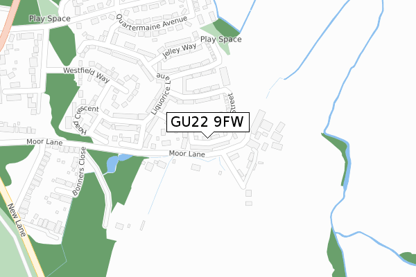
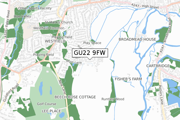
GU22 9FW is located in the Hoe Valley electoral ward, within the local authority district of Woking and the English Parliamentary constituency of Woking. The Sub Integrated Care Board (ICB) Location is NHS Surrey Heartlands ICB - 92A and the police force is Surrey. This postcode has been in use since December 2017.


GetTheData
Source: OS Open Zoomstack (Ordnance Survey)
Licence: Open Government Licence (requires attribution)
Attribution: Contains OS data © Crown copyright and database right 2024
Source: Open Postcode Geo
Licence: Open Government Licence (requires attribution)
Attribution: Contains OS data © Crown copyright and database right 2024; Contains Royal Mail data © Royal Mail copyright and database right 2024; Source: Office for National Statistics licensed under the Open Government Licence v.3.0
| Easting | 500824 |
| Northing | 156159 |
| Latitude | 51.295641 |
| Longitude | -0.555303 |
GetTheData
Source: Open Postcode Geo
Licence: Open Government Licence
| Country | England |
| Postcode District | GU22 |
➜ See where GU22 is on a map ➜ Where is Woking? | |
GetTheData
Source: Land Registry Price Paid Data
Licence: Open Government Licence
| Ward | Hoe Valley |
| Constituency | Woking |
GetTheData
Source: ONS Postcode Database
Licence: Open Government Licence
2024 26 JUL £550,000 |
2022 22 JUL £550,000 |
12, BULLOCK CRESCENT, WOKING, GU22 9FW 2018 4 MAY £482,995 |
37, BULLOCK CRESCENT, WOKING, GU22 9FW 2018 13 APR £375,000 |
23, BULLOCK CRESCENT, WOKING, GU22 9FW 2018 29 MAR £499,995 |
2018 2 MAR £482,995 |
1, BULLOCK CRESCENT, WOKING, GU22 9FW 2017 21 DEC £510,995 |
2017 21 DEC £489,995 |
3, BULLOCK CRESCENT, WOKING, GU22 9FW 2017 21 DEC £510,995 |
5, BULLOCK CRESCENT, WOKING, GU22 9FW 2017 21 DEC £512,995 |
GetTheData
Source: HM Land Registry Price Paid Data
Licence: Contains HM Land Registry data © Crown copyright and database right 2024. This data is licensed under the Open Government Licence v3.0.
| Warners Corner (New Lane) | Westfield | 491m |
| Warners Corner (New Lane) | Westfield | 504m |
| The Cricketers (Westfield Road) | Westfield | 585m |
| Cricket Pitch (Westfield Road) | Westfield | 597m |
| The Cricketers (Westfield Road) | Westfield | 605m |
| Worplesdon Station | 2km |
| Woking Station | 2.5km |
| Clandon Station | 5.1km |
GetTheData
Source: NaPTAN
Licence: Open Government Licence
| Percentage of properties with Next Generation Access | 100.0% |
| Percentage of properties with Superfast Broadband | 100.0% |
| Percentage of properties with Ultrafast Broadband | 100.0% |
| Percentage of properties with Full Fibre Broadband | 100.0% |
Superfast Broadband is between 30Mbps and 300Mbps
Ultrafast Broadband is > 300Mbps
| Percentage of properties unable to receive 2Mbps | 0.0% |
| Percentage of properties unable to receive 5Mbps | 0.0% |
| Percentage of properties unable to receive 10Mbps | 0.0% |
| Percentage of properties unable to receive 30Mbps | 0.0% |
GetTheData
Source: Ofcom
Licence: Ofcom Terms of Use (requires attribution)
GetTheData
Source: ONS Postcode Database
Licence: Open Government Licence


➜ Get more ratings from the Food Standards Agency
GetTheData
Source: Food Standards Agency
Licence: FSA terms & conditions
| Last Collection | |||
|---|---|---|---|
| Location | Mon-Fri | Sat | Distance |
| Westfield Road | 17:15 | 12:00 | 582m |
| Westfield Road | 17:15 | 12:15 | 782m |
| Bonsey Lane | 17:00 | 12:00 | 830m |
GetTheData
Source: Dracos
Licence: Creative Commons Attribution-ShareAlike
The below table lists the International Territorial Level (ITL) codes (formerly Nomenclature of Territorial Units for Statistics (NUTS) codes) and Local Administrative Units (LAU) codes for GU22 9FW:
| ITL 1 Code | Name |
|---|---|
| TLJ | South East (England) |
| ITL 2 Code | Name |
| TLJ2 | Surrey, East and West Sussex |
| ITL 3 Code | Name |
| TLJ25 | West Surrey |
| LAU 1 Code | Name |
| E07000217 | Woking |
GetTheData
Source: ONS Postcode Directory
Licence: Open Government Licence
The below table lists the Census Output Area (OA), Lower Layer Super Output Area (LSOA), and Middle Layer Super Output Area (MSOA) for GU22 9FW:
| Code | Name | |
|---|---|---|
| OA | E00157883 | |
| LSOA | E01030973 | Woking 011C |
| MSOA | E02006466 | Woking 011 |
GetTheData
Source: ONS Postcode Directory
Licence: Open Government Licence
| GU22 9RB | Moor Lane | 75m |
| GU22 9FU | Reed Street | 94m |
| GU22 9FR | Inwood Close | 148m |
| GU22 9NY | Liquorice Lane | 198m |
| GU22 9NU | Westfield Way | 284m |
| GU22 9FQ | Hoad Crescent | 310m |
| GU22 9NN | Quartermaine Avenue | 315m |
| GU22 9NL | Balfour Avenue | 345m |
| GU22 9RA | Bonners Close | 357m |
| GU22 9NR | Newlands Avenue | 359m |
GetTheData
Source: Open Postcode Geo; Land Registry Price Paid Data
Licence: Open Government Licence