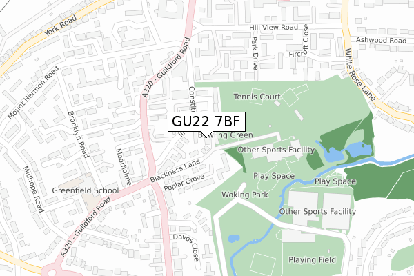
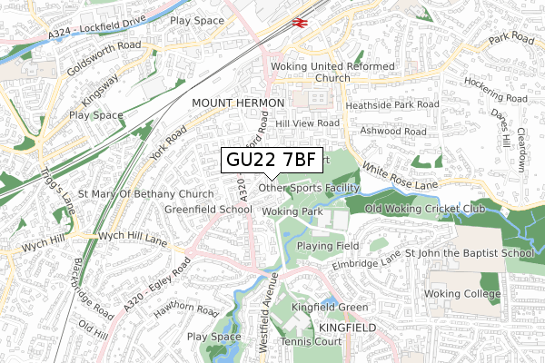
GU22 7BF is located in the Mount Hermon electoral ward, within the local authority district of Woking and the English Parliamentary constituency of Woking. The Sub Integrated Care Board (ICB) Location is NHS Surrey Heartlands ICB - 92A and the police force is Surrey. This postcode has been in use since April 2018.


GetTheData
Source: OS Open Zoomstack (Ordnance Survey)
Licence: Open Government Licence (requires attribution)
Attribution: Contains OS data © Crown copyright and database right 2025
Source: Open Postcode Geo
Licence: Open Government Licence (requires attribution)
Attribution: Contains OS data © Crown copyright and database right 2025; Contains Royal Mail data © Royal Mail copyright and database right 2025; Source: Office for National Statistics licensed under the Open Government Licence v.3.0
| Easting | 500490 |
| Northing | 157920 |
| Latitude | 51.311530 |
| Longitude | -0.559597 |
GetTheData
Source: Open Postcode Geo
Licence: Open Government Licence
| Country | England |
| Postcode District | GU22 |
➜ See where GU22 is on a map ➜ Where is Woking? | |
GetTheData
Source: Land Registry Price Paid Data
Licence: Open Government Licence
| Ward | Mount Hermon |
| Constituency | Woking |
GetTheData
Source: ONS Postcode Database
Licence: Open Government Licence
2021 23 SEP £900,000 |
2018 15 AUG £825,000 |
1, GREEN VIEW, WOKING, GU22 7BF 2018 25 MAY £805,000 |
9, GREEN VIEW, WOKING, GU22 7BF 2018 23 APR £840,000 |
GetTheData
Source: HM Land Registry Price Paid Data
Licence: Contains HM Land Registry data © Crown copyright and database right 2025. This data is licensed under the Open Government Licence v3.0.
| Claremont Avenue Turn (Guildford Road) | Woking | 181m |
| Claremont Avenue | Woking | 200m |
| Midhope Road (Guildford Road) | Woking | 252m |
| Midhope Road (Guildford Road) | Woking | 321m |
| Montgomery Road | Woking | 324m |
| Woking Station | 0.8km |
| Worplesdon Station | 3km |
| West Byfleet Station | 4.9km |
GetTheData
Source: NaPTAN
Licence: Open Government Licence
| Percentage of properties with Next Generation Access | 100.0% |
| Percentage of properties with Superfast Broadband | 100.0% |
| Percentage of properties with Ultrafast Broadband | 100.0% |
| Percentage of properties with Full Fibre Broadband | 0.0% |
Superfast Broadband is between 30Mbps and 300Mbps
Ultrafast Broadband is > 300Mbps
| Percentage of properties unable to receive 2Mbps | 0.0% |
| Percentage of properties unable to receive 5Mbps | 0.0% |
| Percentage of properties unable to receive 10Mbps | 0.0% |
| Percentage of properties unable to receive 30Mbps | 0.0% |
GetTheData
Source: Ofcom
Licence: Ofcom Terms of Use (requires attribution)
GetTheData
Source: ONS Postcode Database
Licence: Open Government Licence


➜ Get more ratings from the Food Standards Agency
GetTheData
Source: Food Standards Agency
Licence: FSA terms & conditions
| Last Collection | |||
|---|---|---|---|
| Location | Mon-Fri | Sat | Distance |
| Constitution Hill | 17:00 | 12:00 | 56m |
| Claremont Avenue | 17:00 | 12:00 | 248m |
| Mount Hermon Road | 17:45 | 12:00 | 320m |
GetTheData
Source: Dracos
Licence: Creative Commons Attribution-ShareAlike
The below table lists the International Territorial Level (ITL) codes (formerly Nomenclature of Territorial Units for Statistics (NUTS) codes) and Local Administrative Units (LAU) codes for GU22 7BF:
| ITL 1 Code | Name |
|---|---|
| TLJ | South East (England) |
| ITL 2 Code | Name |
| TLJ2 | Surrey, East and West Sussex |
| ITL 3 Code | Name |
| TLJ25 | West Surrey |
| LAU 1 Code | Name |
| E07000217 | Woking |
GetTheData
Source: ONS Postcode Directory
Licence: Open Government Licence
The below table lists the Census Output Area (OA), Lower Layer Super Output Area (LSOA), and Middle Layer Super Output Area (MSOA) for GU22 7BF:
| Code | Name | |
|---|---|---|
| OA | E00157984 | |
| LSOA | E01030991 | Woking 008D |
| MSOA | E02006463 | Woking 008 |
GetTheData
Source: ONS Postcode Directory
Licence: Open Government Licence
| GU22 7RY | Woodlands Court | 28m |
| GU22 7RZ | Constitution Hill | 52m |
| GU22 7RU | Woodlands | 79m |
| GU22 7SA | Elmdene Court | 89m |
| GU22 7RX | Effingham Court | 90m |
| GU22 7SE | Park View Court | 90m |
| GU22 7SD | Poplar Grove | 106m |
| GU22 7RB | Guildford Road | 117m |
| GU22 7RW | Park Gate Court | 124m |
| GU22 7EW | Constitution Hill | 131m |
GetTheData
Source: Open Postcode Geo; Land Registry Price Paid Data
Licence: Open Government Licence