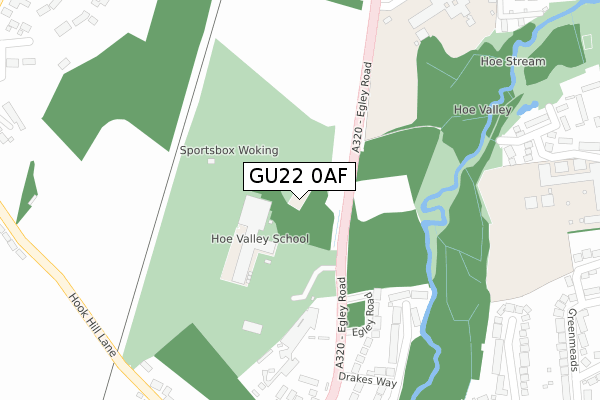
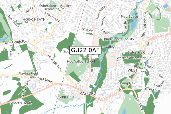
GU22 0AF is located in the Heathlands electoral ward, within the local authority district of Woking and the English Parliamentary constituency of Woking. The Sub Integrated Care Board (ICB) Location is NHS Surrey Heartlands ICB - 92A and the police force is Surrey. This postcode has been in use since August 2018.


GetTheData
Source: OS Open Zoomstack (Ordnance Survey)
Licence: Open Government Licence (requires attribution)
Attribution: Contains OS data © Crown copyright and database right 2025
Source: Open Postcode Geo
Licence: Open Government Licence (requires attribution)
Attribution: Contains OS data © Crown copyright and database right 2025; Contains Royal Mail data © Royal Mail copyright and database right 2025; Source: Office for National Statistics licensed under the Open Government Licence v.3.0
| Easting | 499579 |
| Northing | 156616 |
| Latitude | 51.299968 |
| Longitude | -0.573026 |
GetTheData
Source: Open Postcode Geo
Licence: Open Government Licence
| Country | England |
| Postcode District | GU22 |
➜ See where GU22 is on a map ➜ Where is Woking? | |
GetTheData
Source: Land Registry Price Paid Data
Licence: Open Government Licence
| Ward | Heathlands |
| Constituency | Woking |
GetTheData
Source: ONS Postcode Database
Licence: Open Government Licence
| Almond Avenue (Egley Road) | Woking | 304m |
| Almond Avenue (Egley Road) | Woking | 309m |
| The Bird In Hand (Egley Road) | Mayford | 343m |
| Barnsbury School (Almond Avenue) | Woking | 399m |
| The Bird In Hand (Egley Road) | Mayford | 400m |
| Worplesdon Station | 1.4km |
| Woking Station | 2.3km |
| Brookwood Station | 4.4km |
GetTheData
Source: NaPTAN
Licence: Open Government Licence
GetTheData
Source: ONS Postcode Database
Licence: Open Government Licence


➜ Get more ratings from the Food Standards Agency
GetTheData
Source: Food Standards Agency
Licence: FSA terms & conditions
| Last Collection | |||
|---|---|---|---|
| Location | Mon-Fri | Sat | Distance |
| Mayford Post Office | 17:15 | 12:00 | 457m |
| Bonsey Lane | 17:00 | 12:00 | 611m |
| Westfield Road | 17:15 | 12:00 | 761m |
GetTheData
Source: Dracos
Licence: Creative Commons Attribution-ShareAlike
The below table lists the International Territorial Level (ITL) codes (formerly Nomenclature of Territorial Units for Statistics (NUTS) codes) and Local Administrative Units (LAU) codes for GU22 0AF:
| ITL 1 Code | Name |
|---|---|
| TLJ | South East (England) |
| ITL 2 Code | Name |
| TLJ2 | Surrey, East and West Sussex |
| ITL 3 Code | Name |
| TLJ25 | West Surrey |
| LAU 1 Code | Name |
| E07000217 | Woking |
GetTheData
Source: ONS Postcode Directory
Licence: Open Government Licence
The below table lists the Census Output Area (OA), Lower Layer Super Output Area (LSOA), and Middle Layer Super Output Area (MSOA) for GU22 0AF:
| Code | Name | |
|---|---|---|
| OA | E00157957 | |
| LSOA | E01030986 | Woking 012D |
| MSOA | E02006467 | Woking 012 |
GetTheData
Source: ONS Postcode Directory
Licence: Open Government Licence
| GU22 0NH | Egley Road | 238m |
| GU22 0NX | Drakes Way | 287m |
| GU22 0NQ | Egley Road | 325m |
| GU22 0NJ | Egley Drive | 367m |
| GU22 0PL | Chiltern Close | 388m |
| GU22 0PS | Hook Hill Lane | 409m |
| GU22 9PY | Hoebrook Close | 431m |
| GU22 0BB | Almond Avenue | 434m |
| GU22 0PR | Mayford Green | 450m |
| GU22 0NL | Mayford Green | 465m |
GetTheData
Source: Open Postcode Geo; Land Registry Price Paid Data
Licence: Open Government Licence