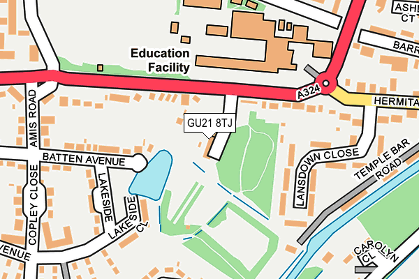
GU21 8TJ is located in the St John's electoral ward, within the local authority district of Woking and the English Parliamentary constituency of Woking. The Sub Integrated Care Board (ICB) Location is NHS Surrey Heartlands ICB - 92A and the police force is Surrey. This postcode has been in use since June 2002.


GetTheData
Source: OS OpenMap – Local (Ordnance Survey)
Source: OS VectorMap District (Ordnance Survey)
Licence: Open Government Licence (requires attribution)
| Easting | 497486 |
| Northing | 157892 |
| Latitude | 51.311800 |
| Longitude | -0.602691 |
GetTheData
Source: Open Postcode Geo
Licence: Open Government Licence
| Country | England |
| Postcode District | GU21 |
➜ See where GU21 is on a map ➜ Where is Woking? | |
GetTheData
Source: Land Registry Price Paid Data
Licence: Open Government Licence
Elevation or altitude of GU21 8TJ as distance above sea level:
| Metres | Feet | |
|---|---|---|
| Elevation | 50m | 164ft |
Elevation is measured from the approximate centre of the postcode, to the nearest point on an OS contour line from OS Terrain 50, which has contour spacing of ten vertical metres.
➜ How high above sea level am I? Find the elevation of your current position using your device's GPS.
GetTheData
Source: Open Postcode Elevation
Licence: Open Government Licence
| Ward | St John's |
| Constituency | Woking |
GetTheData
Source: ONS Postcode Database
Licence: Open Government Licence
| Crematorium (Hermitage Road) | St Johns | 79m |
| Raglan Road (Hermitage Road) | St Johns | 172m |
| Raglan Road (Hermitage Road) | St Johns | 220m |
| Raglan Road Turn (Raglan Road) | St Johns | 254m |
| Health Centre (Hermitage Road) | St Johns | 255m |
| Brookwood Station | 2.5km |
| Worplesdon Station | 2.9km |
| Woking Station | 3.3km |
GetTheData
Source: NaPTAN
Licence: Open Government Licence
GetTheData
Source: ONS Postcode Database
Licence: Open Government Licence


➜ Get more ratings from the Food Standards Agency
GetTheData
Source: Food Standards Agency
Licence: FSA terms & conditions
| Last Collection | |||
|---|---|---|---|
| Location | Mon-Fri | Sat | Distance |
| Hermitage Road | 17:30 | 12:00 | 288m |
| Inkerman Way | 17:00 | 12:00 | 423m |
| St Johns Post Office | 18:30 | 12:00 | 506m |
GetTheData
Source: Dracos
Licence: Creative Commons Attribution-ShareAlike
The below table lists the International Territorial Level (ITL) codes (formerly Nomenclature of Territorial Units for Statistics (NUTS) codes) and Local Administrative Units (LAU) codes for GU21 8TJ:
| ITL 1 Code | Name |
|---|---|
| TLJ | South East (England) |
| ITL 2 Code | Name |
| TLJ2 | Surrey, East and West Sussex |
| ITL 3 Code | Name |
| TLJ25 | West Surrey |
| LAU 1 Code | Name |
| E07000217 | Woking |
GetTheData
Source: ONS Postcode Directory
Licence: Open Government Licence
The below table lists the Census Output Area (OA), Lower Layer Super Output Area (LSOA), and Middle Layer Super Output Area (MSOA) for GU21 8TJ:
| Code | Name | |
|---|---|---|
| OA | E00157843 | |
| LSOA | E01030960 | Woking 009A |
| MSOA | E02006464 | Woking 009 |
GetTheData
Source: ONS Postcode Directory
Licence: Open Government Licence
| GU21 8TQ | Hermitage Road | 81m |
| GU21 8TG | Lansdown Close | 116m |
| GU21 8UN | Lakeside Close | 152m |
| GU21 8UP | Batten Avenue | 168m |
| GU21 8UW | Lakeside | 194m |
| GU21 8TF | Lansdown Close | 194m |
| GU21 8US | New Coppice | 226m |
| GU21 8TA | Temple Bar Road | 229m |
| GU21 8TW | Copley Close | 249m |
| GU21 7SJ | Carolyn Close | 261m |
GetTheData
Source: Open Postcode Geo; Land Registry Price Paid Data
Licence: Open Government Licence