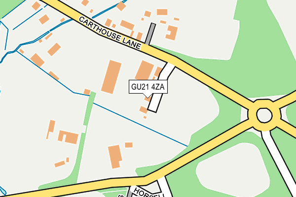
GU21 4ZA is located in the Horsell electoral ward, within the local authority district of Woking and the English Parliamentary constituency of Woking. The Sub Integrated Care Board (ICB) Location is NHS Surrey Heartlands ICB - 92A and the police force is Surrey. This postcode has been in use since May 2012.


GetTheData
Source: OS OpenMap – Local (Ordnance Survey)
Source: OS VectorMap District (Ordnance Survey)
Licence: Open Government Licence (requires attribution)
| Easting | 498355 |
| Northing | 159795 |
| Latitude | 51.328758 |
| Longitude | -0.589721 |
GetTheData
Source: Open Postcode Geo
Licence: Open Government Licence
| Country | England |
| Postcode District | GU21 |
➜ See where GU21 is on a map | |
GetTheData
Source: Land Registry Price Paid Data
Licence: Open Government Licence
Elevation or altitude of GU21 4ZA as distance above sea level:
| Metres | Feet | |
|---|---|---|
| Elevation | 30m | 98ft |
Elevation is measured from the approximate centre of the postcode, to the nearest point on an OS contour line from OS Terrain 50, which has contour spacing of ten vertical metres.
➜ How high above sea level am I? Find the elevation of your current position using your device's GPS.
GetTheData
Source: Open Postcode Elevation
Licence: Open Government Licence
| Ward | Horsell |
| Constituency | Woking |
GetTheData
Source: ONS Postcode Database
Licence: Open Government Licence
| Parley Bridge (Littlewick Road) | Goldsworth Park | 170m |
| Parley Bridge (Littlewick Road) | Goldsworth Park | 231m |
| Tresta Walk (Claydon Road) | Goldsworth Park | 246m |
| Tresta Walk (Claydon Road) | Goldsworth Park | 263m |
| Horsell Birch | Horsell | 326m |
| Woking Station | 2.6km |
| Brookwood Station | 4.2km |
| Worplesdon Station | 4.4km |
GetTheData
Source: NaPTAN
Licence: Open Government Licence
GetTheData
Source: ONS Postcode Database
Licence: Open Government Licence


➜ Get more ratings from the Food Standards Agency
GetTheData
Source: Food Standards Agency
Licence: FSA terms & conditions
| Last Collection | |||
|---|---|---|---|
| Location | Mon-Fri | Sat | Distance |
| Bullbeggars Lane | 17:45 | 12:00 | 670m |
| Tracious Close | 17:30 | 12:00 | 893m |
| Sythwood | 17:30 | 12:00 | 1,063m |
GetTheData
Source: Dracos
Licence: Creative Commons Attribution-ShareAlike
The below table lists the International Territorial Level (ITL) codes (formerly Nomenclature of Territorial Units for Statistics (NUTS) codes) and Local Administrative Units (LAU) codes for GU21 4ZA:
| ITL 1 Code | Name |
|---|---|
| TLJ | South East (England) |
| ITL 2 Code | Name |
| TLJ2 | Surrey, East and West Sussex |
| ITL 3 Code | Name |
| TLJ25 | West Surrey |
| LAU 1 Code | Name |
| E07000217 | Woking |
GetTheData
Source: ONS Postcode Directory
Licence: Open Government Licence
The below table lists the Census Output Area (OA), Lower Layer Super Output Area (LSOA), and Middle Layer Super Output Area (MSOA) for GU21 4ZA:
| Code | Name | |
|---|---|---|
| OA | E00157871 | |
| LSOA | E01030967 | Woking 003E |
| MSOA | E02006458 | Woking 003 |
GetTheData
Source: ONS Postcode Directory
Licence: Open Government Licence
| GU21 4XP | Horsell Birch | 212m |
| GU21 4XQ | Watts Lea | 280m |
| GU21 4XS | Carthouse Lane | 290m |
| GU21 4XF | Tresta Walk | 351m |
| GU21 4XG | Darvel Close | 371m |
| GU21 4XE | Claydon Road | 408m |
| GU21 4XR | Littlewick Road | 430m |
| GU21 4XB | Horsell Birch | 532m |
| GU21 3BA | Goldsworth Park Trading Estate | 574m |
| GU21 4XD | Horsell Birch | 610m |
GetTheData
Source: Open Postcode Geo; Land Registry Price Paid Data
Licence: Open Government Licence