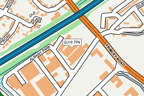
GU16 7PN is located in the Frimley electoral ward, within the local authority district of Surrey Heath and the English Parliamentary constituency of Surrey Heath. The Sub Integrated Care Board (ICB) Location is NHS Frimley ICB - D4U1Y and the police force is Surrey. This postcode has been in use since October 2000.


GetTheData
Source: OS OpenMap – Local (Ordnance Survey)
Source: OS VectorMap District (Ordnance Survey)
Licence: Open Government Licence (requires attribution)
| Easting | 487187 |
| Northing | 158353 |
| Latitude | 51.317615 |
| Longitude | -0.750322 |
GetTheData
Source: Open Postcode Geo
Licence: Open Government Licence
| Country | England |
| Postcode District | GU16 |
➜ See where GU16 is on a map ➜ Where is Frimley? | |
GetTheData
Source: Land Registry Price Paid Data
Licence: Open Government Licence
Elevation or altitude of GU16 7PN as distance above sea level:
| Metres | Feet | |
|---|---|---|
| Elevation | 70m | 230ft |
Elevation is measured from the approximate centre of the postcode, to the nearest point on an OS contour line from OS Terrain 50, which has contour spacing of ten vertical metres.
➜ How high above sea level am I? Find the elevation of your current position using your device's GPS.
GetTheData
Source: Open Postcode Elevation
Licence: Open Government Licence
| Ward | Frimley |
| Constituency | Surrey Heath |
GetTheData
Source: ONS Postcode Database
Licence: Open Government Licence
| James Road (Frimley Road) | Frimley | 174m |
| James Road (Frimley Road) | Frimley | 189m |
| Bain Avenue | Frimley | 365m |
| Lyon Way (Frimley Road) | Frimley | 385m |
| Watchetts Drive (Frimley Road) | Frimley | 388m |
| Frimley Station | 0.7km |
| Farnborough North Station | 1.8km |
| Camberley Station | 2.1km |
GetTheData
Source: NaPTAN
Licence: Open Government Licence
GetTheData
Source: ONS Postcode Database
Licence: Open Government Licence


➜ Get more ratings from the Food Standards Agency
GetTheData
Source: Food Standards Agency
Licence: FSA terms & conditions
| Last Collection | |||
|---|---|---|---|
| Location | Mon-Fri | Sat | Distance |
| Apollo Rise | 18:45 | 11:00 | 193m |
| Frimley Road | 17:00 | 11:45 | 252m |
| Gilbert Road | 16:45 | 11:45 | 266m |
GetTheData
Source: Dracos
Licence: Creative Commons Attribution-ShareAlike
| Risk of GU16 7PN flooding from rivers and sea | High |
| ➜ GU16 7PN flood map | |
GetTheData
Source: Open Flood Risk by Postcode
Licence: Open Government Licence
The below table lists the International Territorial Level (ITL) codes (formerly Nomenclature of Territorial Units for Statistics (NUTS) codes) and Local Administrative Units (LAU) codes for GU16 7PN:
| ITL 1 Code | Name |
|---|---|
| TLJ | South East (England) |
| ITL 2 Code | Name |
| TLJ2 | Surrey, East and West Sussex |
| ITL 3 Code | Name |
| TLJ25 | West Surrey |
| LAU 1 Code | Name |
| E07000214 | Surrey Heath |
GetTheData
Source: ONS Postcode Directory
Licence: Open Government Licence
The below table lists the Census Output Area (OA), Lower Layer Super Output Area (LSOA), and Middle Layer Super Output Area (MSOA) for GU16 7PN:
| Code | Name | |
|---|---|---|
| OA | E00156892 | |
| LSOA | E01030766 | Surrey Heath 010A |
| MSOA | E02006425 | Surrey Heath 010 |
GetTheData
Source: ONS Postcode Directory
Licence: Open Government Licence
| GU16 7QQ | Albany Park | 93m |
| GU16 7PL | Albany Park | 126m |
| GU16 7ER | Lyon Way | 179m |
| GU15 2SL | Old Pond Close | 185m |
| GU15 2RH | James Road | 252m |
| GU15 2RR | Bain Avenue | 264m |
| GU15 2RW | Newlands Road | 269m |
| GU16 7AL | Lyon Way | 270m |
| GU15 2RP | Newlands Road | 286m |
| GU16 7RF | Gilbert Road | 296m |
GetTheData
Source: Open Postcode Geo; Land Registry Price Paid Data
Licence: Open Government Licence