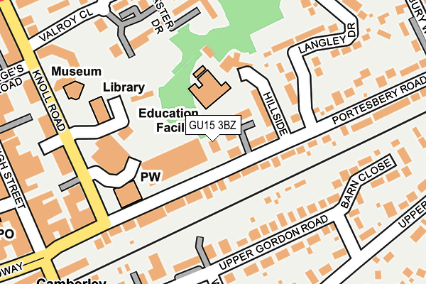
GU15 3BZ is located in the Town electoral ward, within the local authority district of Surrey Heath and the English Parliamentary constituency of Surrey Heath. The Sub Integrated Care Board (ICB) Location is NHS Frimley ICB - D4U1Y and the police force is Surrey. This postcode has been in use since May 2017.


GetTheData
Source: OS OpenMap – Local (Ordnance Survey)
Source: OS VectorMap District (Ordnance Survey)
Licence: Open Government Licence (requires attribution)
| Easting | 487858 |
| Northing | 160667 |
| Latitude | 51.338313 |
| Longitude | -0.740109 |
GetTheData
Source: Open Postcode Geo
Licence: Open Government Licence
| Country | England |
| Postcode District | GU15 |
➜ See where GU15 is on a map ➜ Where is Camberley? | |
GetTheData
Source: Land Registry Price Paid Data
Licence: Open Government Licence
| Ward | Town |
| Constituency | Surrey Heath |
GetTheData
Source: ONS Postcode Database
Licence: Open Government Licence
| Knoll Road | Camberley | 217m |
| Knoll Road | Camberley | 221m |
| Knoll Road | Camberley | 233m |
| Shalbourne Rise (Upper Park Road) | Camberley | 266m |
| Shalbourne Rise (Upper Park Road) | Camberley | 279m |
| Camberley Station | 0.4km |
| Blackwater Station | 2.7km |
| Frimley Station | 3km |
GetTheData
Source: NaPTAN
Licence: Open Government Licence
| Percentage of properties with Next Generation Access | 100.0% |
| Percentage of properties with Superfast Broadband | 100.0% |
| Percentage of properties with Ultrafast Broadband | 0.0% |
| Percentage of properties with Full Fibre Broadband | 0.0% |
Superfast Broadband is between 30Mbps and 300Mbps
Ultrafast Broadband is > 300Mbps
| Percentage of properties unable to receive 2Mbps | 0.0% |
| Percentage of properties unable to receive 5Mbps | 0.0% |
| Percentage of properties unable to receive 10Mbps | 0.0% |
| Percentage of properties unable to receive 30Mbps | 0.0% |
GetTheData
Source: Ofcom
Licence: Ofcom Terms of Use (requires attribution)
GetTheData
Source: ONS Postcode Database
Licence: Open Government Licence


➜ Get more ratings from the Food Standards Agency
GetTheData
Source: Food Standards Agency
Licence: FSA terms & conditions
| Last Collection | |||
|---|---|---|---|
| Location | Mon-Fri | Sat | Distance |
| Clarewood Drive | 17:30 | 12:15 | 145m |
| Upper Park Road | 17:45 | 12:15 | 257m |
| Townside Place | 17:30 | 12:30 | 274m |
GetTheData
Source: Dracos
Licence: Creative Commons Attribution-ShareAlike
The below table lists the International Territorial Level (ITL) codes (formerly Nomenclature of Territorial Units for Statistics (NUTS) codes) and Local Administrative Units (LAU) codes for GU15 3BZ:
| ITL 1 Code | Name |
|---|---|
| TLJ | South East (England) |
| ITL 2 Code | Name |
| TLJ2 | Surrey, East and West Sussex |
| ITL 3 Code | Name |
| TLJ25 | West Surrey |
| LAU 1 Code | Name |
| E07000214 | Surrey Heath |
GetTheData
Source: ONS Postcode Directory
Licence: Open Government Licence
The below table lists the Census Output Area (OA), Lower Layer Super Output Area (LSOA), and Middle Layer Super Output Area (MSOA) for GU15 3BZ:
| Code | Name | |
|---|---|---|
| OA | E00157057 | |
| LSOA | E01030802 | Surrey Heath 004E |
| MSOA | E02006419 | Surrey Heath 004 |
GetTheData
Source: ONS Postcode Directory
Licence: Open Government Licence
| GU15 3TA | Portesbery Road | 95m |
| GU15 2HN | Upper Gordon Road | 144m |
| GU15 2HJ | Upper Gordon Road | 186m |
| GU15 2HE | Upper Gordon Road | 196m |
| GU15 3HY | Lancaster Drive | 196m |
| GU15 2HL | West Road | 207m |
| GU15 3SZ | Portesbery Road | 210m |
| GU15 3TB | Langley Drive | 219m |
| GU15 3SY | Knoll Road | 233m |
| GU15 3HS | Townside Place | 233m |
GetTheData
Source: Open Postcode Geo; Land Registry Price Paid Data
Licence: Open Government Licence